
If you had trouble sleeping over the past couple of nights in Brisbane, this is why.
- With a Monday morning minimum of 25.3°C followed by 25.1°C this Tuesday, Brisbane just sweated through its warmest pair of December nights on record.
- There have been warmer individual December nights where the mercury failed to dip below 26°C, but never in more than 100 years of records have two minimums in a row topped 25°C.
- For the record, Brisbane’s long-term December average minimum is 20.6°C.
Why has Brisbane been so warm the last couple of nights?
In addition to the warm tropical air which has been funnelled over southern Queensland and much of southern Australia over the last week, cloud is a large part of the equation.
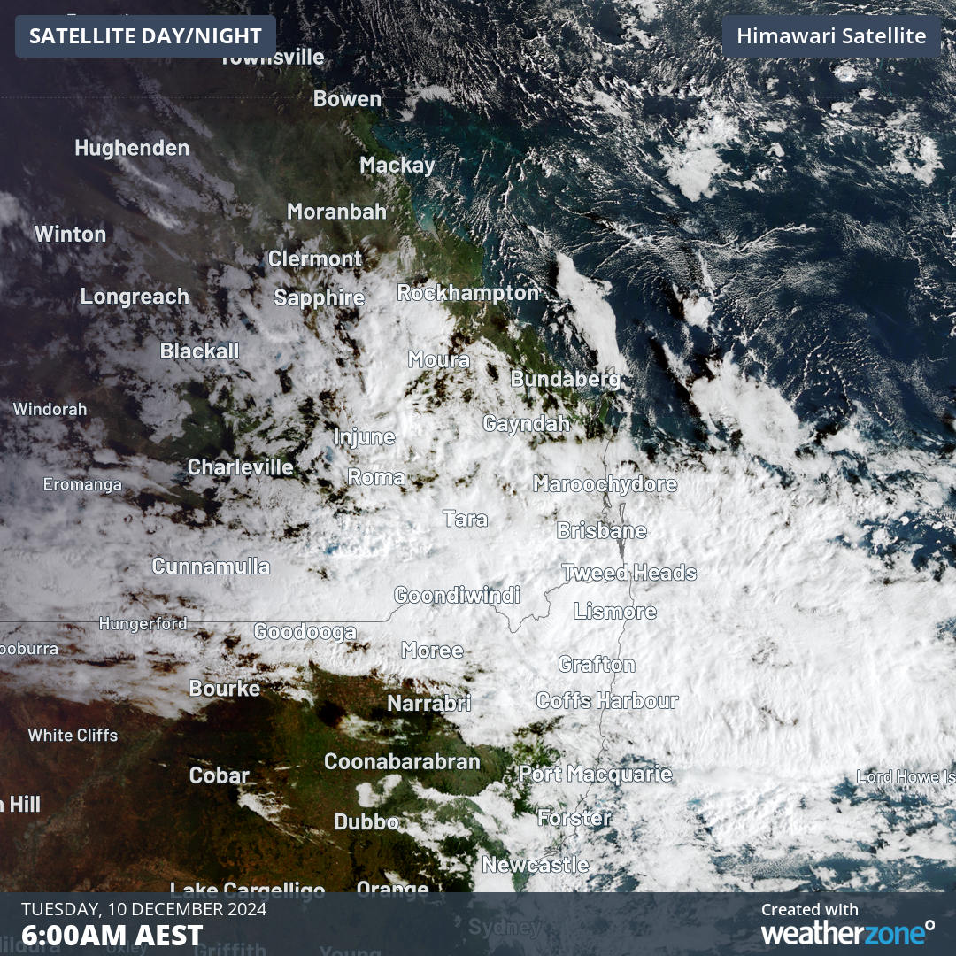
Image: Satellite image of southeast Queensland early on December 10, 2024.
The image above shows a consistent layer of cloud over the Brisbane metro area and beyond at 6am Tuesday.
That cloud hung around all night and acted like a blanket, preventing warmth from escaping after the temperature had reached a muggy 31°C on Monday afternoon.
Typical for summer, Brisbane was also just a little too far north to receive any relief from the cooler southerlies which knocked a few degrees off both maximums and minimums in the southeastern capitals, including Sydney.
So over the last couple of nights, Brisbane has been doing its best impression of Cairns in Queensland’s tropical north – and will likely stay uncomfortably warm into Wednesday morning as cloud and humidity persist.
Indeed, Brisbane was significantly warmer than Cairns over both of the last two nights, with Cairns dipping to 23.1°C on Monday and then 21.3°C this morning.
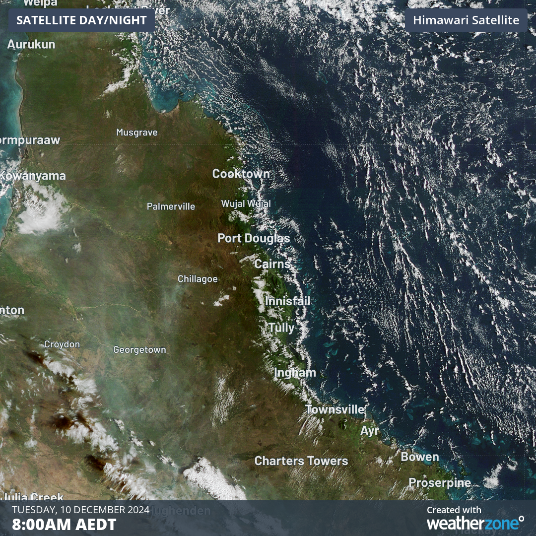
Image: Satellite view of Cairns and nearby areas on the morning of Dec 10, 2024.
As the image above shows, there was no large expanse of cloud to prevent nocturnal cooling over the Cairns area. This again illustrates the part played by cloud in Brisbane’s warm minimums.
DTN APAC supplies precise weather intelligence to over 75% of the National Energy Market (NEM); and is the trusted provider for the Australian Energy Market Operator (AEMO).
Weatherzone’s next-generation nowcasting and forecasting system, OpticastTM, is independently proven to outperform other industry models, allowing energy traders to respond rapidly to changing conditions. From 14 day forecasting to seasonal outlooks, you have access to complete and powerful weather intelligence giving you the confidence to make the best call.
Meeting the needs of the changing market, Weatherzone utilises high-resolution modelling and local knowledge to provide 5-min granularity observations and forecasts, optimising your market bidding and maximising your profits. These, coupled with briefings from our energy meteorologists, give you full awareness of the associated risk.
Benefit from specialised indices such as apparent temperature, Cooling/Heating Degree Days (CDD/HDD) and Effective Degree Days (EDD) to help accurately predict demand. You can get a clear picture of forecast conditions across the market and quickly assess heat/heatwave potential from 14 days out to 12 months
No matter where your energy trading focus lies, we have the power generation and weather insights to inform your critical decisions, keeping you ahead of the curve. For more information please visit our website or email us at sales.apac@dtn.com.


