
The final month of autumn has been exceptionally cold in eastern Australia, with parts of Sydney and Brisbane just registering one of their coldest Mays on record based on minimum temperatures.
May is typically a time of cooling in eastern Australia as autumn draws to a close and wintry weather becomes more frequent. However, this May has been abnormally cold for large areas of NSW and Qld, particularly during the nights and mornings.
A series of large high pressure systems centred over and to the southwest of Australia this month have caused a persistent stream of cold air to flow across southeastern and eastern Australia.
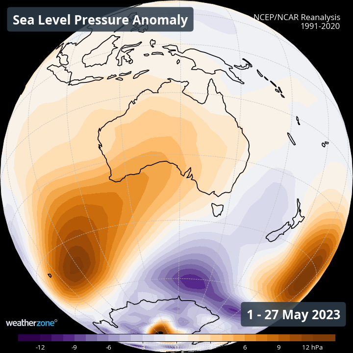
Image: Sea level pressure anomaly between May 1 and May 27, 2023.
These persistent high pressure systems over Australia have also caused an abundance of clear skies and relatively light winds during May, creating the perfect conditions for unusually low overnight temperatures.
Monthly minimum temperatures have been as much as 3-5ºC below the long-term average in parts of Qld and NSW this month, with numerous places enduring their coldest May nights on record.
In Qld, Amberley’s monthly minimum temperature up to 9am on May 30 was 5.2ºC. This is well below its long-term May average of 10ºC, and the lowest May minimum in records dating back to 1942, beating the previous record of 6.1ºC from 2006.
Brisbane Airport’s average May minimum of 10.6ºC as of May 30 is also a new May record, with data from the current and old airport weather stations dating back to 1950. The previous record was 10.9ºC in 2004.
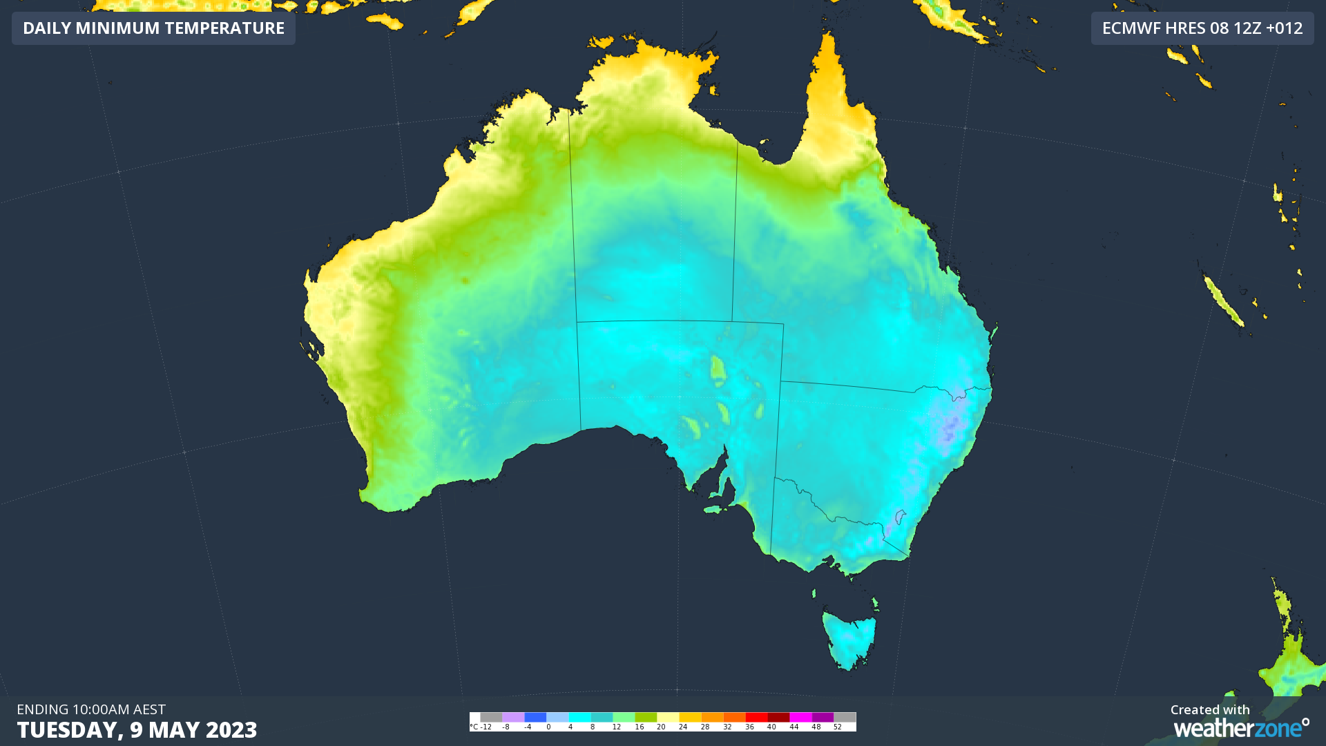
Image: Modelled minimum temperatures on Tuesday, May 9, which was a cold morning for large areas of southern, central and eastern Australia.
Many other locations in Qld and NSW also just had their coldest May in more than 20 years based on minimums.
In Sydney, the average minimum temperature at Observatory Hill up to 9am on May 30 was a nippy 10.0ºC. This is 1.6ºC below average and the city’s lowest May minimum temperature since 1957.
Sydney’s western suburbs were even colder than the city, with Richmond Airport’s average monthly minimum of 4.4ºC also the lowest for May since 1957.
Colder-than-average overnight temperatures are a known side-effect of El Niño. With all long-range forecast models currently predicting that El Niño will develop this winter, large areas of Australia could see more abnormally cold nights in the coming months.
DTN APAC can provide super-rapid forecast updates every 5 minutes so you can stay ahead of the competition. To find out more, please visit our website or email us at apac.sales@dtn.com.


