
An early burst of spring-like warmth is drifting across the eastern states this week, while winter continues to grip the southern states.
A warm airmass from central Australia will be transported towards the east coast over the next few days by a stream of northerly winds ahead of an approaching cold front.
The map below shows warm temperatures are forecast across parts of NSW and QLD.
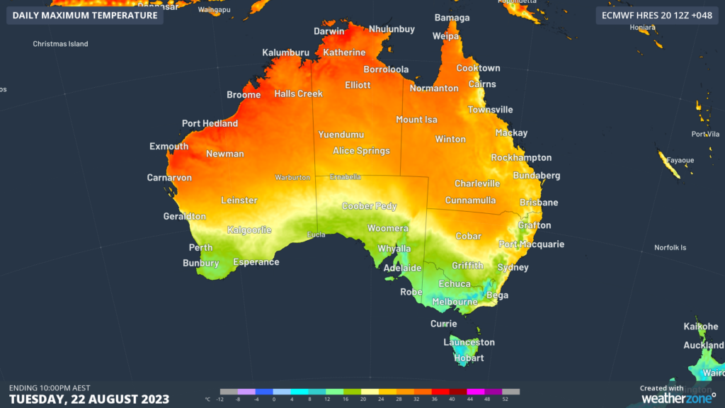
Image: ECMWF maximum temperature forecast for Tuesday, August 22.
On Tuesday, central and northern NSW will bathe in late-winter warmth, with Sydney expecting a top of 25°C, a whopping 7°C above August average.
If the mercury at Sydney Observatory Hill exceeds 25.2°C on Tuesday, this will be the city’s warmest day since April.
In Brisbane, a week of maximums at or above 25°C is forecast, which the city hasn’t seen since August 2017.
The warmth will peak in QLD on Wednesday, with Brisbane’s temperature forecast to reach 29°C.
Brisbane’s warmest day so far this winter was 29.1°C on Sunday, August 13, so if temperatures exceed this on Wednesday, the capital will also see its warmest temperature since April.
Further south, the cold front will blast southern Australia with more typical wintry weather, with a bout of snow even expected on the Alps in Vic and NSW.
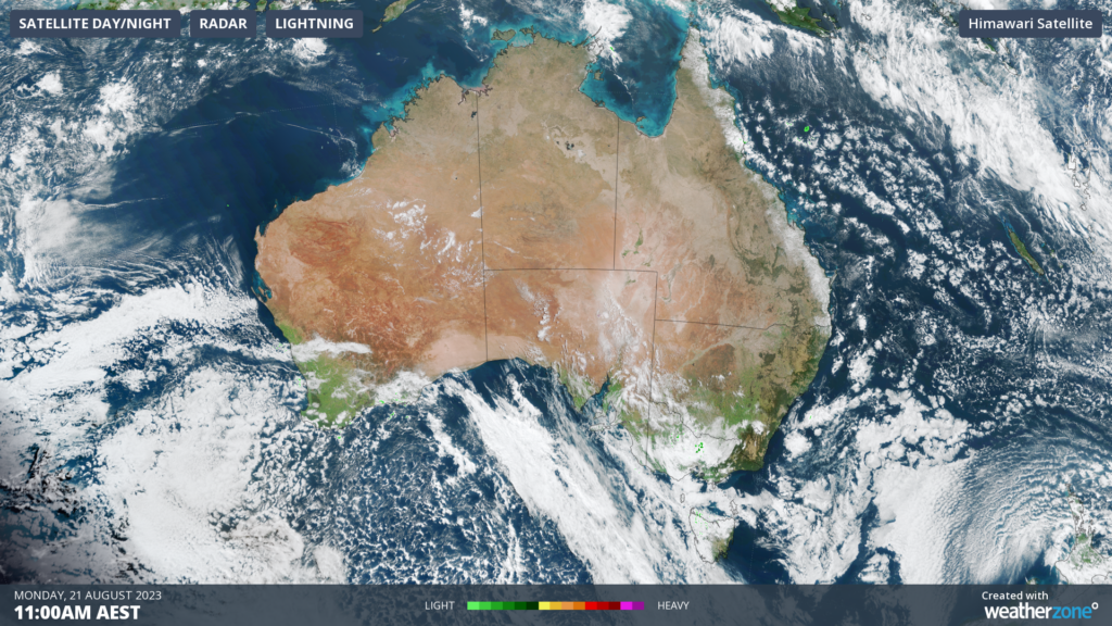
The satellite image below shows the cold front in the Bight approaching SA and Vic on Monday, with a large region of speckled cloud behind it. This broad area of speckled cloud is a tell-tale sign that a large mass of cold polar air has broken away from the Antarctic region and is venturing into the relatively warm mid-latitudes.
In contrast to the warm temperatures in the north, both Adelaide and Melbourne forecast to reach a maximum of 15°C on Tuesday as the cool airmass sweeps over the region.
Fortunately, some warmth is on the horizon for the southern states, with Adelaide forecast to see a run of three days in the low twenties later this week.
Hobart’s temperatures this week will also be mostly above average with 18°C forecast on Monday and 17°C on Thursday.
How can Weatherzone help?
Weatherzone’s next-generation nowcasting and forecasting system, OpticastTM, is independently proven to outperform other industry models, allowing energy traders to respond rapidly to changing conditions. From 14 day forecasting to seasonal outlooks, you have access to complete and powerful weather intelligence giving you the confidence to make the best call.
Meeting the needs of the changing market, Weatherzone utilises high-resolution modelling and local knowledge to provide 5-min granularity observations and forecasts, optimising your market bidding and maximising your profits. These, coupled with briefings from our energy meteorologists, give you full awareness of the associated risk. For more information, please contact us at apac.sales@dtn.com.


