Thunderstorms will develop over large areas of Australia every day this week and likely continue into next week as the country becomes locked into a relentless stormy weather pattern through the middle of November.
Thunderstorms require three key ingredients to form:
- Moisture in the atmosphere
- An unstable atmosphere
- A lifting mechanism that causes air to start rising away from the surface
These three ingredients will be available in abundance over Australia this week, leading to lots of lightning and thunder. Abnormally warm seas surrounding Australia will help to pump warm and humid air into the atmosphere, while numerous low pressure troughs, cold fronts and mountain ranges will act as triggers for storms.
Where will storms occur this week?
Early in the week, showers and thunderstorms will target central, eastern, southern and southeastern Australia on Monday and Tuesday. Severe thunderstorms are likely in parts of NSW and Qld on both days and are also possible in other states.
Storms will become more focussed on a broad arc stretching across Australia’s eastern and northern states and down into the WA interior through the middle of the week. Sydney, Brisbane and Canberra will all be at risk of severe thunderstorm activity on Wednesday.
Showers and thunderstorms will continue then over Australia’s east and north on Thursday and Friday, while also extending towards the south of WA due to the passage of a cold front. This frontal system, combined with deepening low pressure troughs over Australia, will lead to further widespread thunderstorm activity over Australia from this weekend into early next week.
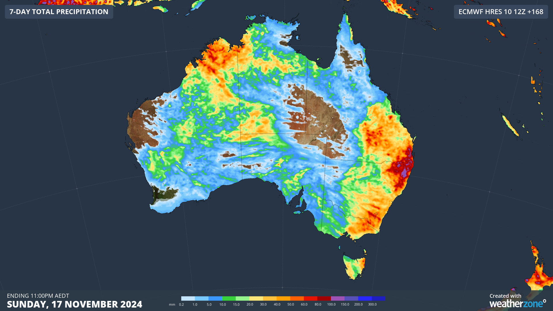
Image: Forecast accumulated rain this week, giving an indication of where the rain and storms are expected to occur during the next seven days.
Computer models suggest that thunderstorm activity will continue over several Australian states and territories next week as the key ingredients for storms continue to combine over the country.
On Sunday, more than 1.1 million lightning strikes were detected by Weatherzone’s Total Lightning Network, primarily over central Australia, southeast Queensland and the Kimberley.
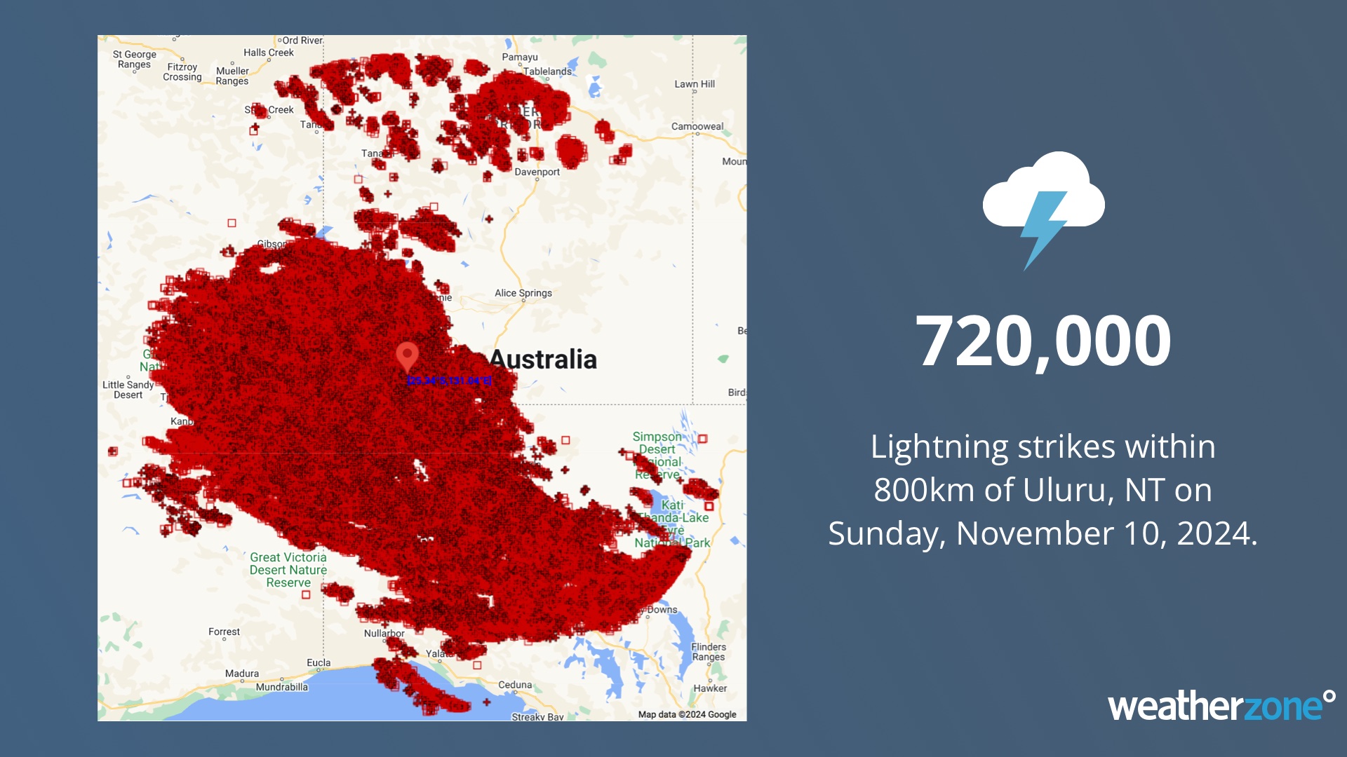
Image: The Red Centre was red with lightning, as depicted on our map.
With daily thunderstorms anticipated to affect Australia for the next one-to-two weeks, be sure to keep a close eye on the latest severe thunderstorm warnings in your state or territory each day.
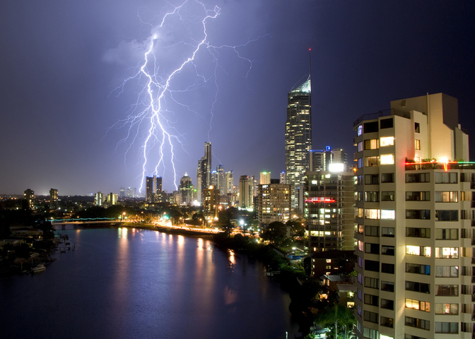
Title image: lightning in Surfers Paradise, Qld. Source: iStock / KathyGould
Stormtracker is a severe weather solution that can assist you in observing, in real-time, any storm or event that has the potential to impact your business.
Embedded in DTN’s industry interfaces, the system gives you a time advantage when monitoring conditions developing over your infrastructure and location.
Stormtracker is our Global Information System (GIS) tracking tool, providing multiple weather layers and zoom controls overlaid on a map of your location and infrastructure. You can choose a snapshot or full screen view, depending on your requirements. The maps allow you to monitor all weather, and specifically any systems likely to cause risk for your business. You also have the capacity to observe:
- real time lightning and thunderstorm alerts
- localised lightning strike frequency
- official warnings for storm, cyclone, wind, flood and fire
- sentinel hotspot fires and fire agency current incidents
Stormtracker’s radar imagery updates every 10 minutes, so you are always able to respond rapidly to changing conditions. You can customise alerting to notify you when your staff or infrastructure are under threat. With increased situational awareness, your ability to make informed decisions quickly is optimised.
DTN’s experience and intelligence gives you a clear path through complex situations. Let us assist you, offering actionable insight when extreme weather poses risk to your business. For more information please visit our website or email us at sales.apac@dtn.com.


