
Prosper in a dynamic world
Search

At last, snow!


It’s been a while, but heavy snow has fallen in the alpine regions of New South Wales and Victoria in Australia.

The not-so-great news is that Tuesday’s flakes appear to have been a relatively quick burst. But some snow is better than no snow after an almost totally snowless midwinter spell from early July to early August – with rain and unseasonably warm temps thrown into the mix.

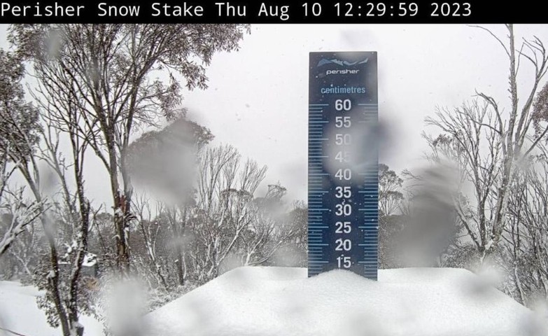
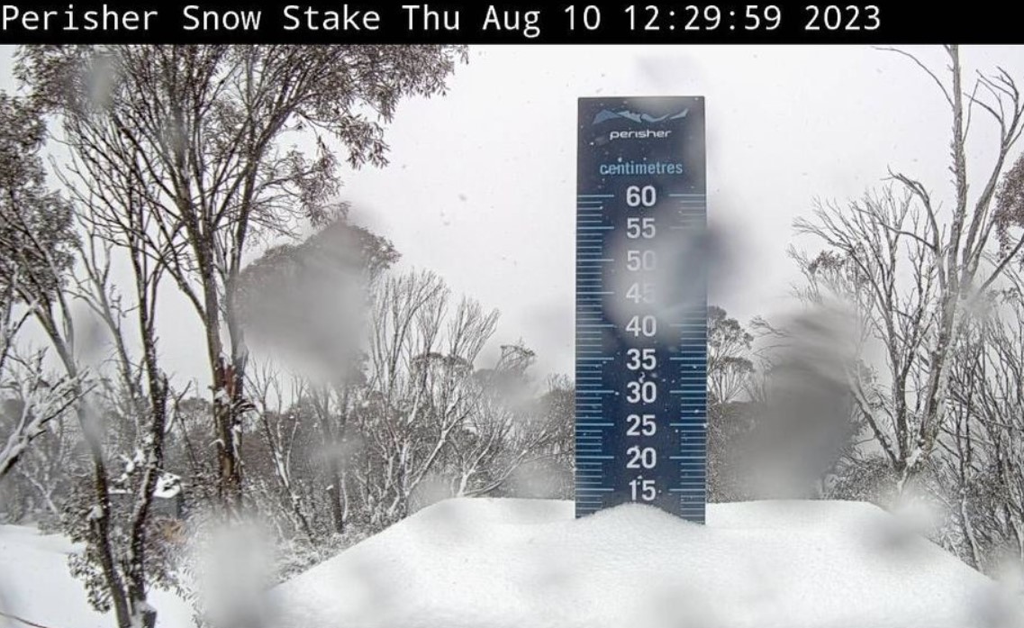
This is what the Perisher snow stake looked like at 12:30 pm Thursday. As you can see, there’s around 10 cm of accumulated snow.
At last snow!

Image: That’s our favourite kind of stake for lunch. Source: ski.com.au.

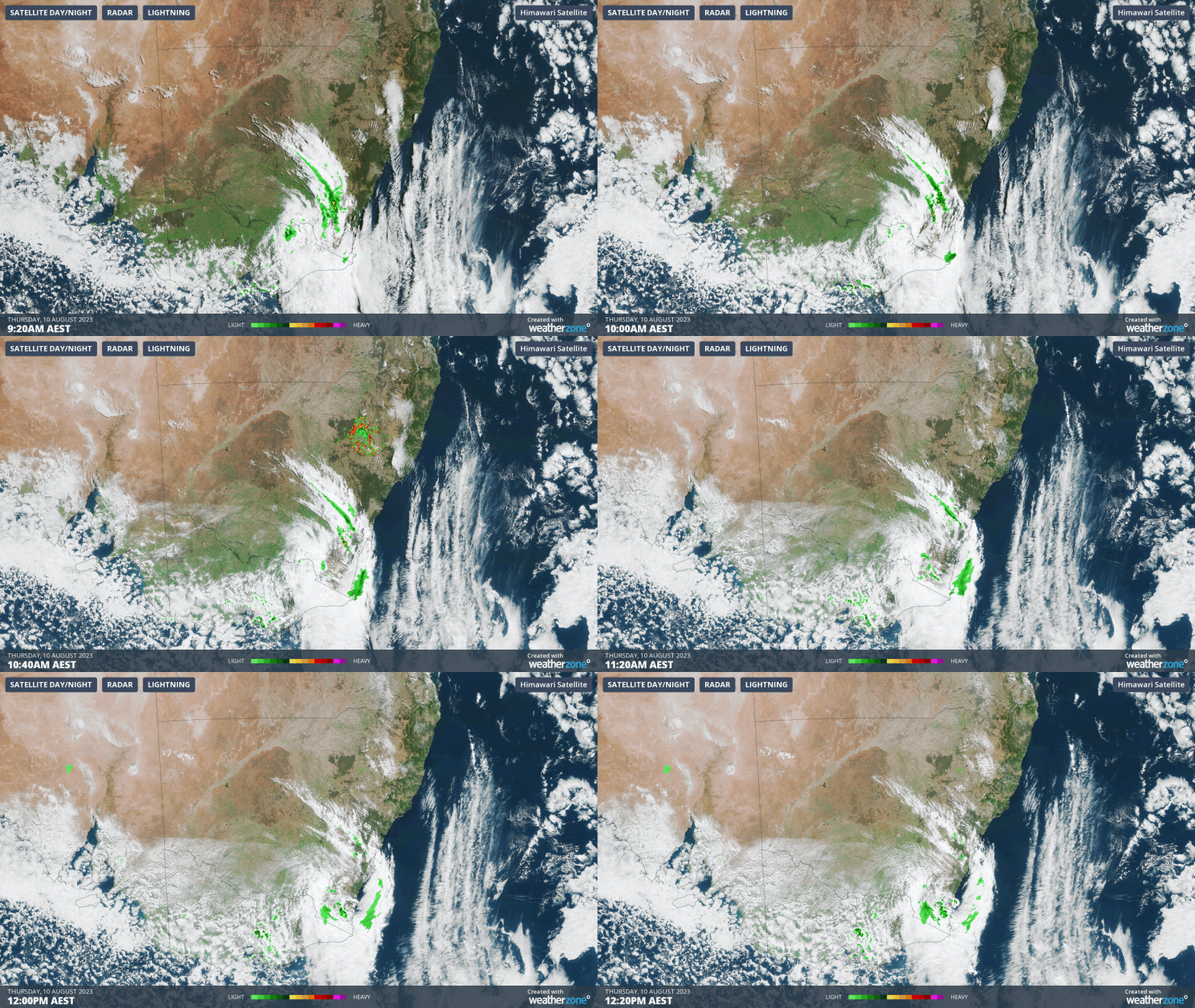
Below is a three-hour loop showing what the cloudband associated with the cold front looked like as it crossed the alpine region on Thursday morning.

As you can see, the main band of moisture was pretty narrow and short-lived. Perisher received 5.8 mm of precipitation in its official weather station between 9 am and 12:30 pm, which generally translates to roughly the same amount of snow in centimetres, or sometimes a little more when the snow is wettish Aussie “cement”.
At last snow!

You can also see cold air pushing northwards from Bass Strait on the loop above, and that should generate a few more snow showers throughout the day, especially at the southernmost Victorian resorts Mt Buller and Mt Baw Baw where snow is desperately needed.

So Thursday’s snowfall is far from a game changer in terms of repairing the damage of the last month of weather, which dramatically reduced the snowpack and the amount of water running off into the hydro dams.

For more information on Weatherzone’s snow and hydro forecasts, please contact us at apac.sales@dtn.com.


Latest news

Satisfy your weather obsession with these news headlines from around the nation, and the world.

The 2026 Indian Southwest Monsoon onset is expected in the next two weeks

The Indian Southwest Monsoon will reach India in the next two weeks, but a developing El Niño could signal a drier than normal monsoon for businesses and major industries across the country. Southwest monsoon onset over southern India in the next two weeks The Indian Meteorological Department (IMD) is responsible for tracking the advance and […]

Rapid El Niño signal accelerating risk for Australian businesses

El Niño–favourable conditions are gathering pace across the tropical Pacific, with key ocean indicators approaching threshold levels and early atmospheric responses emerging.  While uncertainty remains around final El Niño strength, historical analogues show that even weak events can generate widespread impacts, including reduced rainfall, warmer daytime temperatures, increased frost risk, elevated fire danger, reduced tropical cyclone activity, and more. Industries including […]

Australia’s 2025–26 Cyclone Season: Slightly Above Average, Dominated by Severe Systems

Australia has just experienced a highly impactful tropical cyclone season, with more than 60% of systems reaching severe intensity, causing widespread disruption and damage to communities and multiple industries across northern Australia.  The 2025–26 Australian tropical cyclone season officially ran from 1 November 2025 to 30 April 2026. During this six-month period, Australia saw 11 tropical cyclones, with nine […]

What does a ‘super El Niño’ mean for Australia’s businesses?

There are signs that a very strong, or ‘super’ El Niño could develop in the tropical Pacific Ocean later this year. So, what does this mean for Australia’s weather during the second half of 2026? El Niño on the horizon The tropical Pacific Ocean is currently in a neutral state, meaning neither El Niño nor […]

