Hundreds of millimetres of rainfall are forecast for western Tasmania in the next week, which will help replenish hydroelectric lakes in the region after some of the lowest rainfall on record.
Hydropower is Tasmania’s main source of electricity, with frequent rain filling Tassie Hydro’s 54 major dams and feeding into 30 hydropower stations. In fact, during winter, the state usually exports electricity to Victoria, via the underwater Basslink. In summer, when it is usually drier, the state relies on the National Electricity Market (NEM) for a top up of power.
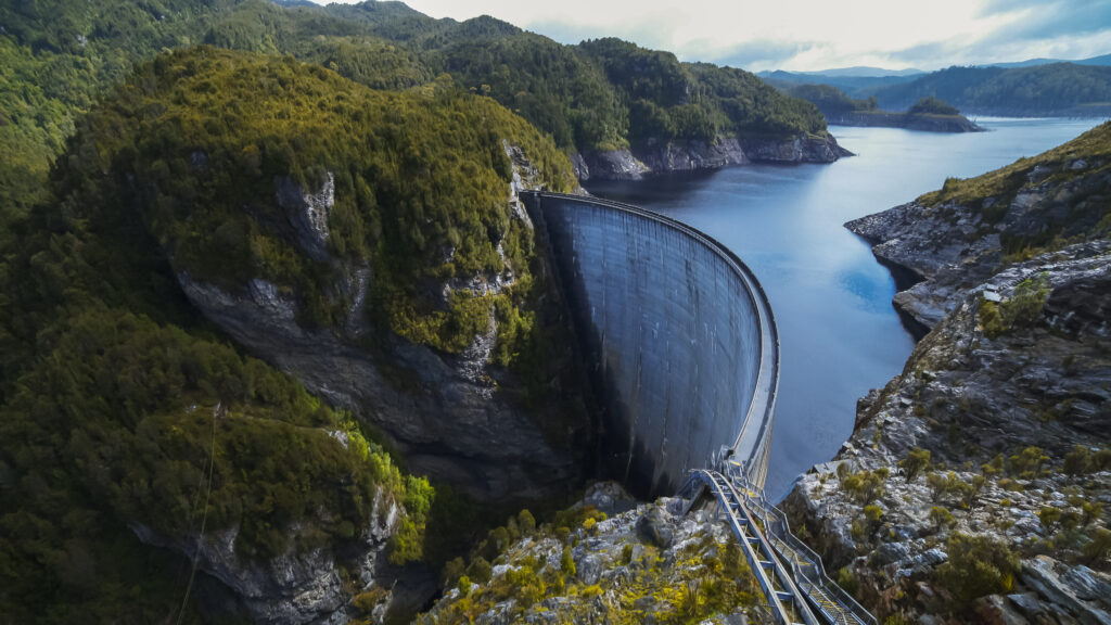
Image: Hydroelectricity dam at Strathgordon in Tasmania
According to Hydro Tasmania, they produce around 9000 gigawatts of clean renewable electricity from hydropower, enough to power 900,000 homes or businesses.
The map below shows the catchments and power stations scattered across Tasmania; the largest lakes used for hydro are the Great Lake and Gordon-Pedder. The rain that falls in these catchments or dams is collected and used to generate electricity.

Image: Hydro catchment areas. Source: Hydro Tasmania
Usually, the west coast of Tasmania is the wettest due to prevailing westerly winds from cold fronts passing over the state, which tend to be blocked by vast mountains through central areas.
During the past three months, unfortunately, this has not been the case for the west coast. Overall, the area has seen below average rain, reaching record lows in the far northwest, while the east coast saw average to above average rain.
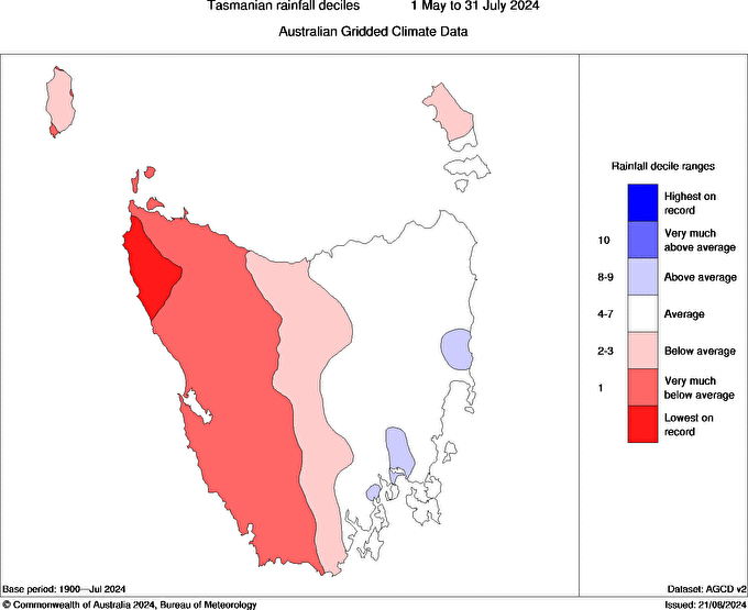
Image: Tasmania rain deciles between May 1 and July 31, 2024. Source: Bureau of Meteorology
During July 2024, rain in western and central Tasmania was in the lowest 10% of Julys since 1900.
The below average rain has affected water storage across western Tasmania, with some areas seeing record low or very much below average streamflow. The Great Lake was only 25.1% full by the end of July, which is a 10.4% decrease from the same time last year.

Image: Streamflow decile categories for July 2024. Source: BOM
The good news is that rain is on its way, with a complex low pressure system set to direct several cold fronts across the state in the coming week.
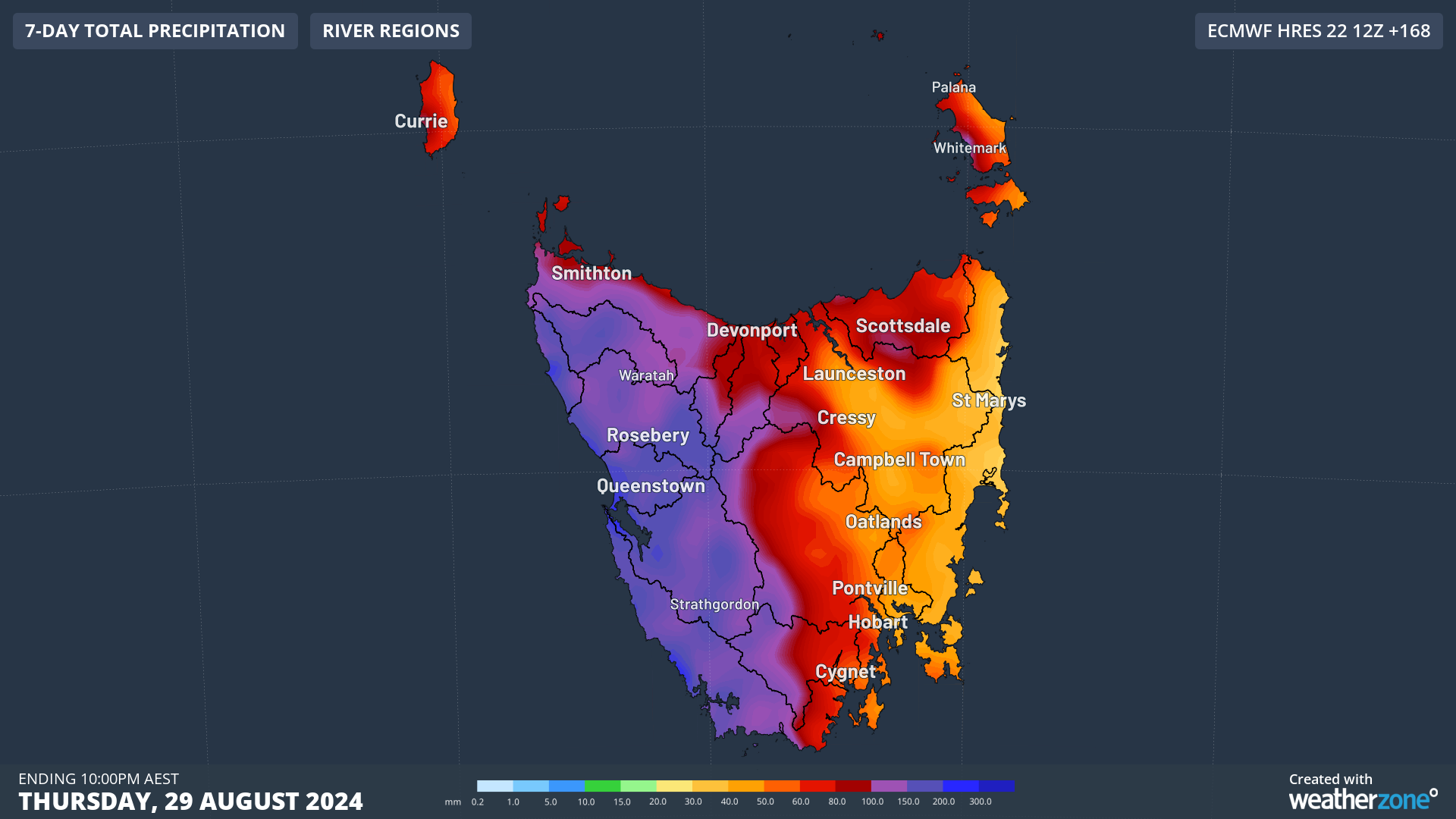
Western Tasmania is forecast to see around 100 to 200mm of rain in the next 7 days, which could help fill up the western lakes, including the Gordon-Pedder. Eastern Tasmania, however, will see slightly less rain, with widespread falls of 30 to 50mm and isolated falls of 60 to 80mm.

Image: Accumulated rain forecast for the next 7 days leading up to 10pm AEST on Thursday, August 29.
Some of these totals will fall as snow as a cold airmass moves over the state from mid to late next week.
Looking ahead, the rain should continue next Friday, August 30, and into the weekend as the low continues to linger over the region.
Using Opticast’s nowcasting and forecasting capabilities, you will have long-term outlooks covering rainfall and extreme heat events out to 12 months. This can significantly improve your planning as you integrate the data with site-specific hydrological parameters.
With renewables making up more of Australia’s energy mix every year, we want to support your business to make informed critical decisions and improve your overall generation and safety. To find out more visit our contact page or email us at apac.sales@dtn.com.


