
A cold airmass has reached as far north as Qld on Monday, with below average temperatures forecast this week and possibly snow.
But light snow flurries are absolutely possible on Tuesday July 16, Wednesday July 17, and Thursday July 18 on the Granite Belt region of southern Queensland, as a cold airmass originating in Antarctic waters crosses the border.
The chilly air will be accompanied by sufficient moisture for occasional light showers which could fall as snow on high ground above about 1000 metres.
Snow is of course not unknown in Queensland
The Granite Belt town of Stanthorpe, at an elevation of just over 800 metres, holds the record for Queensland’s coldest recorded temperature of a bitterly cold –10.6°C back in June 1961, and also sees occasional snowfalls.
The heaviest snowfalls in Stanthorpe this century occurred on July 17, 2015, when at least 5 cm of fluffy white stuff coated the region.
Welcome to @Queensland , we currently have some technical issues, Weather shall be fixed in 6 months.
@MiladyEly pic.twitter.com/2rVXuVQcev— Kat (@KatRose1997) July 17, 2015
Even the nearby town of Ballandean at an elevation of 720 m saw settled snow that day.
@slqld @abcsouthqld Coldest dinosaur in Queensland, Fruitisforus dino at Ballandean on New England highway. pic.twitter.com/awjKobGU2I
— Louise (@houseofbromley) July 17, 2015
Here’s what the BoM’s synoptic chart looked like on July 17, 2015.
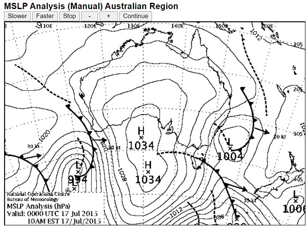
Source: BoM.
And here’s the Weatherzone synoptic chart for July 17 2024, as in this Wednesday.
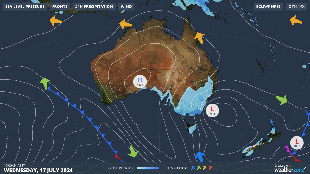
The two charts are not identical but they’re not too different either. The main feature they have in common is a flow of air from polar latitudes circulating anti-clockwise around a high in the Bight and being directed northwards toward southern Queensland, with moisture provided by troughs associated with a low in the Tasman Sea.
These systems are always a bit hit and miss, so we’ll have to wait and see if this week’s set-up delivers a few flakes for Queensland.
Brisbane’s overnight temperature will be around eight to nine degrees with maximums of 17 to 19°C expected from Monday through to Thursday. The coldest day looks like Wednesday, with a maximum of 17°C which is 5°C below the July average.
Benefit from the timely delivery of accurate weather information, allowing informed and effective decision-making. To find out more, please visit our contact page or email us at apac.sales@dtn.com.


