It’s going to be an uncomfortably sweaty end to the week for southern capital cities, with maximum temperatures set to reach 14 to 16°C above the December average.
Temperatures will soar into the low to mid 40s across parts of southeastern Australia for three days late this week in response to a prolonged period of hot northerly winds ahead of a cold front forecast early next week.
This surge of intense heat will impact large areas of central and southeastern Australia from Saturday, causing severe heatwave conditions across central parts of the country. 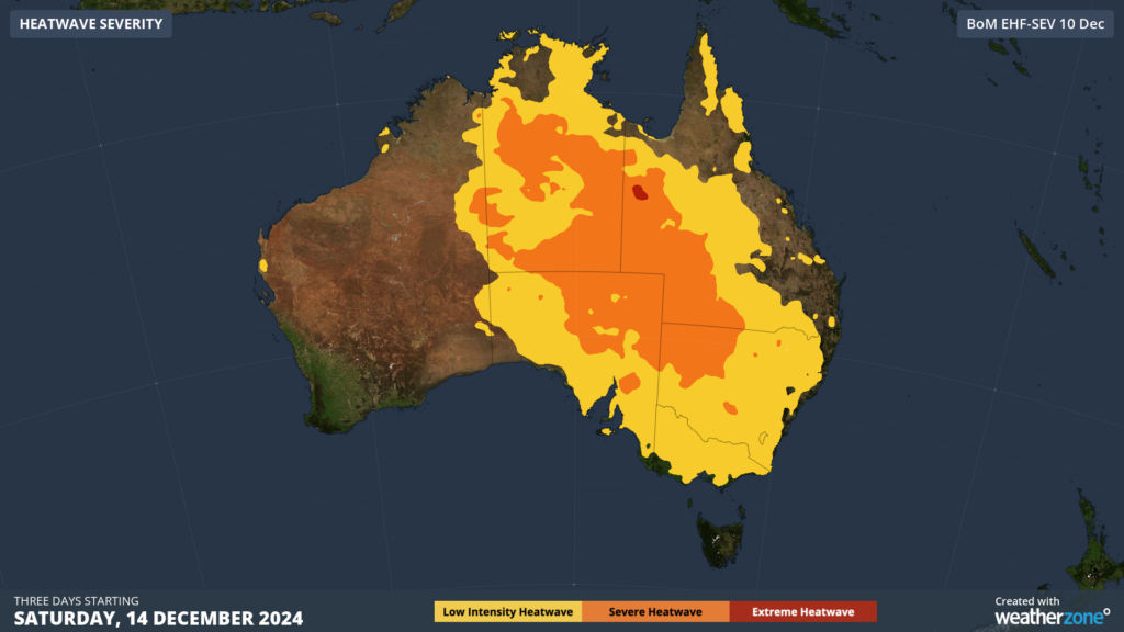
Image: Heatwave severity for three days beginning Saturday, December 14: Source: Bureau of Meteorology
While this isn’t classified as a severe heatwave for Adelaide and Melbourne, both capital cities will see two to three days above 30°C from Saturday.
The heat is forecast to peak at about 41°C on Sunday in Adelaide and Monday in Melbourne, according to our meteorologists. Adelaide will continue to swelter into Sunday evening, with temperatures remaining in the mid 30s until around 9pm.
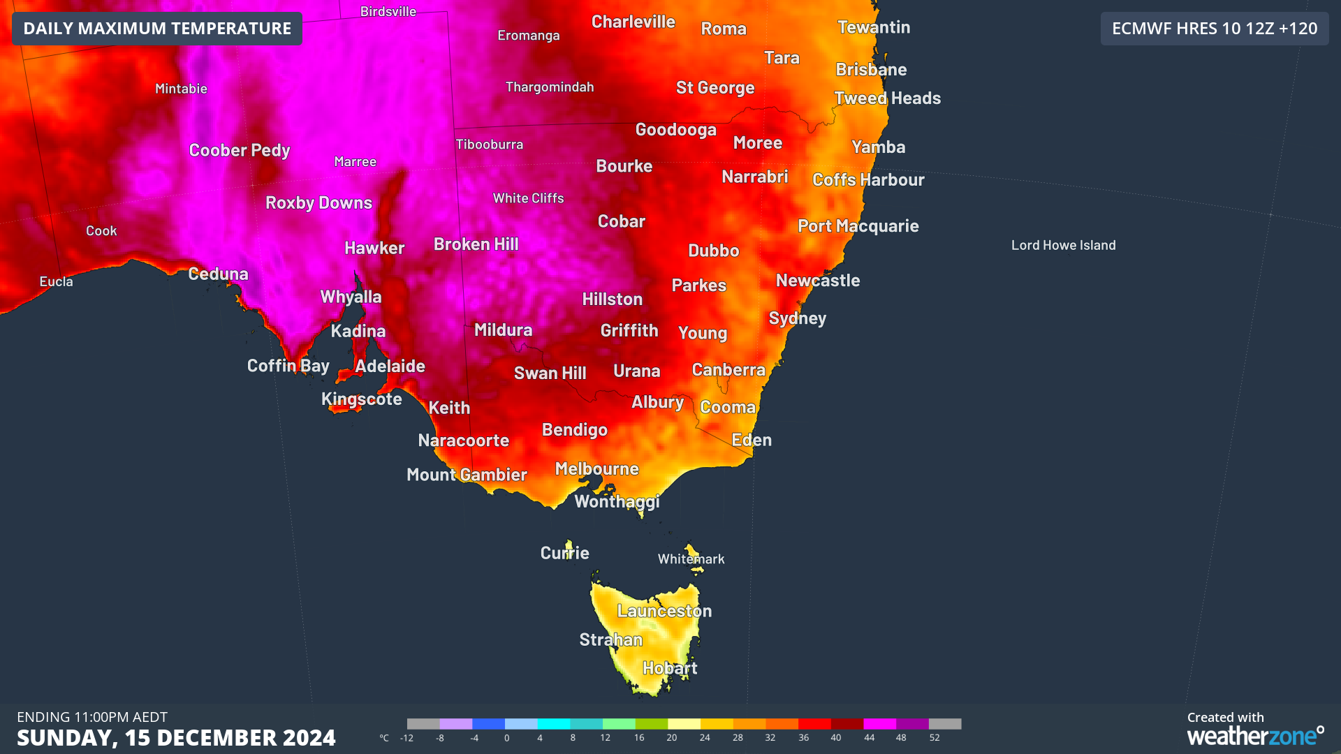
The image below shows the extremely hot conditions forecast to impact SA, western NSW and parts of Vic on Sunday, before the heat focuses on the eastern states early next week ahead of a southerly change.

Image: Maximum temperature forecast for Sunday, December 15, according to ECMWF
Night-time temperatures will also be very warm, with Adelaide’s minimum temperature not forecast to drop below 27°C on Sunday night.
This is 12°C above the December average of 15°C, caused by a warm northerly airmass sitting over the city on Sunday night and Monday morning.
The image below shows the warm northerly winds continuing to flow over the capital city early Monday morning ahead of a cooler airmass associated with a southerly change.

Image: 850hPa temperature and wind forecast for 5am AEDT on Monday, December 16
There is still some uncertainty in the timing of the change, but it should arrive in Adelaide on Monday morning, cooling temperatures in the afternoon.
The front and southerly change will then continue on their path towards Vic, arriving in Melbourne on Monday afternoon or early evening. Both capital cities will see the temperature drop into the low to mid 20s on Tuesday next week, providing some relief after the oppressive heat.
DTN APAC supplies precise weather intelligence to over 75% of the National Energy Market (NEM); and is the trusted provider for the Australian Energy Market Operator (AEMO).
Weatherzone’s next-generation nowcasting and forecasting system, OpticastTM, is independently proven to outperform other industry models, allowing energy traders to respond rapidly to changing conditions. From 14 day forecasting to seasonal outlooks, you have access to complete and powerful weather intelligence giving you the confidence to make the best call.
Meeting the needs of the changing market, Weatherzone utilises high-resolution modelling and local knowledge to provide 5-min granularity observations and forecasts, optimising your market bidding and maximising your profits. These, coupled with briefings from our energy meteorologists, give you full awareness of the associated risk.
Benefit from specialised indices such as apparent temperature, Cooling/Heating Degree Days (CDD/HDD) and Effective Degree Days (EDD) to help accurately predict demand. You can get a clear picture of forecast conditions across the market and quickly assess heat/heatwave potential from 14 days out to 12 months
No matter where your energy trading focus lies, we have the power generation and weather insights to inform your critical decisions, keeping you ahead of the curve. For more information please visit our website or email us at sales.apac@dtn.com.


