Nearly three weeks into autumn does seem like an odd time for the eastern states to see their highest temperatures of the hot season so far, so we examine what is causing this late blast of heat.
Recent temperatures have indeed been hotter than in summer by some metrics. Of the eastern capitals:
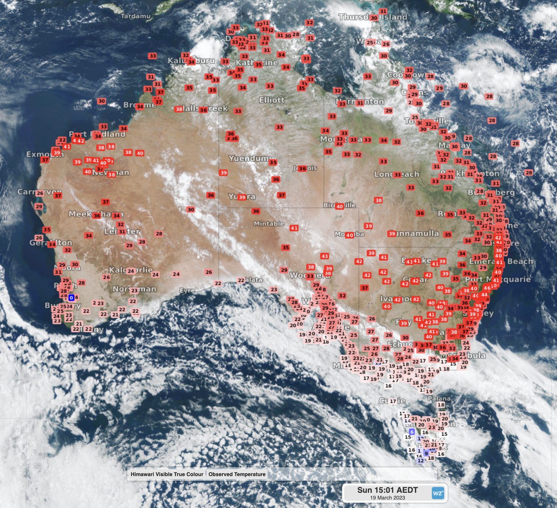
- Canberra reached 37.4°C on Sunday, its hottest March day in 25 years and close to the long-term March record of 37.5°C set in 1998. The hottest the nation’s capital was this summer was 36.1°C
- Sydney reached its peak heat of 37.9°C on 6th March, over seven degrees warmer than its summer top of 30.6°C
- Brisbane warmed to 36.6°C on Friday, nearly a degree warmer than its summer top of 35.7°C
As we told you on Tuesday, La Niña has officially seen its end, and an El Niño Watch is now in place. La Niña summers tend to be quite cloudy and cool compared to normal for the eastern states, as seen in the summers of 2020/21 and 2021/22.
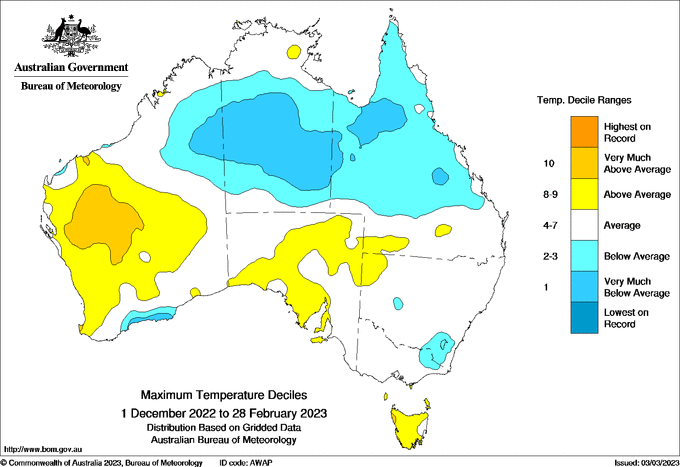
However, this summer was close to the long-term average for most of southeast Qld and NSW, while it was cooler than average for the ACT. This reflects how the 2022/23 La Niña peaked in strength in November and became weaker during summer.
But while the breakdown of La Niña has been one factor influencing the recent heat in Australia, this late-season surge in temperatures is largely being driven by a negative swing in the Southern Annular Mode (SAM).
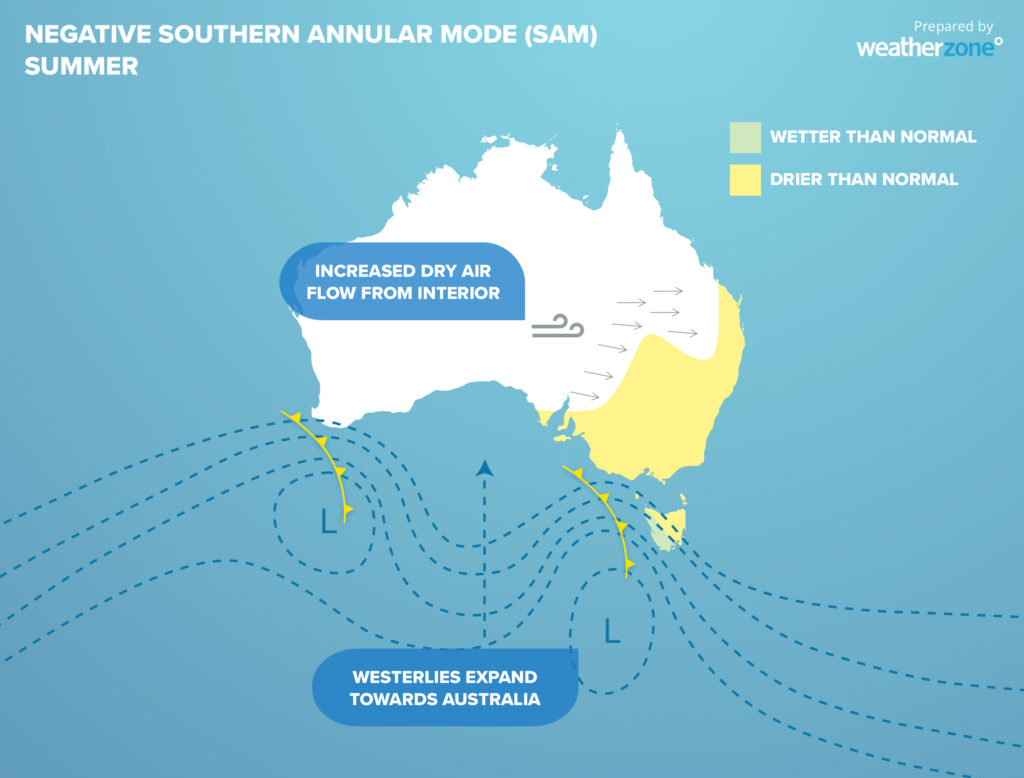
The SAM refers to how far cold fronts push away from Antartica. In a positive phase, cold fronts contract closer to the south pole and provide more high pressure near Australia, and during a negative phase, cold fronts more regularly cross southern Australia.
For the entirety of 2022, the SAM was in a predominantly positive phase, leading to more high pressure and increased easterly winds over the nation’s east coast. These regular and strong easterlies led to one of the cloudiest, wettest and coolest years on records for large parts of eastern Australia.
It’s also worth noting that La Niña often helps create a positive SAM, so it is common to see these two climate drivers working in unison and reinforcing their influence on Australia’s weather.
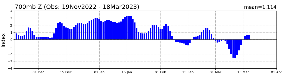
Image: Observed values of SAM since late November 2022. Values were persistently above +1 (positive SAM) through December and January, while values have fallen below –1 (negative SAM) during March. Source: NOAA CPC
Recently, the SAM has swung to a strong negative phase. During summer and early autumn, a negative SAM sees more cold fronts crossing Australia, but with less cold air in them. For the eastern states, the increased frontal activity causes westerly winds to become more common, allowing hot, dry desert air from the interior to blow across the region.
Even though we are in an El Niño Watch, La Niña and El Niño take months to really kick in with their cool/wet or hot/dry conditions, respectively. SAM on the other hand works on the scale of weeks, meaning this sudden burst of heat is more likely to be attributed to the SAM than the transition towards El Niño.
The good news for the eastern states is that the SAM is starting to move back to a neutral phase, meaning temperatures will start to return to normal over the next few weeks. However, with the forecast building strength of El Niño, a more persistent negative SAM may return later in the year.
DTN APAC can provide tailored climate briefings to your business to alert you of the most likely weather conditions and hazards to look out for during the upcoming season. Now is a good time to get a good look at the forecast for autumn, winter and beyond. To find out more or to book a presentation, please email apac.sales@dtn.com.


