Due to the variety of climates of Australia, from the northern tropics to the temperate south, thunderstorms across this large continent exhibit a great deal of variety in terms of the way they form and move, their size, shape, and longevity. These features influence the severe phenomena they can produce.

Image: Annual average lightning strikes from the Total Lightning Network (WZTLN)
The map above shows the average number of days that thunderstorms occur. The highest number of thunder days are experienced over the northern tropics including the WA Kimberley, the NT Top End, and the Gulf region of northern QLD. These storms form during the wet season when hot, humid air flows in from over the warm waters to the north.
The next peak in thunderstorm activity occurs over southeast QLD and northeast NSW where warm humid air flowing in from the Coral and Tasman Seas clashes with cold air flowing in from the Southern Ocean as cold fronts sweep across the continent.
The least number of storms occur over the south of Australia, especially Tasmania, where there is relatively less heat and moisture. Storms over this region often occur in cooler months with cold fronts.
The following animations show some of the types of storms that occur across Australia.
One storm becomes two – supercells over southeast Queensland
On the 8th of December 2022, a low-pressure trough triggered thunderstorms across southeast QLD. At the same time the jetstream was flowing over the region which helped to cause some storms to split into two storms as you can happening with the storms at the bottom of the following animation (the purple lightning blobs split, one moving to the northeast and the other to the southeast).
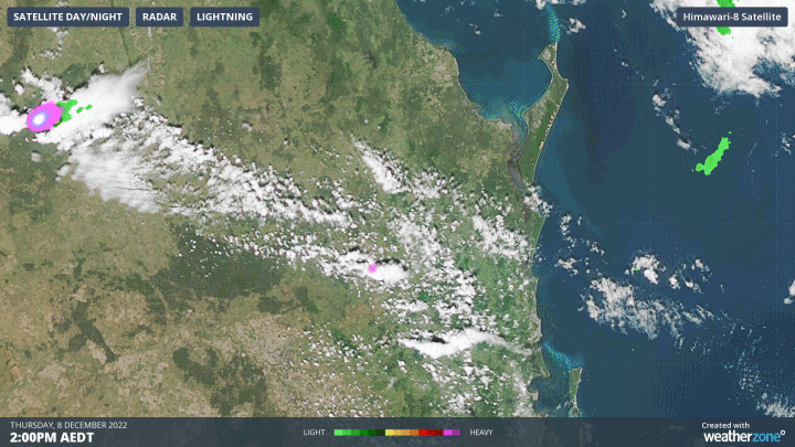
Image: Himawari visible satellite imagery, radar and lightning on 8 December 2022
Such splitting storms rotate and are called supercells. The rotation increases the strength of the updraft and increases the risk of severe phenomena. These storms are very dangerous and on occasion produce destructive tornadoes. On this day, storms produced hail larger than cricket balls and destructive winds exceeding 120km/h.
Storms over the Southern Interior of Western Australia
Yesterday, with moisture reaching the desert regions of Western Australia, a low-pressure trough triggered severe thunderstorms. In the animation below you can see the small clouds running away from the large storms. This is because of the downward currents of air rushing down from the storm and spreading away quickly. This process is aided by rain evaporating in the dry air below and making it rush down faster (hot air rises, cool air sinks). These winds can be dangerous and cause damage.

Image: Himawari visible satellite imagery, radar and lightning on 16 December, 2022
Slow-moving storms over southeast Australia
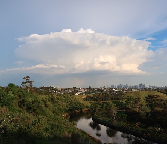
Sometimes storms form in environments with weak winds throughout the atmosphere. These weak winds allow storms to move very slowly and continually produce rain over the same area for an extended period. An example of this occurred over southeast Australia on November 7th and 8th including around Melbourne and Canberra. The following photograph shows a slow-moving storm that produced 38.8mm of rainfall in just one hour over an eastern suburb of Melbourne.

Image: A slow-moving severe thunderstorm to the east of Melbourne on November 7 (James Rout)
A tropical low near the Cocos Island
Thunderstorms can be building blocks for larger and even more intense weather systems. Tropical lows and tropical cyclones develop from tropical thunderstorms over warm waters that organize into large rotating bands. There is currently a tropical low to the northwest of Australia (called 05U) which the Bureau of Meteorology currently evaluates as not a risk to the mainland and as a low risk of developing into a tropical cyclone. The following animation shows the thick convective cloud rotating about a central point.

Image: Himawari visible satellite imagery on 17 December, 2022
Thunderstorms are expected to impact parts of every state and territory during the next week, particularly for the northern tropics as the monsoon trough develops to the north and central Australia as an inland trough develops. And another tropical low may form closer to northern Australia later next week with the development of the monsoon trough. The following image shows the 7-day accumulated rainfall totals simulated by the ECMWF model, showing rainfall across the country with the highest totals over the north.
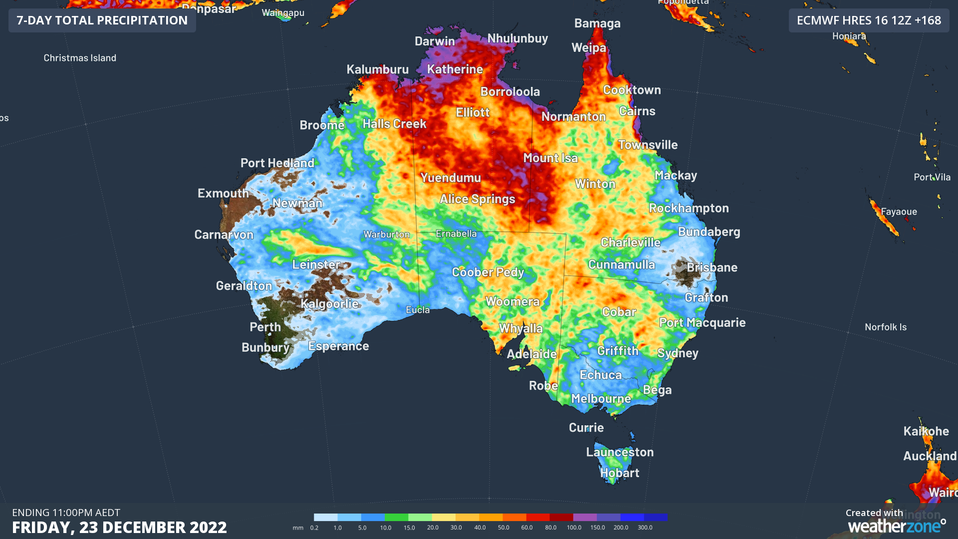
Image: 7-day rainfall accumulation to Friday 23 December (ECMWF model)
With severe summer weather, please stay up to date with the latest forecasts and warnings at: https://www.weatherzone.com.au/warnings
To find out more about the DTN APAC lightning detection services and our thunderstorm forecasts, please email us at apac.sales@dtn.com.


