
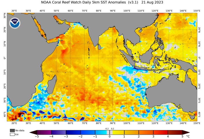
A positive Indian Ocean Dipole pattern has started to emerge to the northwest of Australia, increasing the likelihood of abnormally warm and dry weather over large parts of the country this spring.
The Indian Ocean Dipole (IOD) refers to an index that measures sea surface temperatures in the tropical Indian Ocean.
A positive IOD occurs when warmer than average water builds up in the western tropical Indian Ocean, near the Horn of Africa, and unusually cold water lies in the eastern Indian Ocean, near Indonesia.
Positive IOD events reduce the amount of atmospheric moisture flowing towards Australia from the northwest, which typically suppresses rainfall and increases daytime temperatures over parts of the continent.
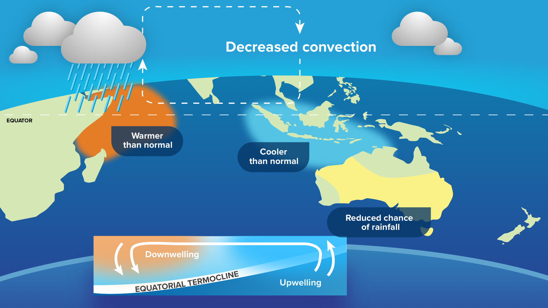
Image: Typical structure and impacts of a positive IOD.
By contrast, negative IOD events occur when abnormally cool water lies near the Horn of Africa and unusually warm water sits near Indonesia. This typically increases rainfall and decreases daytime temperatures over parts of Australia.
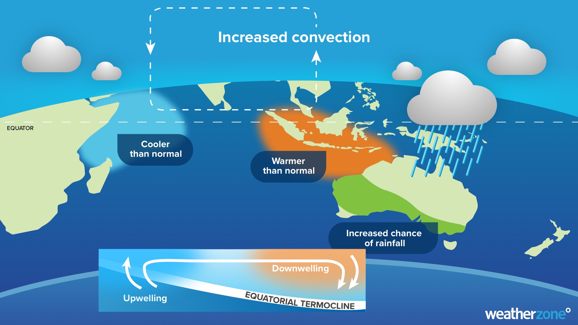
Image: Typical structure and impacts of a negative IOD.
The Bureau of Meteorology declared negative IOD events in 2021 and 2022. Unsurprisingly, both years featured above average rain in parts of Australia, particularly in 2022.
The last positive IOD event was in 2019. This was a very strong IOD event and resulted in Australia’s driest year on record.
The maps below show the contrast in rainfall between the positive IOD in 2019 and the 2022 negative IOD. While the IOD wasn’t the only climate driver influencing Australia’s weather in these years, this comparison shows how the IOD can contribute to widespread and extreme rainfall anomalies in Australia.
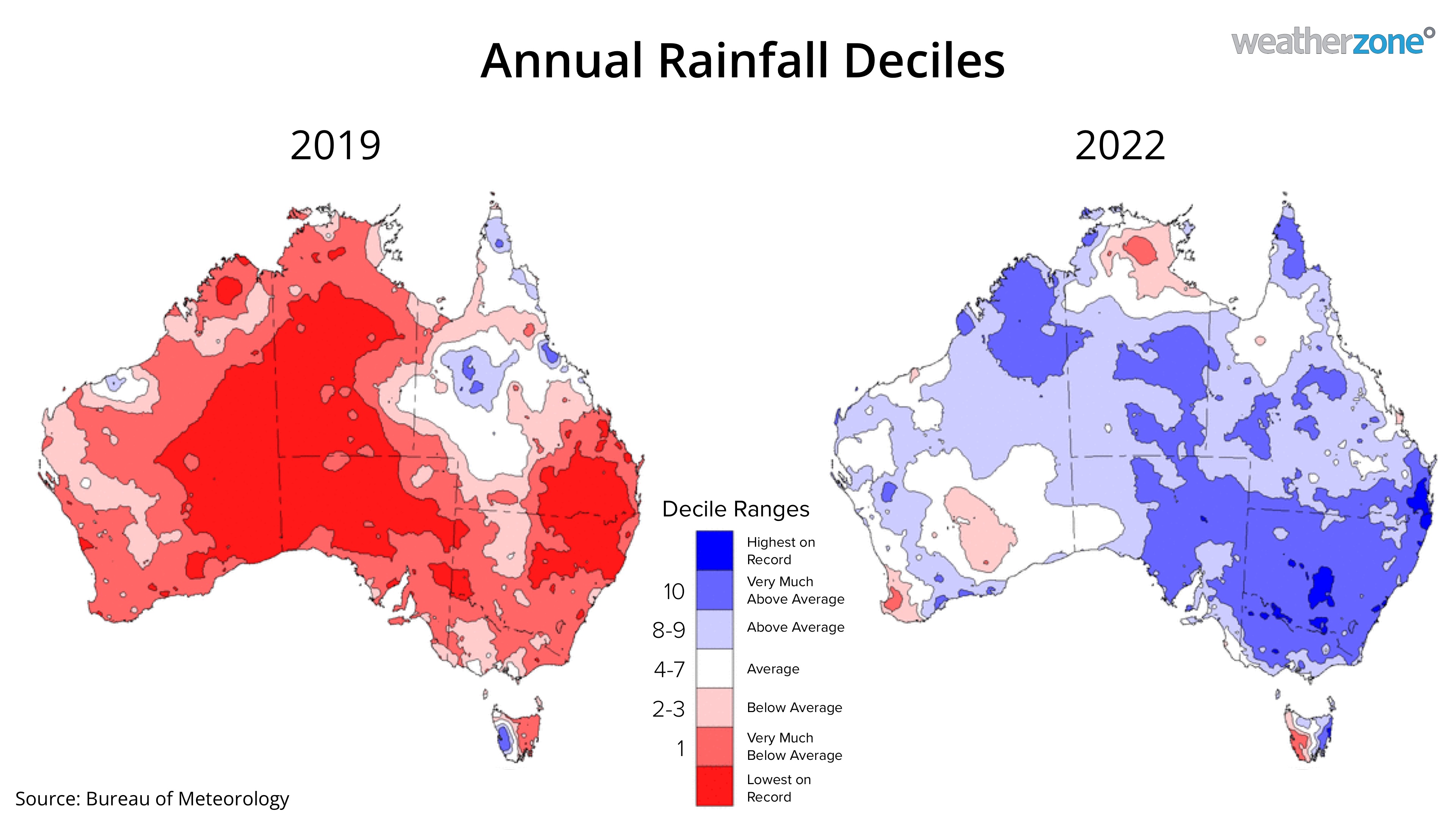
Image: Rainfall deciles during 2019 (left) and 2022 (right), showing the contrast between positive and negative IOD years.
The IOD index has been in a neutral state (between -0.4 and 0.4) since October last year. However, the latest weekly value rose to 0.79, which is the highest value since December 2019.
If the IOD index continues to exceed 0.4 in the coming weeks, which forecast models suggest will happen, the Bureau of Meteorology will officially declare the onset of a positive IOD.

Image: Weekly IOD index values between January 2019 and August 2023.
These recent IOD observations and the strong agreement between forecast models suggest that a positive IOD will occur this spring. This increases the likelihood that large parts of Australia will see below average rain and above average daytime temperatures in the next few months.




