Parts of Australia could be at risk of a flash drought in 2023, with growing signs that El Niño may develop in the Pacific Ocean later this year.
The current La Niña event, which underpinned record-breaking rain and flooding in eastern Australia last year, is about to end. This can be said with confidence because the tropical Pacific Ocean has already returned to a neutral state (neither La Niña nor El Niño), and the overlying atmosphere is also edging towards a neutral state.
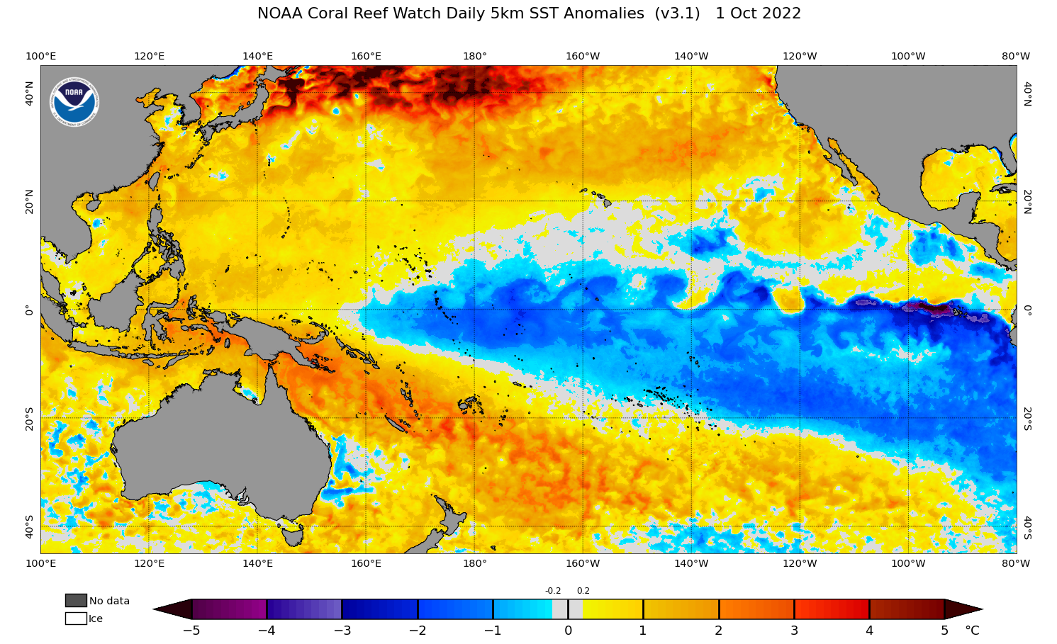
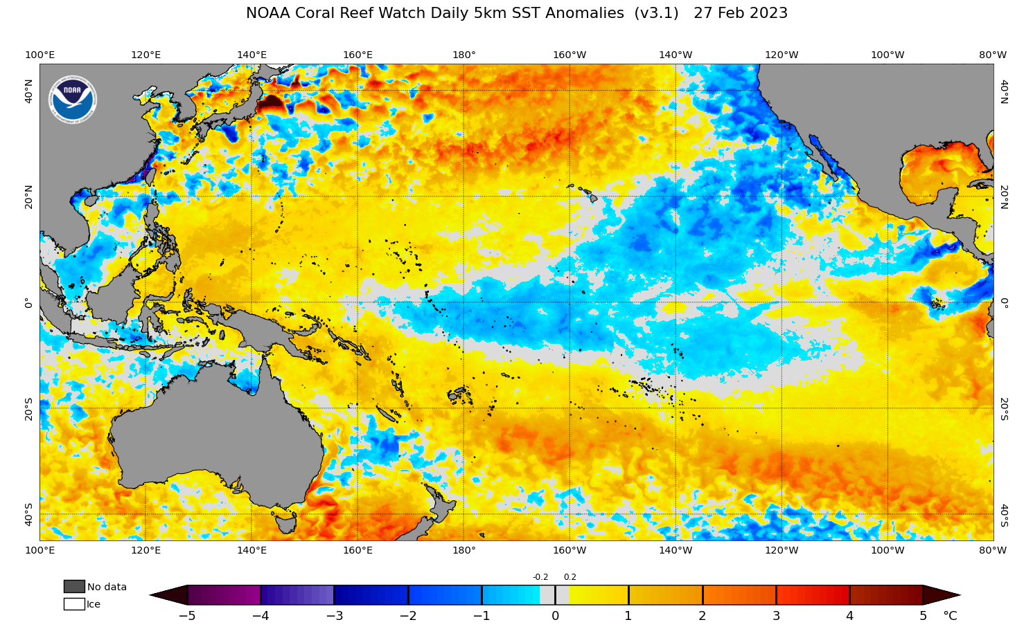
Images: Comparison of sea surface temperature anomalies in the Pacific Ocean, showing a clear La Niña pattern at the beginning of October 2022 (top) and a neutral pattern earlier this week (bottom). Source: NOAA
The Bureau of Meteorology are likely to officially declare the end of La Niña this month. But what happens after that could have a big impact on the rest of this year’s weather in Australia.
What will happen after La Niña?
The Pacific Ocean will remain in a neutral state during the weeks following La Niña. This is guaranteed because La Niña can’t flip straight from La Niña to El Niño without first passing through a neutral phase.
Looking ahead, it is very unlikely that La Niña will return later this year. If it did, this would make four consecutive La Niña events since 2020, a feat that has no precedent in modern records. More importantly, no forecast models currently predict a return of La Niña in 2023.
This leaves either neutral conditions in the Pacific Ocean for the remainder of 2023, or El Niño.
At this stage, both of these options are plausible, and neither is a firm favourite. However, there are growing signs that an El Niño pattern may emerge around the middle of 2023.
While it is still too early to have high confidence about El Niño later this year, most international forecast models currently favour its development this winter. The graph below shows that four of the seven models surveyed by the Bureau of Meteorology expect El Niño to develop this winter.
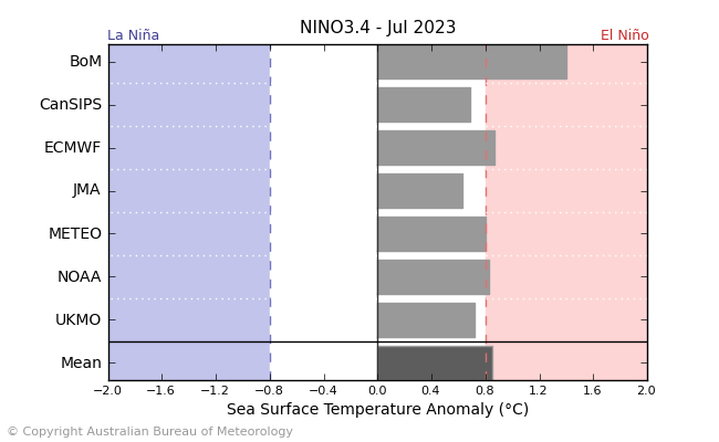
Image: Forecast sea surface temperature anomalies in the Niño-3.4 region of the Pacific Ocean, with four of seven models predicting that this index will be exceeding the Bureau of Meteorology’s threshold for La Niña by July. Source: Bureau of Meteorology
What does this mean for Australia’s weather?
If neutral conditions persist in the Pacific Ocean during the rest of 2023, Australia’s weather will have no forcing from this climate driver. This would make exceptionally wet and dry weather unlikely.
If El Niño emerges in 2023, this will increase the likelihood of unusually dry and warm weather over large areas of Australia.
El Niño is also known to increase the probability of drought and bushfires in Australia. However, it is important to note that Australia just had a prolonged period of wetter-than-average weather under a triple-dip La Niña. This lingering moisture, which is being preserved in the landscape in vegetation and groundwater, would help to offset dry and warm influence of El Niño.
Two key things to watch out for in the back half of 2023 are flash droughts and grass fires, especially if El Niño does occur.
The Bureau of Meteorology defines a flash drought as “a type of drought that has undergone rapid intensification that has devastating impacts on agriculture.”
Unlike a meteorological drought that can take years or even decades to develop, flash droughts intensify quickly, usually over weeks to months. This rapid transition into drier conditions, which can happen when El Niño immediately follows La Niña, can lead to vegetation moisture stress.
Flash droughts can also increase the risk of grass and crop fires, due to this type of vegetation drying out faster than forested areas.
There are already sings that rainfall has been waning over parts of eastern Australia in the last few months, coinciding with the breakdown of La Niña. This abnormally dry weather could persist if El Niño develops later in the year.
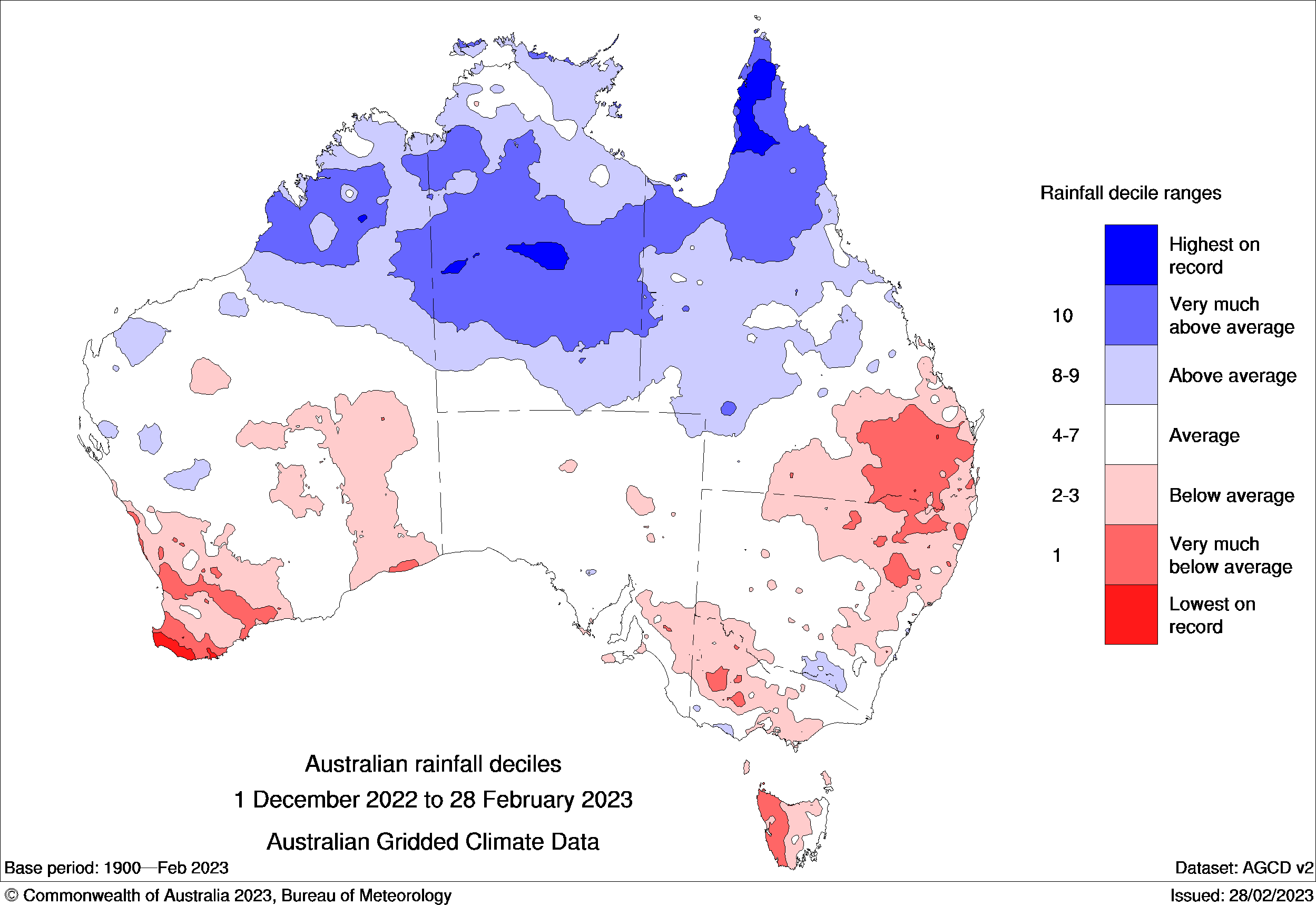
Image: Observed rainfall deciles in summer 2022-23, showing that rainfall was in the lowest 10 percent of historical records in parts of eastern and southern Australia. Source: Bureau of Meteorology
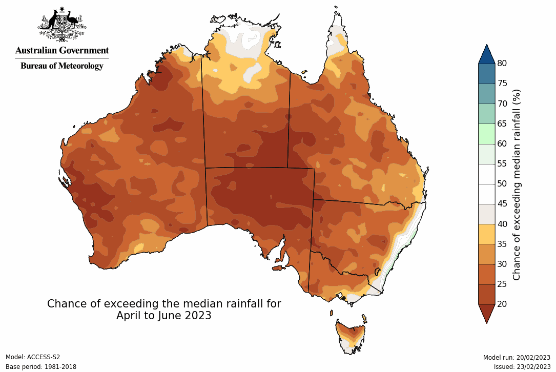
Image: Rainfall outlook for April to June, according to the Bureau of Meteorology.
DTN APAC can provide tailored climate briefings to your business to alert you of the most likely weather conditions and hazards to look out for during the upcoming season. Now is a good time to get a good look at the forecast for autumn and an early look at winter. To find out more or to book a presentation, please email us at apac.sales@dtn.com.


