
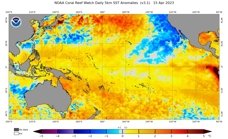
A blob of warm water lurking beneath the surface of the Pacific Ocean is increasing the likelihood that El Niño will develop later this year.
The prospect of El Niño in 2023 is not new news. International forecast models have been hinting at the return of El Niño since late last year.
However, these predictions have so far been treated with caution because computer models are known to be less accurate at predicting El Niño before the end of the Southern Hemisphere’s autumn. This is aptly named the spring predictability barrier.
But a large pool of abnormally warm water building beneath the surface of the Pacific Ocean is making international forecasters more confident that El Niño is indeed on the way, and it could be a strong one.
The animation below shows water temperature anomalies in the top 300 metres of the tropical Pacific Ocean between February and April this year. The red shading shows areas where water temperatures are warmer than average, compared to the 30-year period from 1991 to 2020.
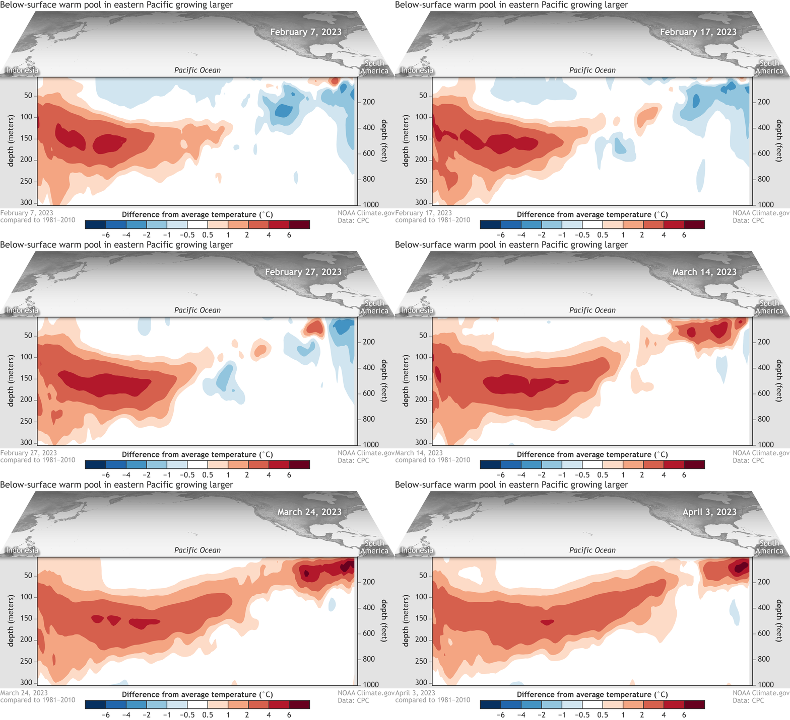
Image: Water temperature anomalies in the top 300 metres of water in the tropical Pacific Ocean, relative to the 1991-2020 mean. Source: NOAA Climate.gov / CPC
In the animation above, the large blob of red that is spreading from left to right highlights a pool of abnormally warm water that has been propagating across the tropical Pacific Ocean beneath the surface over the last couple of months. This movement of warm water below the surface is called a ‘downwelling Kelvin wave’ and it is a known precursor to the development of El Niño.
Another key feature of the animation above is the small region of very warm sea surface temperature anomalies off the west coast of South America. Warm water in this part of the tropical Pacific Ocean can also portend El Niño.
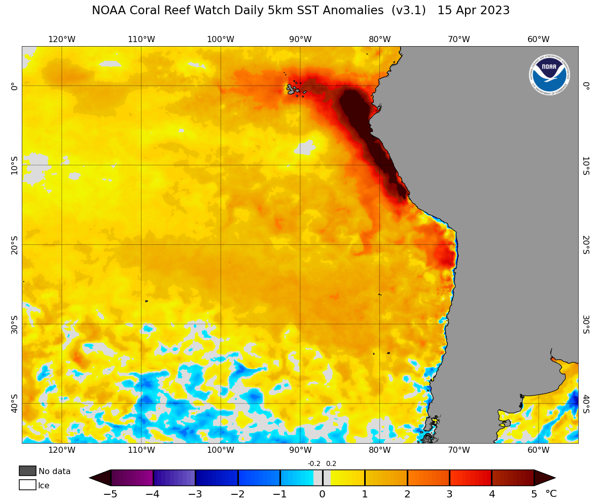
Image: Sea surface temperature anomalies on April 15, 2023, showing water that is more than 5ºC warmer than average off the coast of Peru. Source: NOAA
The downwelling Kelvin wave and the build-up of exceptionally warm water near Peru are both signs that an El Niño could be taking shape. These two features are part of the reason forecasters at the U.S. Climate Prediction Center (CPC) are giving El Niño more than an 80 percent chance of developing by the Southern Hemisphere’s spring.
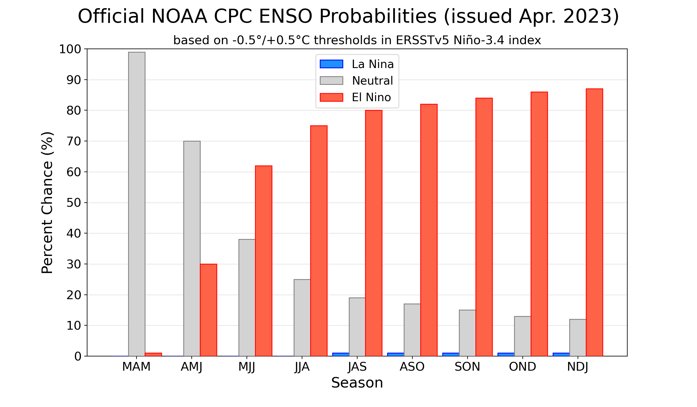
Image: Most recent human-based forecast from the U.S. Climate Prediction Center (CPC), giving El Niño a 62 percent chance of developing in the next few months and more than an 80 percent chance of forming by the Southern Hemisphere’s spring. Source: NOAA CPC
A number of other international forecast organisations are also predicting the development of El Niño in the middle of 2023, including Australia’s Bureau of Meteorology.
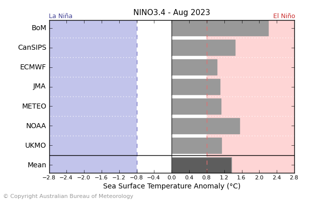
Image: International climate model predictions for El Niño in August 2023, based on the mean Niño-3.4 sea surface temperature anomaly. Source: Bureau of Meteorology
While there is still a chance the models are wrong, all models are currently pointing towards El Niño in 2023 and there are signs that it could be a strong one.
El Niño typically causes below-average rain and above-average daytime temperatures over large areas of Australia. But while days are usually warmer, clearer nights often cause an increased risk of frost during winter and spring. El Niño can also increase fire danger in parts of the county and reduce tropical cyclone activity in the Australian region.
DTN APAC can provide tailored climate briefings to your business to alert you of the most likely weather conditions and hazards to look out for during the upcoming season. Now is a good time to get a good look at the forecast for autumn, winter and beyond. To find out more or to book a presentation, please email apac.sales@dtn.com.




