
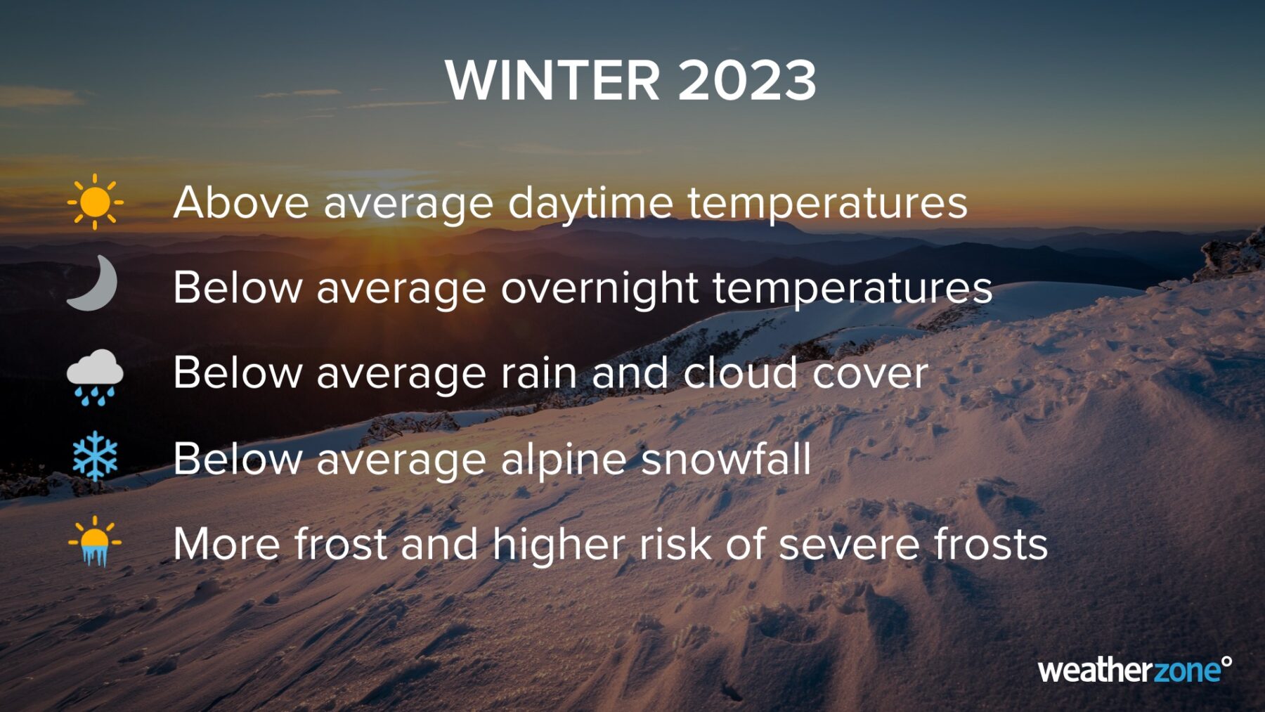
El Niño and a positive Indian Ocean Dipole could combine forces to cause abnormally warm and dry weather over large areas of Australia this winter.
The meteorological winter in Australia runs from June 1 until August 31. These are typically Australia’s three coldest months of the year and a time for seasonal rain and snow in the country’s southern states.
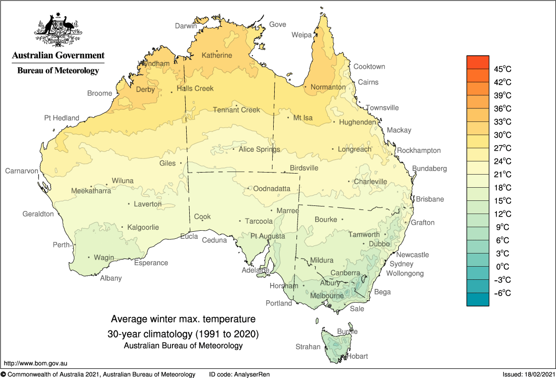
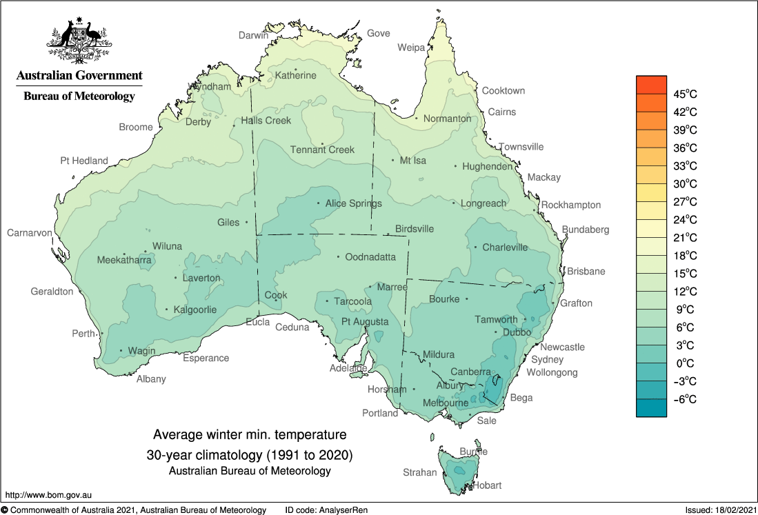
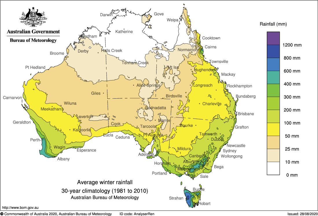
Images: Average winter maximum temperature (top) and minimum temperature (middle) and rainfall (bottom) for Australia during winter.
While this winter will still have plenty of cold weather, rain, snow and frost, two broad-scale climate drivers could team up and make some types of weather more likely than others.
Climate drivers
All major international seasonal forecast models predict that El Niño will develop in the Pacific Ocean this winter. We are already seeing strong signs that the onset of this El Niño pattern is underway, and the overwhelming forecast model consensus makes El Niño more likely than not over the coming months.
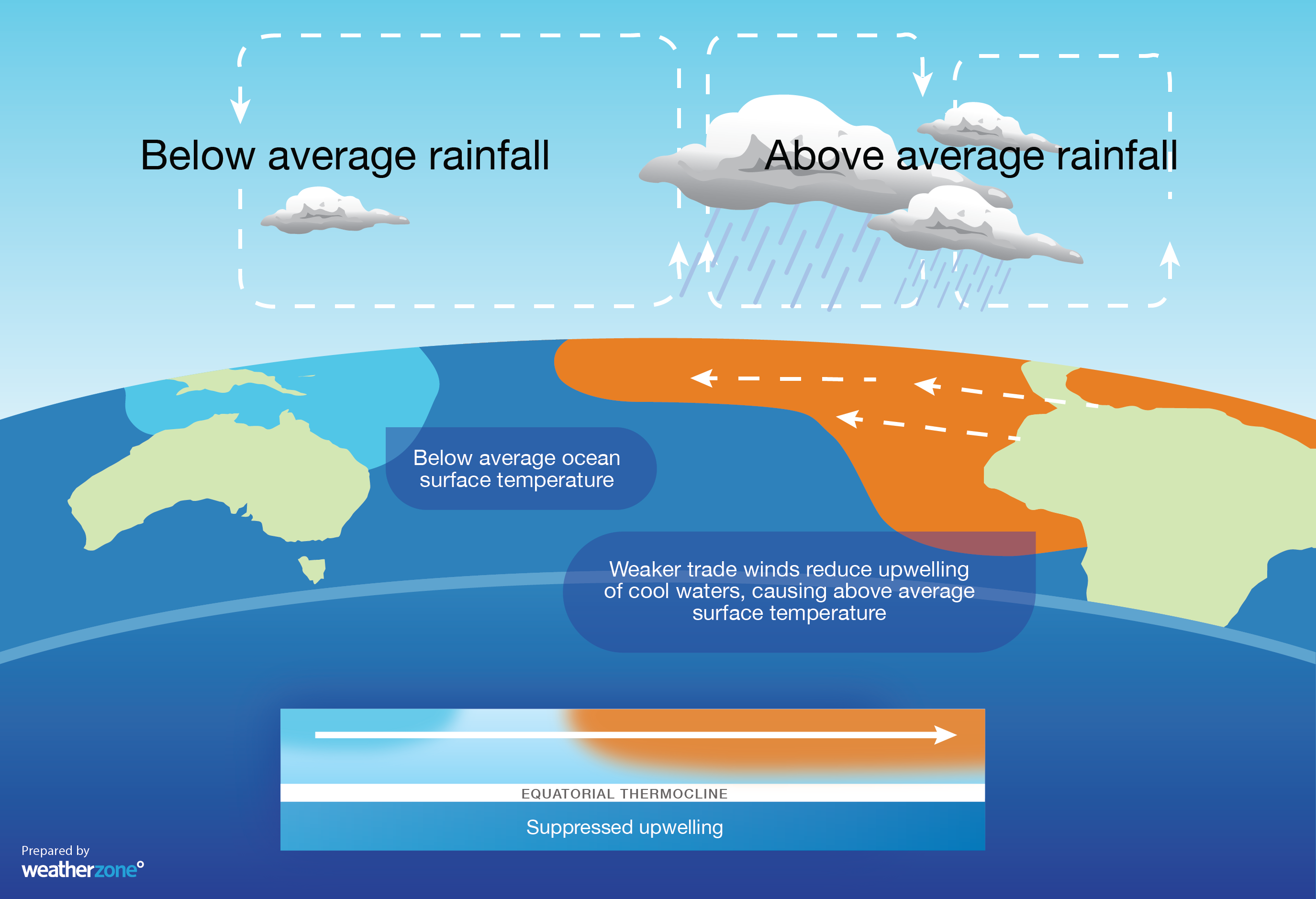
Image: Typical oceanic and atmospheric conditions experienced during El Niño.
On the other side of Australia, both observations and forecast models suggest that a positive Indian Ocean Dipole (IOD) will also form this winter.
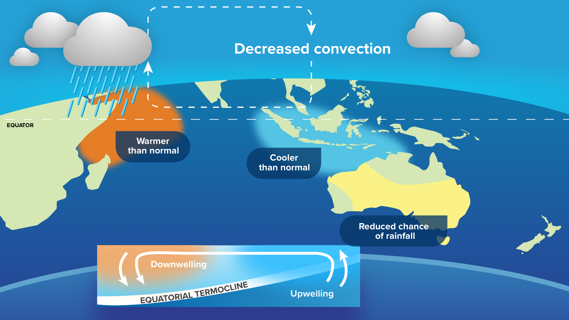
Image: Typical oceanic and atmospheric conditions experienced during a positive IOD.
Both El Niño and a positive IOD promote warmer and drier than average weather in Australia during winter. When these two climate drivers occur at the same time, they can reinforce each other and exacerbate their influence on Australia’s weather.
It’s important to note that the Pacific and Indian Oceans are both currently in a neutral state. This means that the influence of El Niño and a positive IOD, should they develop, will be more pronounced during the second half of the season.
What to expect this winter

Temperatures
Maximum temperatures are expected to be higher than average over most of Australia this winter, particularly during the second half of the season if El Niño and a positive IOD become entrenched.
.png)
Image: Chance of exceeding the median maximum temperature during winter 2023. Source: Bureau of Meteorology.
By contrast, minimum temperatures could be lower than average for some parts of Australia this winter, particularly over the central and southeast inland. These lower minimums increase the risk of frost.
.png)
Image: Chance of exceeding the median minimum temperature during winter 2023. Source: Bureau of Meteorology.
Warm days and cold, frosty nights are a typical during El Niño and a positive IOD winters. This is because clearer skies allow more heating to occur during the day, while radiative cooling is more prevalent during the clear nights.
Rainfall
Winter rainfall is expected to be lower-than-average for most of Australia this winter. While this outlook won’t mean too much for areas of central and northern Australia that are typically dry at this time of year, reduced winter rainfall in southern Australia will be more noticeable.
.png)
Image: Chance of exceeding the median rainfall during winter 2023. Source: Bureau of Meteorology.
Snowfall
Snowfall in the Australian Alps can be very sensitive to the warming and drying effects of El Niño and a positive IOD. If both climate drivers develop this winter as expected, a below average snow season is anticipated for the Australian Alps.
Based on snow measurements at Spencers Creek, NSW dating back to 1954, the average season peak snow depth is around 198 cm. However, this average drops by around 36 cm when El Niño is in place and slightly more when both El Niño and a positive IOD join forces.
DTN APAC has a vast array of services available to meet the needs of any weather-exposed industry. From our Mining Blast Dispersion forecasts, Hub Height Wind forecasts, and Lightning tracking and alerting we have all your needs covered. To find out more, explore our website or email us at apac.sales@dtn.com.




