
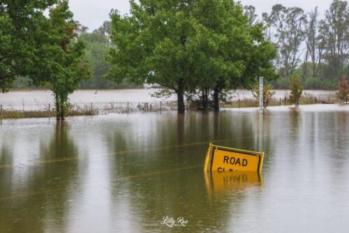
Thick clouds, relentless rain and flooding are plaguing eastern NSW this morning, with Sydney now having its wettest start to a year on record. The composite satellite and radar animation below shows bands of rain lashing the central and southern coast and ranges of NSW on Tuesday morning. The clouds and rain in the animation […]
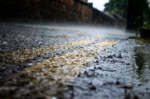
Over the last fortnight, eastern Australia was hit by a major rain and flooding event that affected around 1000 km of the eastern seaboard, stretching from southeast Qld down to southern NSW. This historic rain event was fuelled by a relentless atmospheric river feeding moisture-laden air into a slow-moving upper-level low pressure system. This […]
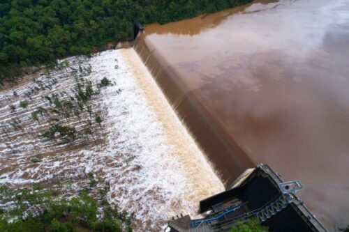
More heavy rain, thunderstorms, damaging winds and dangerous surf will lash eastern NSW over the next 48 hours. After two weeks of relentless rain and widespread flooding, mother nature isn’t ready to turn the tap off over eastern NSW just yet. An upper-level low passing over eastern Australia on the weekend caused moisture-laden air from […]
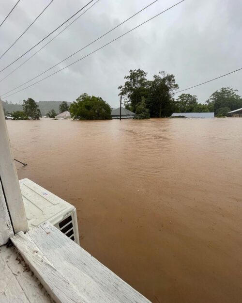
A key question many have asked all week, as floods inundated southeast Queensland, then northeast NSW, then more parts of the NSW coast and nearby ranges, including the Sydney region, is this: Is climate change to blame? The last six days over eastern Australia. pic.twitter.com/0EUy8wf9ZX — Andrew Miskelly (@andrewmiskelly) March 3, 2022 In truth, […]

This year’s Sydney Gay and Lesbian Mardi Gras could become a soggy celebration, with rain and possibly thunderstorms expected to develop at some point on Saturday night. The lead up to this year’s Mardi Gras has been very wet in Sydney. The city’s official rain gauge at Observatory Hill has registered rain on all of the […]
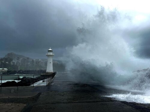
While rain will ease over eastern NSW from tomorrow, there are signs that another round of heavy rain, thunderstorms and strong winds will develop next week. Heavy rainfall, damaging winds and major riverine flooding have all been observed along the NSW coast and adjacent ranges this week, driven by an atmospheric river feeding into […]
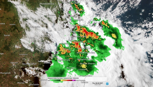
Dangerous thunderstorms are pummelling flood-affected parts of southeast Qld and northeast NSW this morning, with more on the way later today. Just days after being hit by record-breaking rain and flooding, parts of southeast Qld and the far northeast corner of NSW are being hit by intense thunderstorms on Thursday morning. Image: Composite radar/satellite […]
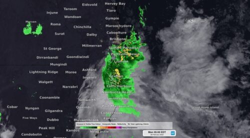
An extremely dangerous flooding situation has developed in southeast QLD and northeast NSW in response to several days of unrelenting rainfall, which included Brisbane’s wettest three days on record. A dynamic weather pattern involving a sustained stream of moisture-laden east-northeasterly winds, a near-stationary low-pressure trough and a slow-moving upper-level low-pressure system caused a river of […]
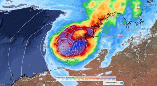
Heavy rain and damaging winds are spreading along the Kimberley coast as Ex-Tropical Cyclone Anika gets set to reintensify over the coming days. Tropical Cyclone Anika formed over the Timor Sea on Friday night before drifting south and making landfall over the north Kimberley coast on Saturday night. Anika crossed the coast as a category […]
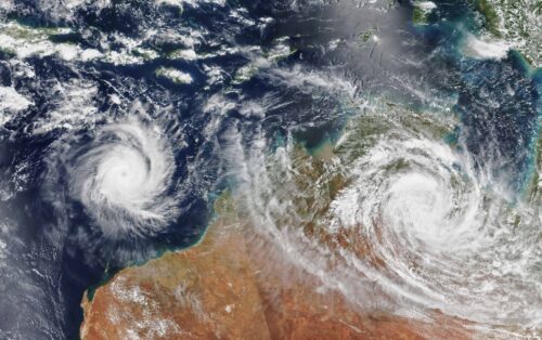
Australia’s tropical cyclone season is officially underway, but we may not see much activity for few months yet. The season runs from November to April, and for mining operators and businesses across northern Australia, 2026-27 is shaping up to be a season where the headline numbers and the real risk may not line up. On […]
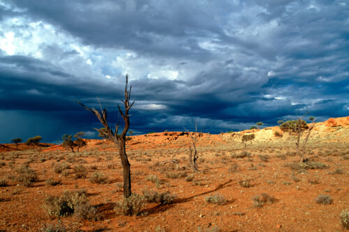
A positive Indian Ocean Dipole is underway, but this one is unlikely to deliver the textbook dry spring and summer that businesses have come to expect from the pattern. The Bureau of Meteorology officially declared a positive IOD on Tuesday, October 27, which typically like El Niño can cause drier and warmer conditions over parts of […]
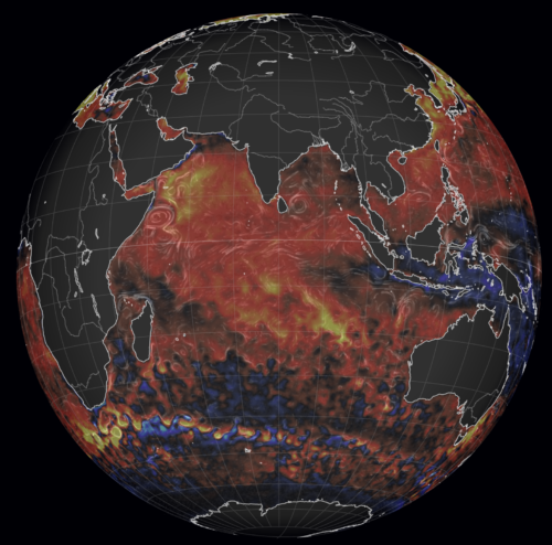
Waters off Indonesia have cooled in recent weeks, an indication that a positive Indian Ocean Dipole (IOD) event could be developing. It’s an important climate driver for Australia, and it could shape rainfall and temperatures heading into summer, with flow-on effects for farmers, energy and other industries. What is the Indian Ocean Dipole? The IOD […]

Leonora, WA, had its wettest September day on record earlier this month. Three weeks later, more than 1.3 million lightning pulses were detected within 800 km of the town in 48 hours. Why is a stalled trough delivering storms to mining country, and what it could mean for operations? The DTN Total Lightning Network detected […]