
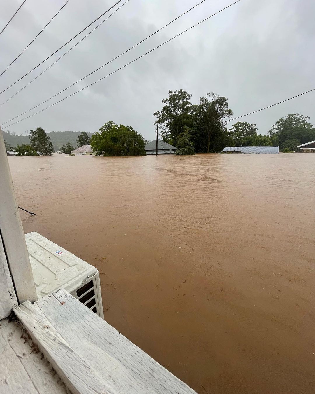
A key question many have asked all week, as floods inundated southeast Queensland, then northeast NSW, then more parts of the NSW coast and nearby ranges, including the Sydney region, is this:
Is climate change to blame?
The last six days over eastern Australia. pic.twitter.com/0EUy8wf9ZX
— Andrew Miskelly (@andrewmiskelly) March 3, 2022
In truth, a better question would have been: “to what extent is climate change involved?” because there is no absolute “yes” or “no” answer to the first question.
Weather is complex, climate several times more so, and the interaction between the two of them is much more complicated again.
It’s tempting for those who advocate action on climate change to pin every extreme weather event to a planetary climate system spinning out of control.
It’s equally appealing for those who dismiss the threat of a changing climate as overstated to say, “we’ve always had natural disasters”.
The truth, as with most things, is quite likely somewhere in the middle.
In the latest #flood news on Tuesday morning, several people and at least six horses are stuck on the bridge across the Richmond River in the small NSW town of #Woodburn.
More at https://t.co/gzOGR3ekWA
Video: @sarah_anne12/IG capturing their rescue evacuation in Lismore. pic.twitter.com/7qhUGKPlgE
— Weatherzone (@weatherzone) March 1, 2022
Yes, weve always had natural disasters, which is why the second stanza of Dorothea McKellar’s nation-defining poem “My Country” features the famous lines: “I love a sunburnt country/A land of sweeping plains/
Of ragged mountain ranges/Of droughts and flooding rains”.
But yes, the world is observably warming to an extent that it is dynamically impacting global and local weather.
The hard part is finding the direct paw prints of climate change in individual weather events like the past week’s relentless eastern Australia rains.
So here’s what we know.
Lismore’s 2022 flood level pic.twitter.com/SXG4gonInT
— Greg O’Connor (@gregoconnor) March 3, 2022
Thanks to this piece on Weatherzone by Andrew Miskelly, we know that there were at least four direct causes of this weather event:
1. This (late spring and) summer’s La Niña event. During a La Niña pattern, warmer-than-usual sea surface temperatures in the western equatorial Pacific allow more moisture to build up in the atmosphere.
2. The area of cool upper air that drifted across SA and southern QLD last week. Cool air in the upper levels destabilises the atmosphere, allowing air that is lifted by converging winds in the low levels to remain buoyant, producing cloud and rain.
3. A series of troughs near the coast, south of which lay a deep feed of moist, tropical air originating over the Coral Sea and beyond. This long conveyor belt of moisture was sufficient to be classed as an “atmospheric river”. These areas of converging winds provided lifting mechanisms which drifted over land at times, creating a focus for the heaviest rain and thunderstorms.
4. The systems this week were slow moving in nature. This was especially true for the upper feature which essentially stalled over southeast Queensland between Friday and Sunday, allowing the band of heavy rain and thunderstorms on its eastern and southern flank to sit over the same areas for 72 hours or more.
So that’s a very brief precis of the meteorological influences behind this week’s weather. The role of climate?
As Miskelly wrote, “In addition to the unique mix of weather-related features that underpinned this rain event, there may also have been some influence from the background climate.”
“Warmer oceans mean more water vapour in the atmosphere, and warmer air has a greater capacity to hold the vapour. So, it’s possible that the warming trend we are observing in our oceans and atmosphere will make these types of events more severe as time goes by.”
The key phrase there is “more severe”. Climate change doesn’t make these events happen. But it likely increases their severity.
Glimpses of an inland sea across north east NSW this morning. The Richmond and Wilsons rivers are visible to the south of the cloud, and the Tweed River to the north. pic.twitter.com/lyLRAtdbH8
— Andrew Miskelly (@andrewmiskelly) February 28, 2022
For more information on Weatherzone’s seasonal services, heavy rainfall and thunderstorm alerts, please contact us at apac.sales@dtn.com.
Thumbnail: Showing flooding at Lismore on Tuesday, March 1. Source: @sarah_anne12




