
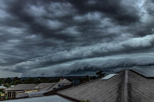
While there are many types of thunderstorms, squall-line thunderstorms are one of the largest types and impact the highest number of people when they roll through. Squall lines are a special and organised version of a traditional thunderstorm. These are almost always associated with a broad scale synoptic feature (like a front or trough) that […]
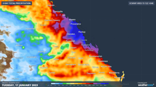
Queensland’s central and northern coasts have been hammered with over 700mm of rain falling over the past 5 days, and the deluge is still not done yet. So far, Proserpine has been one of the wettest locations, notching up a staggering 620mm in the five days since Wednesday. This included its wettest 48 hours in […]
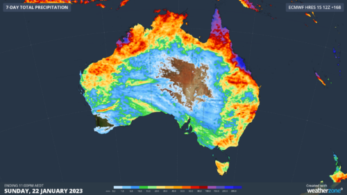
Australia is in for a dynamic mix of summer weather this week, with flooding rain continuing in Queensland, dangerous thunderstorms to replace intense heat in the south, and an increasing risk of tropical cyclone development in the Coral Sea. Rain in every state The map below paints a clear picture of how this week will […]
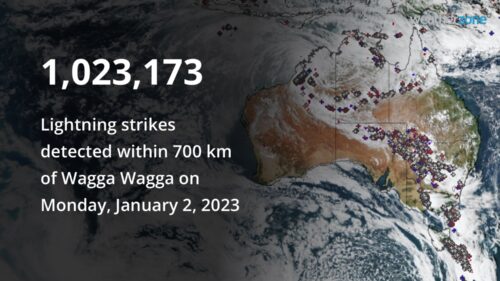
Over one million lightning strikes have been recorded within 700km of Wagga Wagga as widespread storms spread through Victoria and NSW on Monday. Widespread thunderstorms broke out on Monday 2nd along a cold front stretching from the northwest of the country all the way through the interior and down to southern NSW, Victoria, and the […]
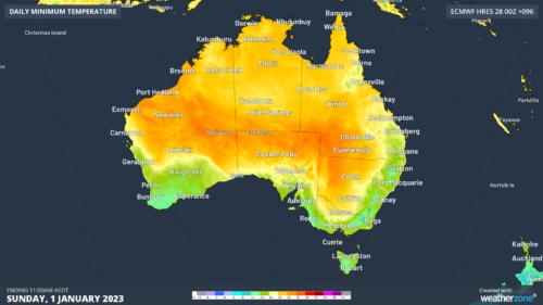
New Year’s Eve is looking pretty good across most of Australia, but how likely are showers and strong winds where you live? Overall, the introduction into 2023 will be fairly typical of an Australian summer night. Image: 3-hour rainfall forecast over midnight on New Year’s Eve. The monsoon will still be active over northern Australia, […]
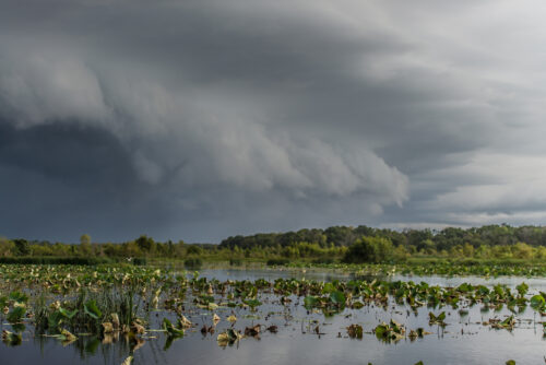
The long-awaited monsoon has officially arrived over northern Australia, supplying the sustaining rain that is critical to the northern flora and fauna. The monsoon arrival means over the next week or two, the north will see frequent rain, showers, and thunderstorms. Initially, this will occur over the Top End (including Darwin) but will move further south […]
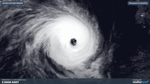
Severe Tropical Cyclone Darian has become Australia’s earliest category 5 system in December since Tropical Cyclone Lawrence in 2009, with wind gusts up to 285km/h. Darian has been steadily intensifying over the last few days, but thanks to some slightly warmer water (a tropical cyclone’s fuel source), it pushed up the scale from category 4 to […]
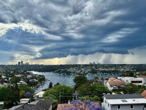
More than 2.5 metres of rain has fallen on Sydney this year, obliterating the city’s previous annual rainfall record by more than 300 mm. Sydney just had an exceptionally wet year thanks to the rain-boosting influence of thee wet-phase climate drivers: Back-to-back La Nina events A negative Indian Ocean Dipole (IOD) A predominantly positive Southern […]
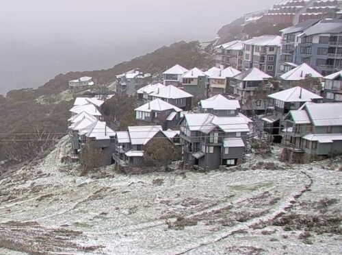
If you think Melbourne and indeed the whole state of Victoria has been cold in recent days by summer standards – and especially this Wednesday morning – you’re absolutely right. In fact, Victoria has just registered its coldest summer temperature on record, when the mercury dipped to -5.4°C at Mt Hotham at 5:09 am on […]
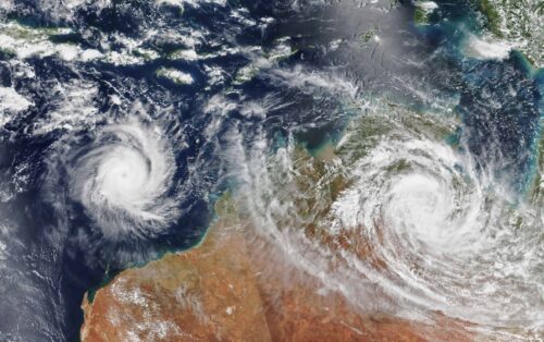
Australia’s tropical cyclone season is officially underway, but we may not see much activity for few months yet. The season runs from November to April, and for mining operators and businesses across northern Australia, 2026-27 is shaping up to be a season where the headline numbers and the real risk may not line up. On […]

A positive Indian Ocean Dipole is underway, but this one is unlikely to deliver the textbook dry spring and summer that businesses have come to expect from the pattern. The Bureau of Meteorology officially declared a positive IOD on Tuesday, October 27, which typically like El Niño can cause drier and warmer conditions over parts of […]
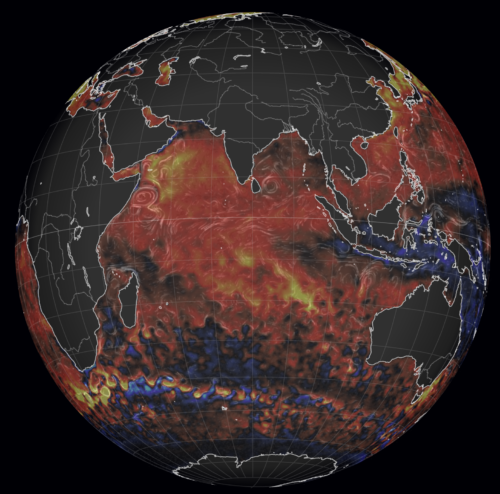
Waters off Indonesia have cooled in recent weeks, an indication that a positive Indian Ocean Dipole (IOD) event could be developing. It’s an important climate driver for Australia, and it could shape rainfall and temperatures heading into summer, with flow-on effects for farmers, energy and other industries. What is the Indian Ocean Dipole? The IOD […]

Leonora, WA, had its wettest September day on record earlier this month. Three weeks later, more than 1.3 million lightning pulses were detected within 800 km of the town in 48 hours. Why is a stalled trough delivering storms to mining country, and what it could mean for operations? The DTN Total Lightning Network detected […]