A massive line of storms has marched its way across central NSW reaching Sydney mid-afternoon and bringing with it heavy rain, strong gusty winds, and thousands of lightning strikes.
This was a storm front that looked as spectacular on radar images as it did in the sky, with shelf clouds heralding the arrival of the wild afternoon weather.
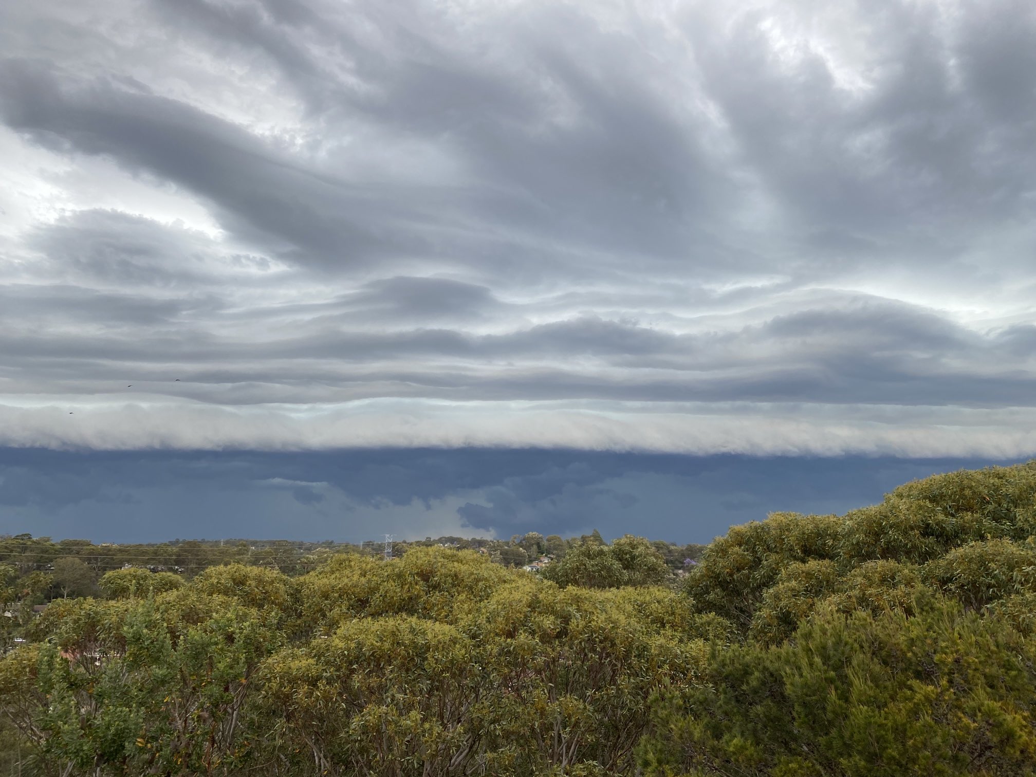
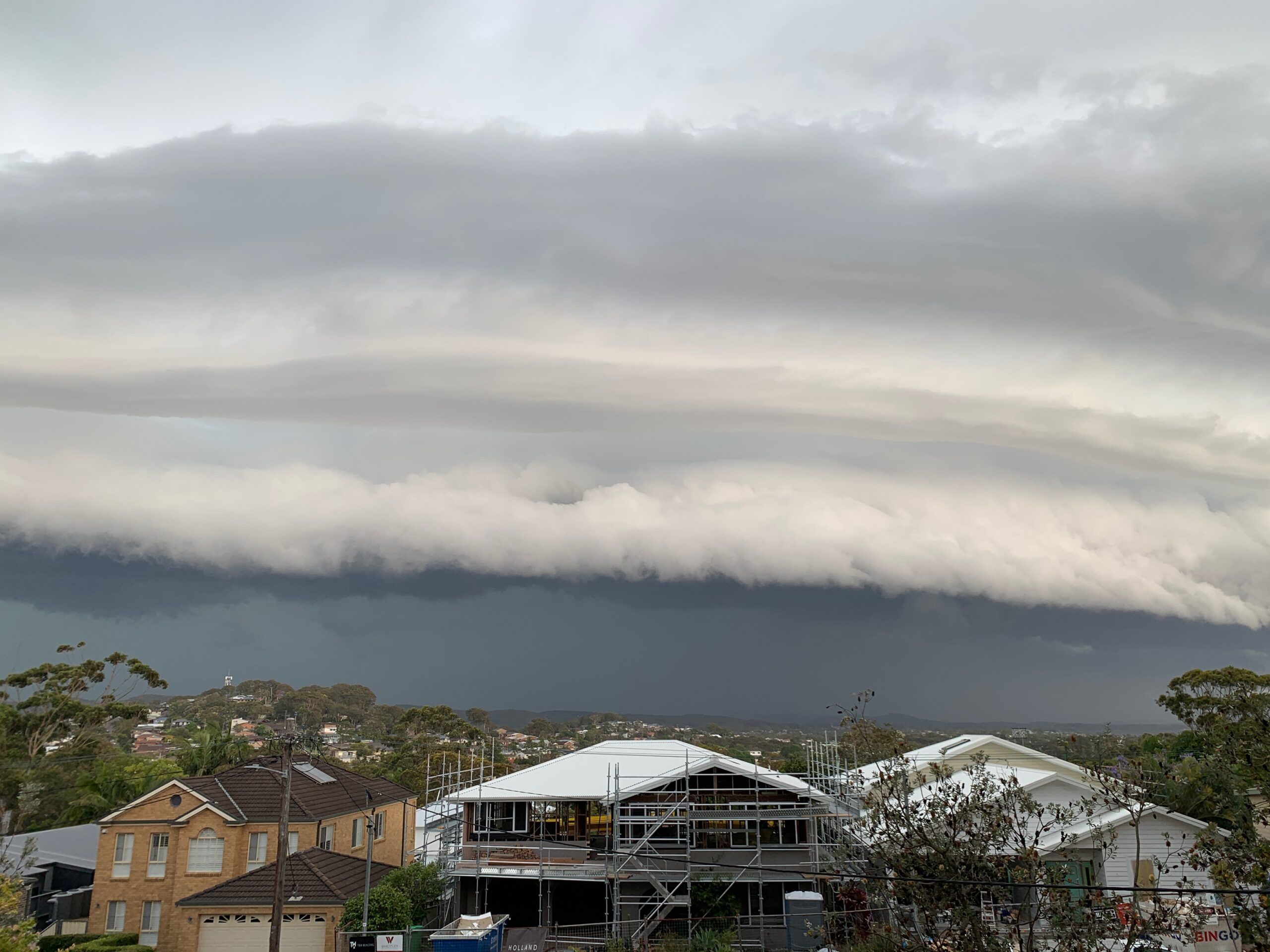
Image: There are no people in this shelf cloud pic so it’s not a shelfie selfie. Source: Phillip Moore.
This spectacular image of the storm arriving over the city of Wollongong, just south of Sydney, was taken by local photographer Andrew Moore (no relation as far as we know to Phillip Moore who took the above image).
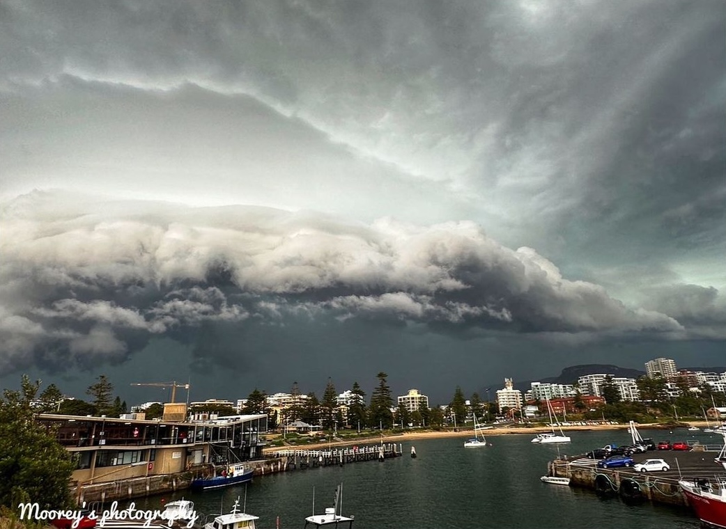
Image: Now THAT is a top shelf image. Source: mooreys_photography on Instagram.
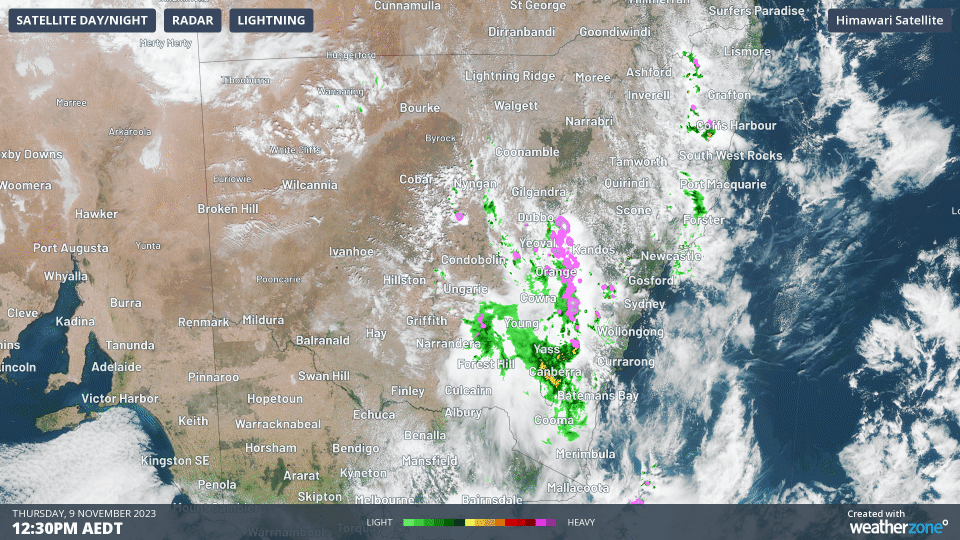
As you can see on the statewide radar for the three-hour period from 12:30 pm to 3: 30 pm, this is an event that affected a much wider area than just the Sydney metropolitan and Blue Mountains regions.
The scale of the storm system is reflected in the warnings. Between 3 and 4 pm, the BoM issued a string of Severe Thunderstorm Warnings for damaging winds, large hailstones and heavy rainfall for the following NSW forecast districts:
- Gosford/Wyong
- Sydney (Metropolitan)
- Blue Mountains/Hawkesbury
- Greater Wollongong
- Hunter
- Central Tablelands
- Central West Slopes and Plains
- North West Slopes and Plains
As ever please check our warnings page for more information.
Meanwhile power outages in the Blue Mountains and parts of Sydney as the storms ripped through, while heavy rain has likely caused flash flooding in some locations.
By 4 pm, between 5 and 20 mm had fallen in most Sydney suburbs over a relatively short period of time, while Mangrove Mountain on the Central Coast, just north of Sydney, had seen 32.4 mm in under an hour, with 21 mm in just 11 minutes.
By 5pm, the Total Lightning Network had already detected over 760,000 lightning strikes over NSW, with peak rate of 4000 flashes per minute. To find out more about our lightning and storm services, please email us at apac.sales@dtn.com.


