
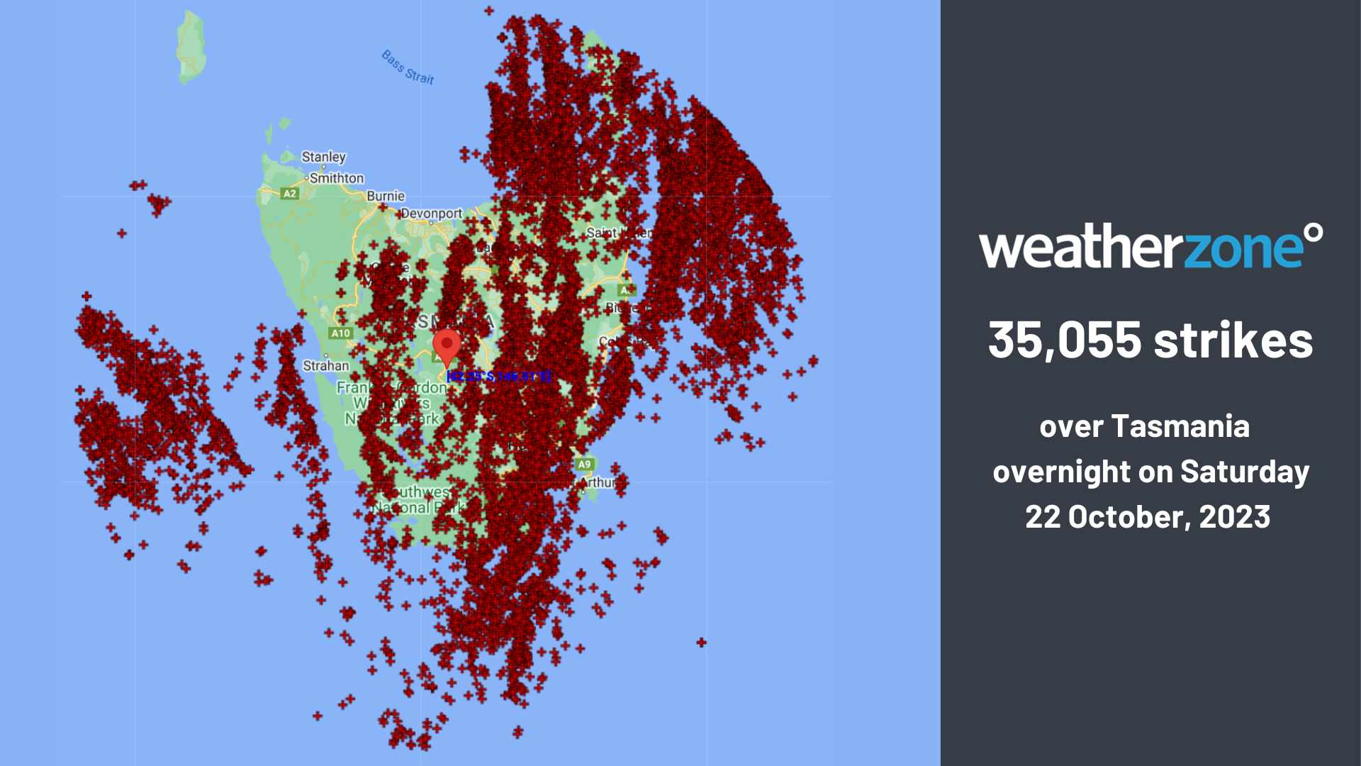
Over 35,000 lightning strikes have been recorded over Tasmania on Saturday night as a line of thunderstorms marched across the state.
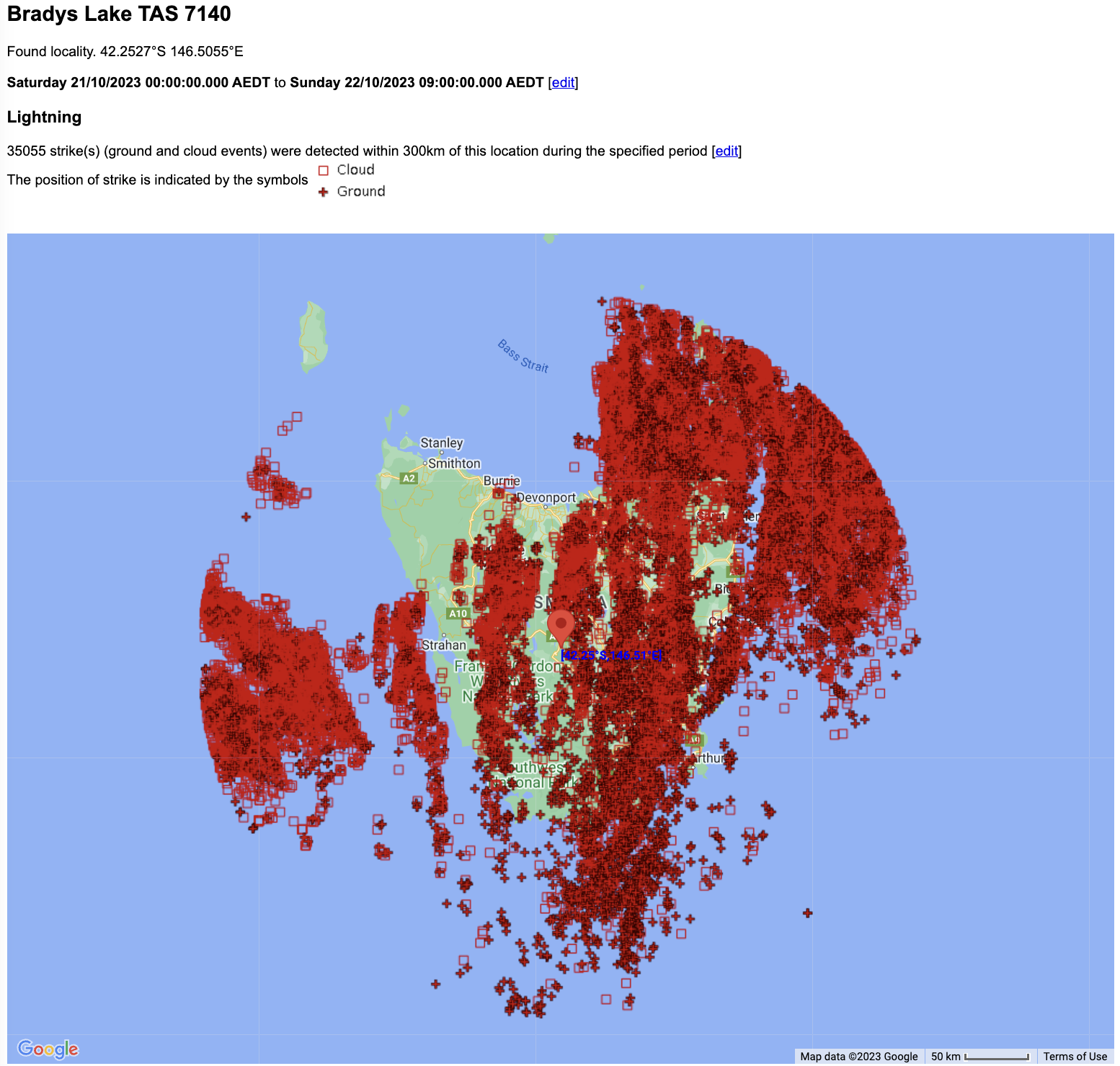
Image: 35,055 lightning flashes, with 15,451 ground strikes were recorded by the Total Lightning Network (TLN) overnight into Sunday morning across Tasmania
As reported over the last few days, a low pressure system has been bearing down on the Apple Isle this weekend. Last night’s storms came as the main cold front attached to this low swept over the state.
The low, front and storms can all be seen in the image below.
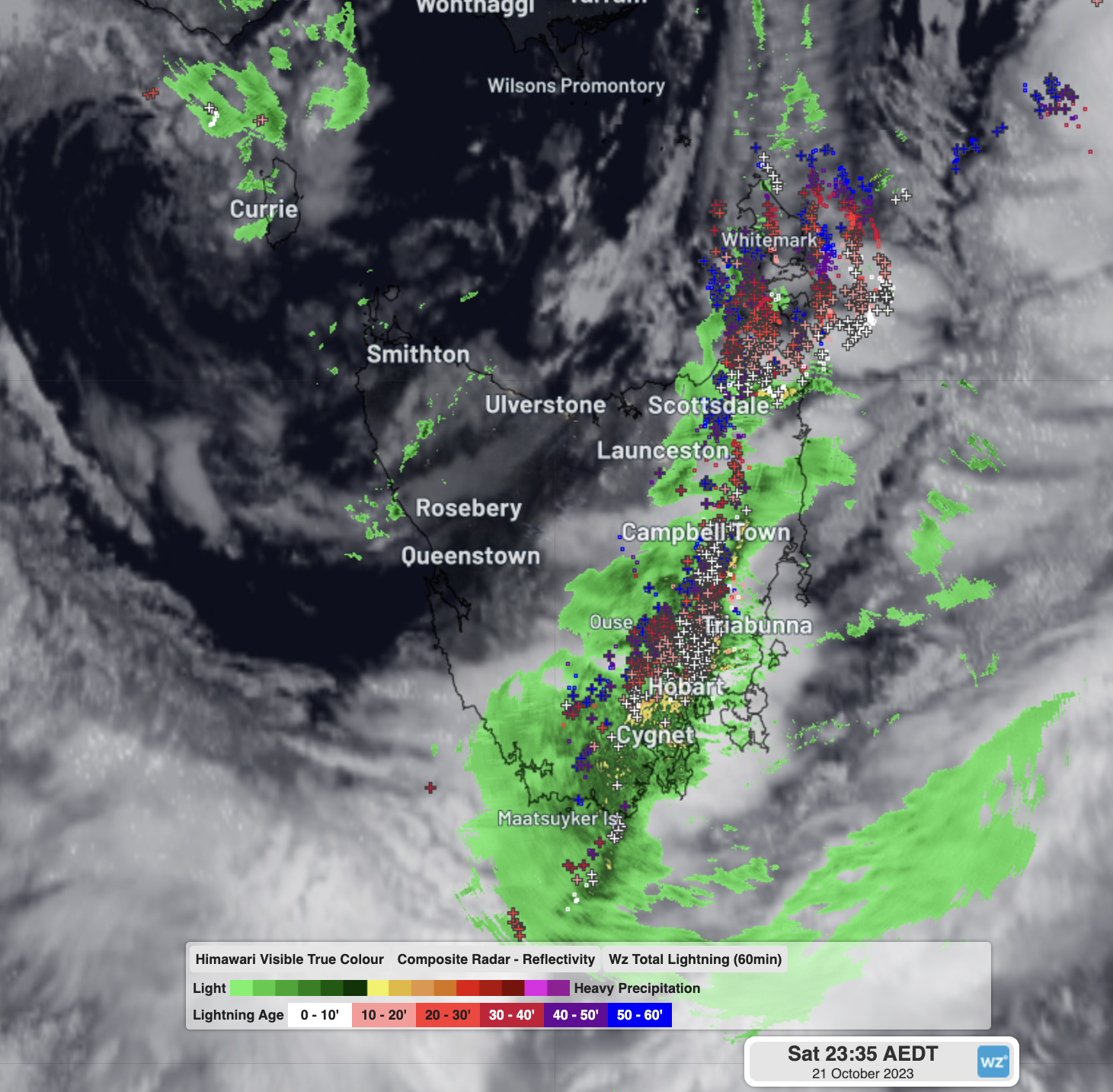
Image: Satellite, radar and lightning over Tas at 11:35pm AEDT on Saturday night. The low centre is just north of Currie (top left) while the line of rain and storms cutting through the east, including Hobart, are along the cold front.
These storms brought a quick deluge of rain along with them, causing severe thunderstorm warnings for heavy rain to be issued by the BoM, a rare feat for Tasmania.
Hobart soaked with a quick 11mm in 10 minutes to 11:50pm as the peak of the storms hit. With 40.2mm all up, it was Hobart’s wettest day in 18 months, and more rain in one day than each individual month between January and September this year (except June).
Don’t see many nights like this in Hobart pic.twitter.com/wfLkXTAocG
— John Hunt (@JohnHunt1992) October 21, 2023
The highest totals across Tas were 55mm at North Boomerang, 53mm at Eaglehawk Neck, and 51mm at Fools Ridge. Cape Bruny’s 39.6mm and Hartz Mountain’s 36mm was both their wettest October days in at least 25 years, while Maatsuyker Island’s 45mm was its wettest day in 2 years.
As of 10am Sunday morning, the low pressure system was sitting directly over Sheffield in the states central north and will continue to track in an ESE direction to leave the east coast around St Marys late this afternoon. When it does, strong southeasterly winds will direct more showers and the odd storm to the south and southeast coasts again overnight into Monday morning.
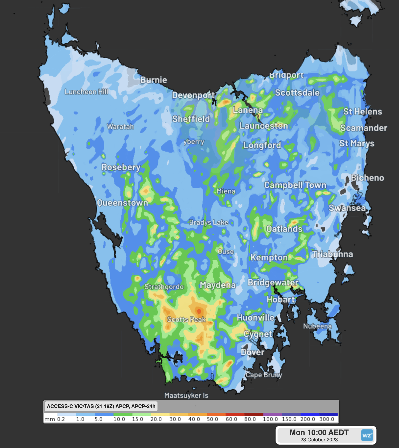
Image: Forecast rainfall for the 24 hours to 10am Monday from Access-C
A flood watch is still in place and flooding may occur over the next 24 hours, particularly for the Huon and Derwent Rivers that are already elevated from last night’s downpour. You can keep track of the latest warnings on the Weatherzone website.
How Weatherzone can prepare you for Thunderstorms
DTN APAC can help your business deal with thunderstorms through:
- Accurate and easy to understand forecasts beforehand
- Thunderstorm tracking and Lightning Alerting during a storm
- Event and Lightning reporting afterwards.
Our colossal influx of data from all the worlds leading weather forecast models and the Total Lightning Network gives us a unique ability to prepare your business for thunderstorms like no other. To find out more, please email us at apac.sales@dtn.com.




