Hot, dry and windy weather is elevating bushfires & fire danger across parts of NSW on Thursday, ahead of a cool and fierce southerly change.
Maximum temperatures across parts of the state are expected to be 5-10°C above the October average, with temperatures climbing into the mid 30’s.
The hot airmass has been dragged towards NSW by hot and gusty northwesterly winds ahead of a strong cold front.
The map below shows the cold front sweeping across Victoria on Thursday morning, with clear skies ahead of it helping the temperatures soar in NSW.
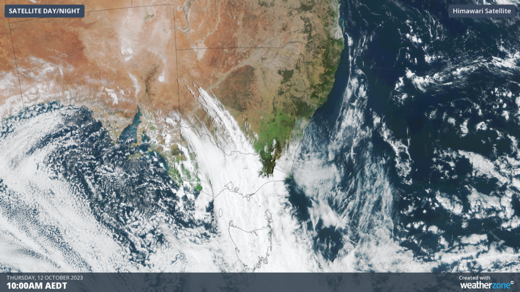
Image: Himawari satellite image at 10am AEDT on Thursday, October 12
In addition to the hot temperatures, dry and gusty northwesterly winds could add fuel to the bushfires on Thursday afternoon.
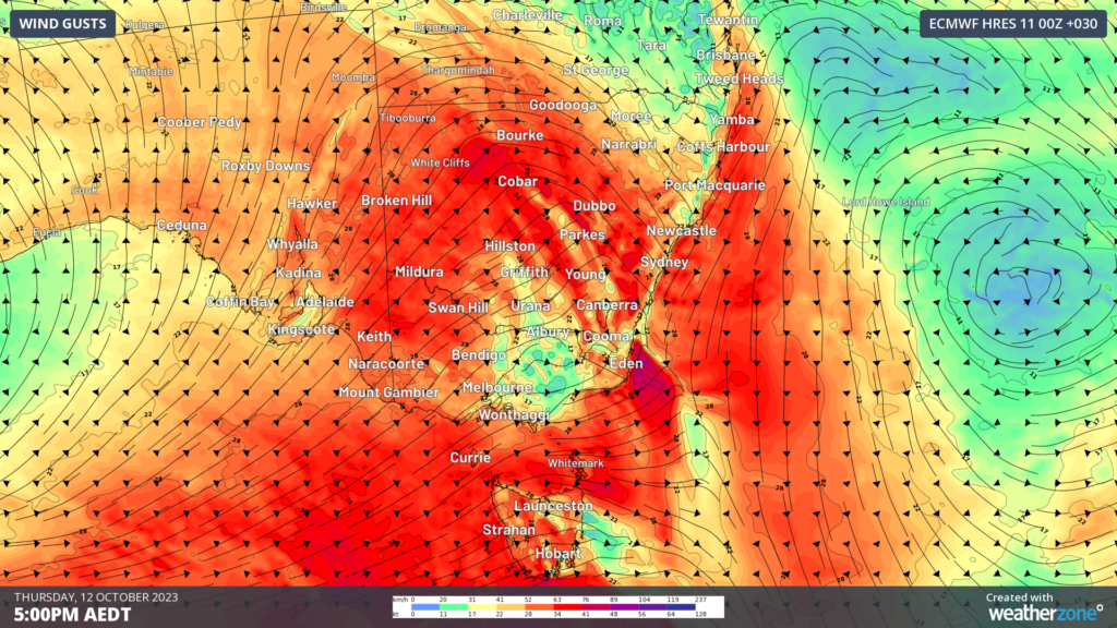
Image: EC instantaneous wind gust forecast at 5pm AEDT on Thursday, October 12.
Locally catastrophic fire danger is forecast in the state’s central west, with winds in Dubbo forecast to reach a mean wind speed of 35km/h with gusts up to 45km/h.
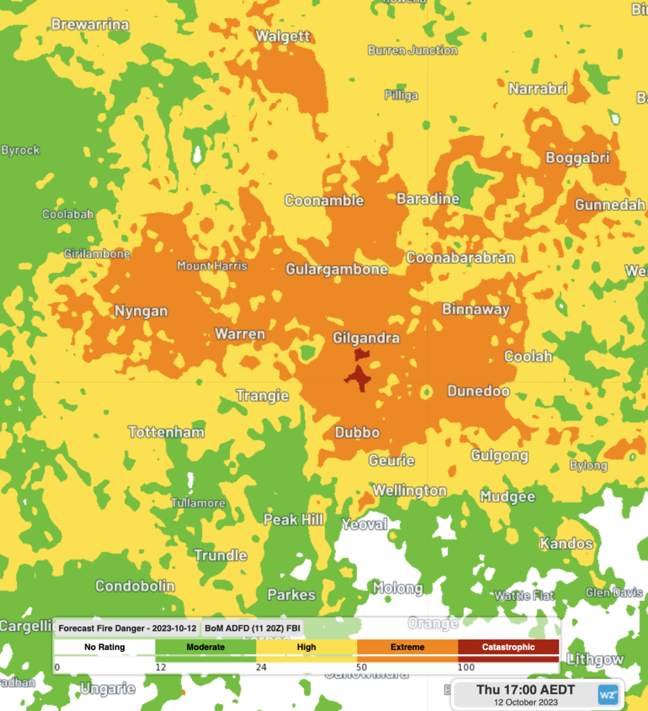
Image: Forecast fire danger on Thursday at 5pm AEDT, Source: BOM
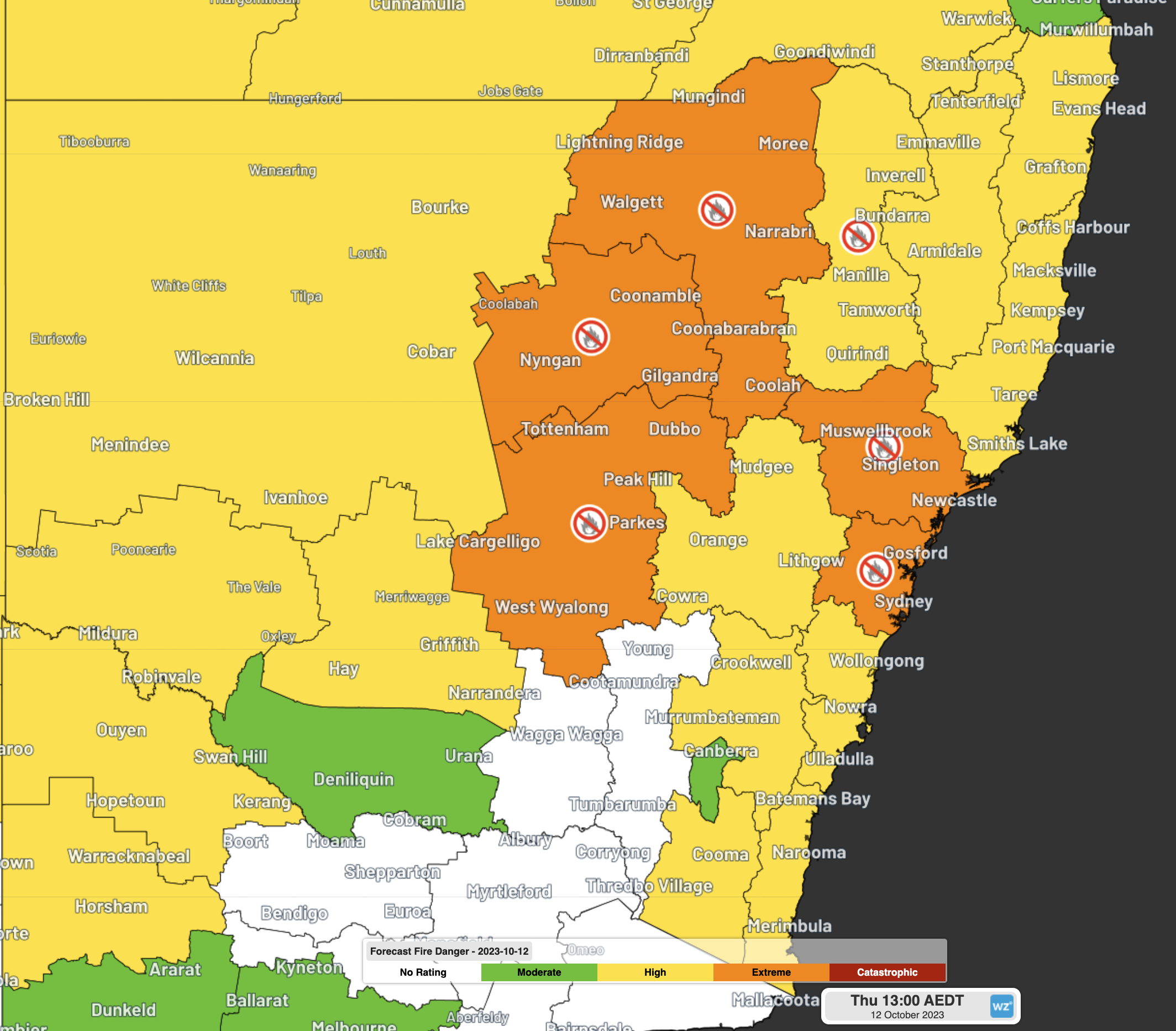
Extreme fire danger is forecast for parts of the Greater Hunter, Greater Sydney, Northwestern, Upper Central West Plains and Lower Central West Plains on Thursday, with total fire bans in place for these districts too.
Severe thunderstorms are possible in the central west during the afternoon which could bring damaging winds to the area, increasing the fire danger further in the region.
Damaging winds are also forecast across the southern NSW coast on Thursday afternoon, as a strong gusty change moves quickly up the coast in the afternoon and evening. Wind gusts may exceed 90km/h in this area providing a challenge to crews attending fires in the area.
This southerly change is expected in Sydney around 8-9pm AEDT providing some relief to Sydneysiders as the temperature plummets behind the change.
The image below shows forecast air temperatures around 1.5km above sea level on Thursday, revealing the dramatic temperatures contrast ahead and behind the southerly change.
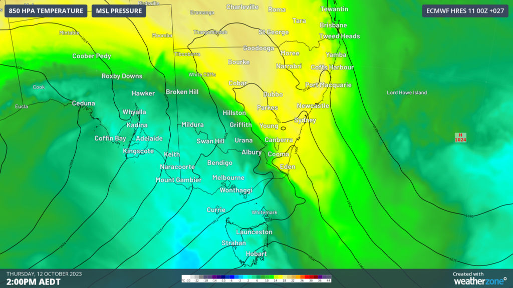
Image: 850Hpa Temperature at 2pm AEDT on Thursday, October 12.
Fire danger and severe weather warnings have been issued today, keep an eye out for the latest warnings and forecasts as the day unfolds.


