One of the world’s most consistent thunderstorms developed for the first time this season, signalling that the ‘build up’ across the north has begun.
The image below shows the famous thunderstorm developing to Darwin’s north on Thursday afternoon.
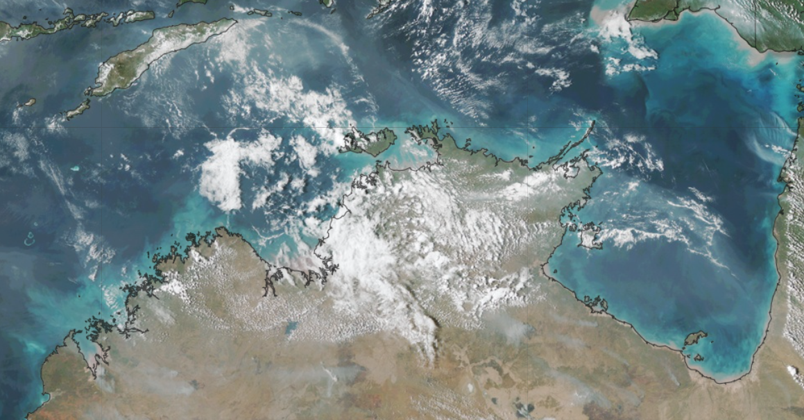
Image: Himawari satellite image at 3:15pm on Thursday, October 5.
Nearly every afternoon the thunderstorm forms over the Tiwi Islands to the north of Darwin between September to March.
This thunderstorm has been given the name Hector or Hector the Convector because it is a regular occurrence in the skies above the NT in the wet season.
Hector forms at the same time every day at around 3pm and announces itself with ominous storm clouds extending 20km into the atmosphere above the Tiwi Islands.

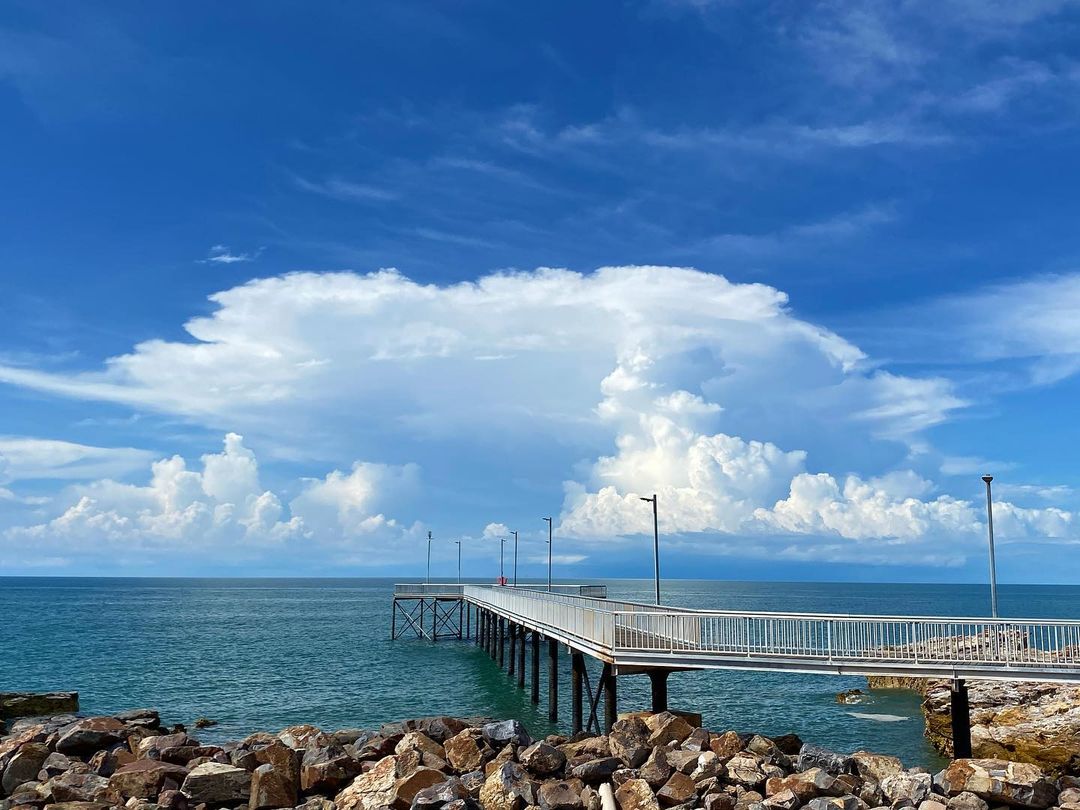
Image: Hector the Convector from Nightcliff Jetty on the 10th of December 2020, source:@weather_watcher_australia
The size, shape and location of the Tiwi Islands make them a perfect place for Hector to develop. Sea breezes develop over the islands from all sides and meet in the middle.
‘These converging winds, which are carrying moisture from the surrounding sea, have to go somewhere when they clash, so they go up,’ said Ben Domensino, one of Weatherzone’s meteorologists. ‘This rising column of air becomes cooler with height, which causes water vapour to condense into liquid droplets, forming the thunderstorm cloud.’
Hector forms most days in the ‘build up’ between September to March and the ‘rainy season’ which typically runs from January to March.
The thunderstorm’s first appearance on Thursday has declared the ‘build up’ season has begun across northern Australia with a bang.
The storm produced 14.8mm in half an hour on Thursday afternoon at Pirlangimpi on the northwest coast of the Tiwi Islands.
The Bureau of Meteorology says, ‘the northern rainfall onset occurs when enough rain has fallen to stimulate plant growth after the northern dry season’.
This is defined as the date when rainfall accumulated after 1 September reaches at least 50 mm. The rainfall onset is especially important for the agricultural and horticultural sectors.
Despite the ‘build up’ season beginning, the rainfall this week has not met the 50mm threshold, with the rainfall onset yet to arrive in the western Top End.
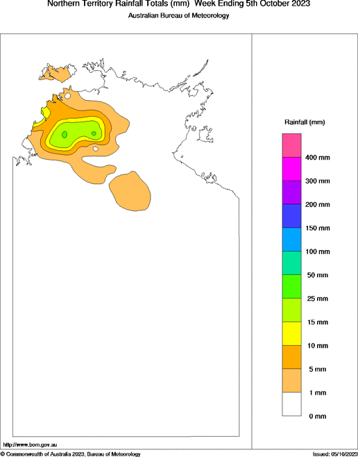
Image: Northern Territory rainfall totals in the week ending Thursday, October 5, source: BOM
Typically, it forms around October or early November for the region; however, with this year’s El Niño it could be delayed.
During El Nino years, the rainfall onset usually is late, typically 2-6 weeks later than La Niña years.
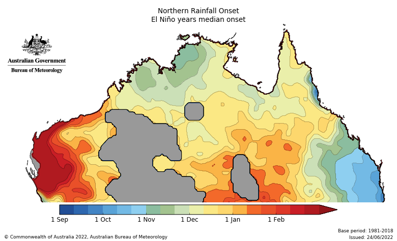
Image: Northern rainfall onset during El Nino years, Source BOM
The potential late arrival of the monsoon means that rainfall should be well-below average during the first half of the wet season, but close to average in the latter half.
For more information about this years wet season and cyclone season, please contact us at apac.sales@dtn.com.


