The wild weather which has lashed southeastern Australia is moving out into the Tasman Sea, leaving in its wake dangerously swollen rivers, wind damage, and even a decent dusting of spring snow.
Overnight, winds howled their way around a low pressure system centred over the eastern part of Bass Strait.
Winds were strong across virtually all of southeastern Australia, but they were strongest on our southeastern coastline, with readings in excess of 100 km/h at several weather stations early on Thursday morning, including:
- Gabo Island (Vic, near the NSW border) – 109 km/h
- Green Cape (NSW, just north of Vic border) – 107 km/h
- Wilsons Promontory (Vic’s southernmost point) – 106 km/h
- Hogan Island (close to Wilsons Prom but technically part of Tas) – 100 km/h
Winds had also been extreme the previous night at Mt Hotham with gusts up to 132 km/h on a night when a record 198.8 mm of rain fell, in conditions as extreme as a Category 2 cyclone.
While numerous Ocean Gale Warnings remain in place on Thursday morning, conditions are slowly moderating over land areas, with the focus turning to flooding in many Victorian rivers.
One day #bushfires, the next #flooding: Towns along Macalister River evacuate as Gippsland in flood, days after battling bushfires https://t.co/jCFqQA02vY
— Neil Dufty (@NeilDufty) October 4, 2023
The flooding situation in parts of Gippsland is already serious this morning, with floodwaters in the streets of Newry, a small town north of Sale. Many local roads are completely cut off.
READ MORE: Gabo Island’s first September 32C in over a century of records
After numerous falls in excess of 100 mm in North East Victoria on Tuesday night into Wednesday morning, the heaviest falls in the 24 hours to 9 am Thursday occurred in southeastern NSW and East Gippsland, hence the flooding in the latter region. Falls included:
- 71 mm at Gabo Island and 63 mm at Mallacoota on Victoria’s far southeastern tip.
- 75 mm at the Mt Cann fire tower and 74 mm at Mt Elizabeth – two relatively remote inland Gippsland weather stations.
- 64 mm at Mt Ginini (ACT) in Canberra’s water catchment
- 63 mm at Thredbo Top Station (NSW), some of which arrived as snow early on Thursday morning.
Flooding in other parts of Victoria can be expected increase in coming days, with numerous moderate and major flood warnings in place for rivers running high with the extreme rainfall of Tuesday night.
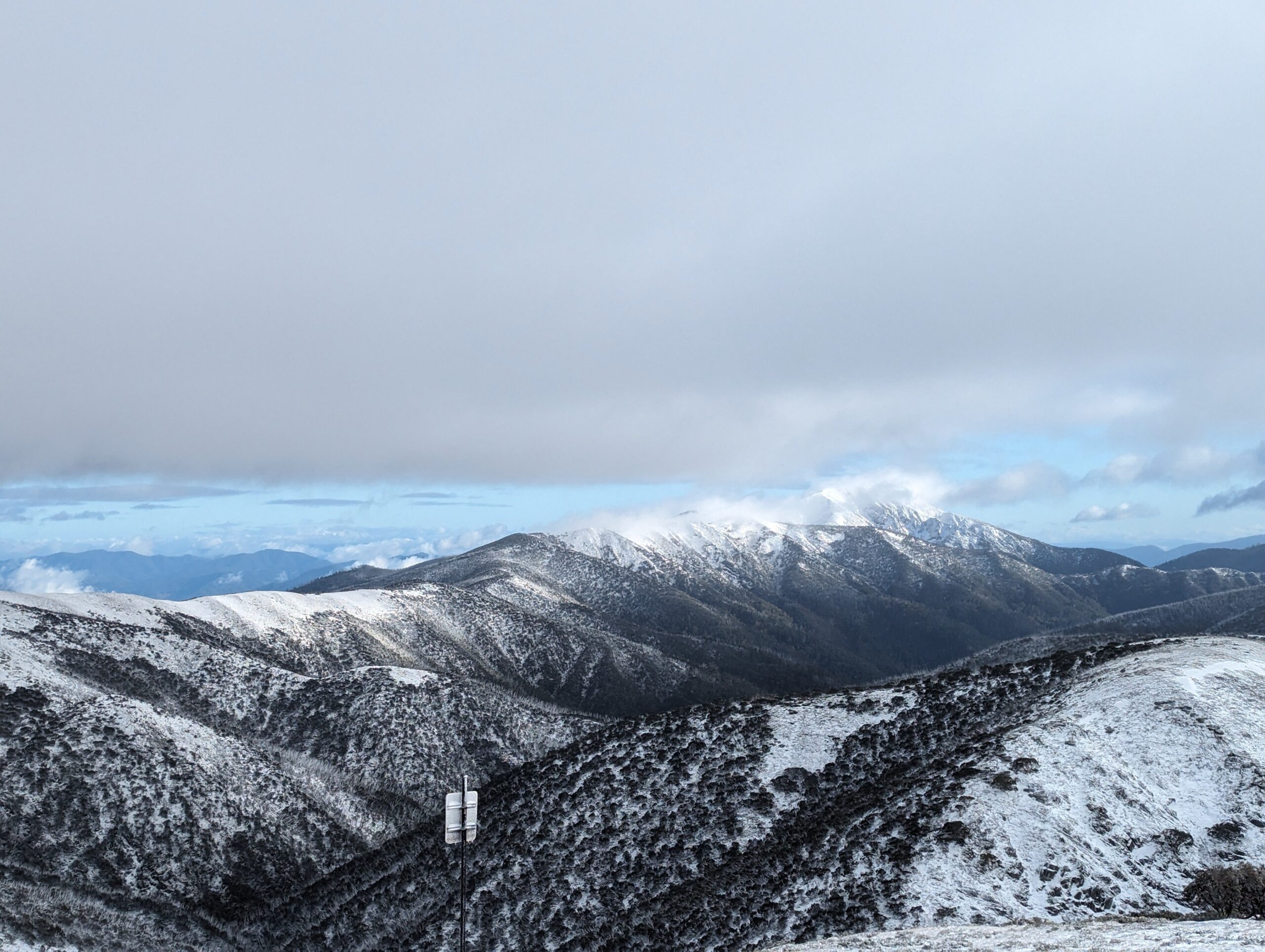
As for the unseasonable spring snow, this was the view of Mt Feathertop from the Great Alpine Rd at Mt Hotham on Thursday morning as cold air behind the front combined arrived in time to combine with the last few hours of available moisture.
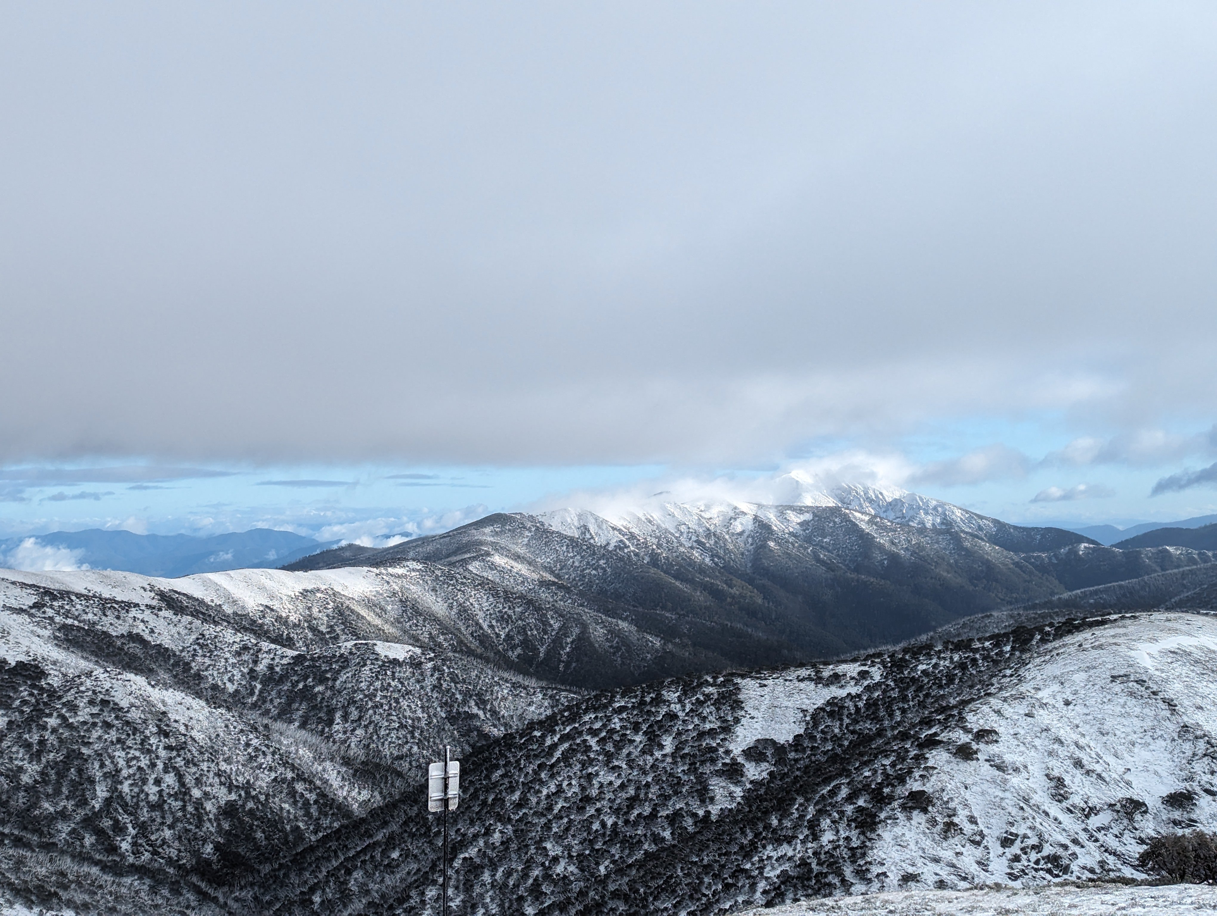
Image: You’d say it was looking like winter all over again, except most of this winter didn’t look like winter! Source: @thatgreenjacketguy on Instagram.
Locals in the Victorian high country reported three or four centimetres on the ground, with similar totals in New South Wales.
The weather looks to moderate by the weekend as a large high pressure system brings stable conditions, although temperatures will stay cool due to southerly winds, and the flood danger will remain high in many rivers for some time.
As ever, please check our warnings page or our app for the latest.
Are you safeguarding your utilities assets and personnel from the threat of increasingly volatile weather?
DTN APAC, a DTN company, offers precise weather intelligence and alerting to protect your utilities network when severe weather, floods and fires threaten.
Over 80% of Australian transmission and distribution networks already rely on our proven nowcasting and forecasting out to 15 days. You can rest assured yours is protected by market-leading analysis. With this foresight you can gain lead time to prepare for possible outages, reduce risk and protect your people and profits.
You will never be left in the dark when conditions suddenly worsen. We deliver reliable, up-to-the-minute weather forecasts and analytical tools that give you the power to enhance your operational management and response to weather risk. Our Total Lightning Network is a globally proven solution that accurately identifies and alerts you to lightning strikes within your defined thresholds, supporting the safety of your team.
Your customisable interface has GIS mapping, showing multiple weather layers over your utilities network and offering full situational awareness. You can quickly recognise any threat to your assets in real-time. 24-hour asset monitoring allows you to track lightning, bushfires and other severe weather systems that approach your service territory.
Advanced and actionable analytics allow you to act decisively and improve your planning and outage response strategy. For more information, please contact us at apac.sales@dtn.com.


