Worst Floods in 24 Years Hit Queenstown as Rain Sweeps North
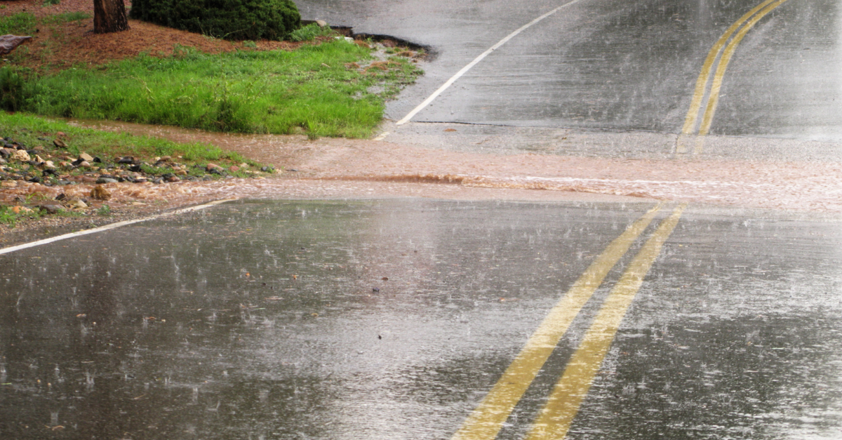
Queenstown, a popular town on New Zealand’s South Island, faced a drenching last week, leading to the swift evacuation of hundreds as waters rapidly rose.
A slow-moving low-pressure system lingered over the South Island on Thursday and Friday causing a multi-day deluge in the region.
The satellite loop below shows thick cloud encircling the low over the South Island on Thursday.
Queenstown declared a state of emergency after the town saw the largest daily rainfall totals in 24 years, with 87 millimeters of rain falling in the 24 hours to 9am NZDT on Friday, September 22.
This rainfall led to multiple debris and flooding events, with hundreds of people evacuated on Thursday night.
A Queenstown cemetery was also damaged in the floods last week.
Weather News Alert – ‘Distressing’ – Queenstown cemetery damaged by flooding – 1News #BreakingNews #Breaking #Flooding #Flood #Weather #WeatherUpdate #LatestNews #DailyNews https://t.co/qVKL3ggqSv pic.twitter.com/Qw1SBygjZn
— Brett Murphy (@bmurphypointman) September 24, 2023
The flooding and landslips have also caused an outbreak of cryptosporidium, a highly infectious parasite with locals encouraged to boil their water.
There were several other huge single day rainfall totals recorded on the South Island on Thursday with Milford Sound to Queenstown’s northwest recording 318.99 mm, Gore 102.6mm and Mount Cook with 50.4mm.
The rainfall caused multiple rivers to peak or overflow, with the Waikaia River flooding nearby farmland.
The Oreti River at Dipton was also full to the brim on Friday.
Oreti River at Dipton bank to bank. @WeatherWatchNZ pic.twitter.com/9IibsFJlRA
— Heather Milligan (@MilliganHeather) September 21, 2023
The map below shows falls exceeding 300 millimeters have been observed in southwest and northeast New Zealand last week.
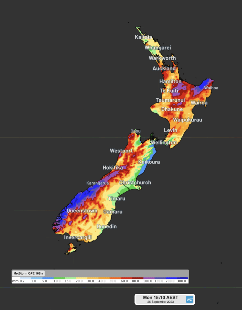
Image: 7 day rainfall observations leading up to 3pm AEST on Monday, September
The system also brought significant snow to the South Island’s Alpine last week. The Remarkables recording 70cm of snow contributing to a healthy late season snow pack depth of 90cm.
The rainfall has now shifted to the country’s north. Heavy rainfall warnings and watches are out as the low progresses further northeast.
The region is being warned by the Metservice that flooding and landslips are a risk with some areas expecting 100mm of rainfall in the next 13 hours. The latest warnings are available here.
We deliver reliable, up-to-the-minute weather forecasts and analytical tools. These give you the power to enhance your operational management and response to weather risk. Our Total Lightning Network is a globally proven solution. It accurately identifies and alerts you to lightning strikes within your defined thresholds, supporting the safety of your team. For more information, please contact us at apac.sales@dtn.com.


