
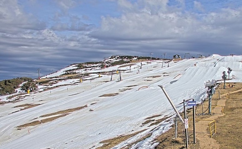
Locals call it the “hair dryer”. It’s a strong, warm northwesterly wind that erodes the Aussie snowpack like a bushfire burns through forest.
Normally you expect the hair dryer to show up in September, or if you’re unlucky, around late August. But this year, it’s already here on August 4.
After an extremely warm July and an even warmer first three days of August, the hair dryer is in full force across the Australian snowfields, with strong winds and very warm temperatures.
Temperature departure from normal across Australia at lunchtime (central/eastern) today. pic.twitter.com/WuUjPHFRKh
— Andrew Miskelly (@andrewmiskelly) August 4, 2023
- For example Perisher had a minimum temp of 3.4°C last night, staying above 5°C for much of the night with consistent winds gusts well above 50 km/h. Those are pure hair dryer conditions
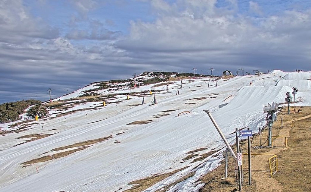
Image: Slopes at Mt Buller hanging in there… just. Source: Ski.com.au.
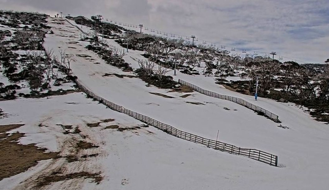
Image: Slopes at Guthega (part of Perisher resort) hanging in there… just. Source: Ski.com.au.
It’s going to rain later this Friday as a band of moisture arrives before all this warm air has dissipated, which is not good news for the snowpack.
However, some snow is coming overnight and into Saturday morning as the cold front which brought bitterly cold temperatures to WA finally pays a visit to eastern Australia. Unfortunately, the front has lost most of its vigour on the way.
READ MORE: WARMEST JULY ON RECORD FOR PARTS OF AUSTRALIA
Earlier this week there was hope that tonight’s snow might repair some of the recent damage to the snowpack, but the definitive answer now is that it won’t.
The snowpack in the Australian Alps started so promisingly this season, but is no longer in such great shape.
While the picture is grim for low altitude slopes of the main resorts, conditions remain reasonable in higher areas.
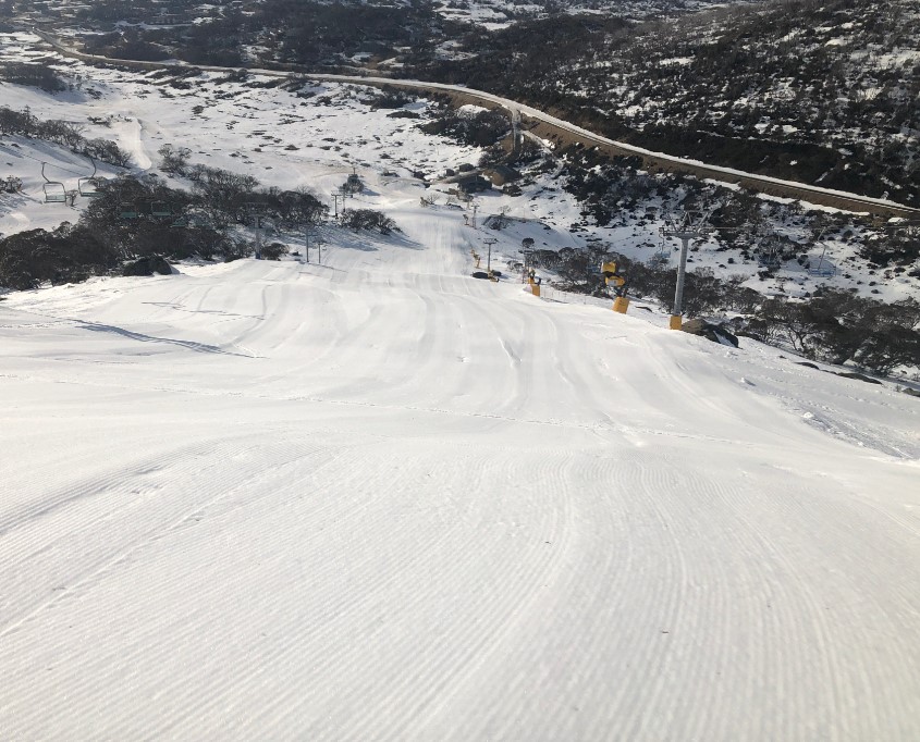
Image: Conditions are still pretty good on Mt Perisher, the highest part of Perisher resort, even if some runs like this one were inaccessible on Friday due to chairlifts on wind hold. Source: Ski.com.au.
Here’s the graph showing the most recent reading at Spencers Creek, at an elevation just over 1800m roughly halfway between the NSW resorts of Perisher and Thredbo.

Image: The warm weather and rain should cause the 110.1 cm level to continue to drop. Source: Snowy Hydro.
This rain and warmth will reduce the already dwindling alpine snowpack following an unusually warm and dry July, causing an early season mass discharge of water runoff into the region’s hydroelectric reservoir dams ahead of spring.
The water will runoff into the reasonably healthy lakes in the Snowy Hydro Scheme. The image below shows Lake Eucumbene’s Lake is sitting near 63% full, which is largest capacity lake in Snowy Hydro’s scheme.
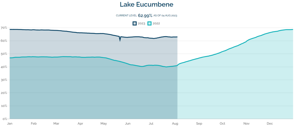
Image: Lake Eucumbene Lake level on Friday, August 4. Source: Snowy Hydro.
These hydro lakes hold water until its needed to make power, at a point that it will be released from the dam.
Hydroelectricity is produced by passing large amounts of water turning a turbine or electricity generator and creating power.
How can Weatherzone help with hydropower forecasts?
Using Opticast’s nowcasting and forecasting capabilities, you will have long-term outlook covering rainfall and extreme heat events out to 12 months. This can significantly improve your planning as you integrate the data with site-specific hydrological parameters.
With renewables making up more of Australia’s energy mix every year, we want to support your business to make informed critical decisions and improve your overall generation and safety. For more information, please contact us at apac.sales@dtn.com




