

The Bureau of Meteorology has refrained from declaring El Niño this week as the atmosphere stubbornly refuses to respond to lingering warm water in the tropical Pacific Ocean.
Murmurs of a potential El Niño have been circulating since the start of this year, when forecast models began hinting at a swift transition from La Niña to El Niño in 2023.
Since then, the tropical Pacific Ocean has indeed shifted into a clear El Niño pattern, with a large tongue of abnormally warm water currently sitting at the surface of the central and eastern equatorial Pacific.
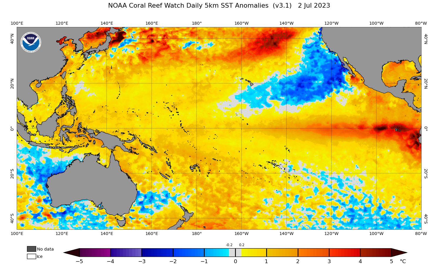
Image: Observed sea surface temperature anomalies in the Pacific Ocean on July 2, 2023. Source: NOAA
This textbook ocean warming saw the U.S. Climate Prediction Center (CPC) declare that El Niño was underway in early of June. However, Australia’s Bureau of Meteorology hasn’t yet followed suite, maintaining this stance in their latest climate driver update issued on Tuesday afternoon.
The Australian BoM and U.S. CPC use different thresholds and criteria to declare El Niño, which usually sees the CPC announcing the arrival of El Niño before the BoM.
One of the main reasons the Bureau have held back on declaring El Niño in recent weeks is the atmosphere failing to respond to the ocean.
El Niño is a coupled ocean-atmosphere climate driver, which means the ocean and atmosphere need to be reinforcing each other for a fully-fledged El Niño to be underway.
While the ocean is in a clear El Niño pattern, the atmosphere has not yet met the Bureau of Meteorology’s thresholds for El Niño. More specifically, trade winds have not weakened in the western or central equatorial Pacific Ocean, and the three-month Southern Oscillation Index (SOI) is not currently sitting below the key value of -7.
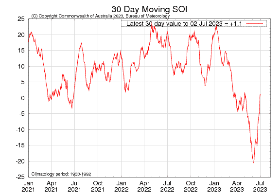
The Bureau is unlikely to declare El Niño until the atmosphere starts to sync up with the ocean and either trade winds or the SOI exceed El Niño thresholds.
You can find the Bureau of Meteorology’s fortnightly climate driver updates here.
DTN APAC has a variety of forecasting and alerting tools on hand to help your business cope with the challenges that an El Niño can bring. For example, with the increase in bushfire risk, our hotspot detection will alert you to nearby fires (even small ones) so you can take action to protect your personnel and assets. To find out more please visit our website or email us at apac.sales@dtn.com.




