

If you think it was cold in Sydney on Wednesday, June 28, you’re not wrong.
- The harbour city’s maximum of 11.7°C was by far its lowest of the year
- It was a full five degrees below the June average max of 17.0°C
- It was colder than Melbourne’s max of 12.7°C, and bear in mind that Melbourne’s top temp was more than a degree below its own June average
- It’s also worth mentioning that Penrith in Sydney’s far outer west reached just 10.9°C yesterday, which was only the 2nd time it has had a day this cold since the site opened in 1995
As Sydney people would know, it’s pretty rare for the temperature not to climb into at least the mid teens, even on days with winter’s chilliest winds blowing straight off the snow country.

Image: It was a couch day for the whippets and pretty much every Sydneysider.
So how often does Sydney peak at 12.0°C or lower?
We love a stats challenge here at Weatherzone, so we ran a quick query and learned that:
- Sydney’s temp peaks at 12°C or colder just 5.4 times a decade on average (in the years from 1910 to 2020).
- In other words, it only happens once every two years or so, over more than 100 years of data sampling. So not often!
The good news for Sydney is that Wintry Wednesday won’t be repeated on Thursday or any day on the immediate horizon – although we can’t state that as confidently for other places which endured cold maximum temps yesterday.
The image below reveals why.
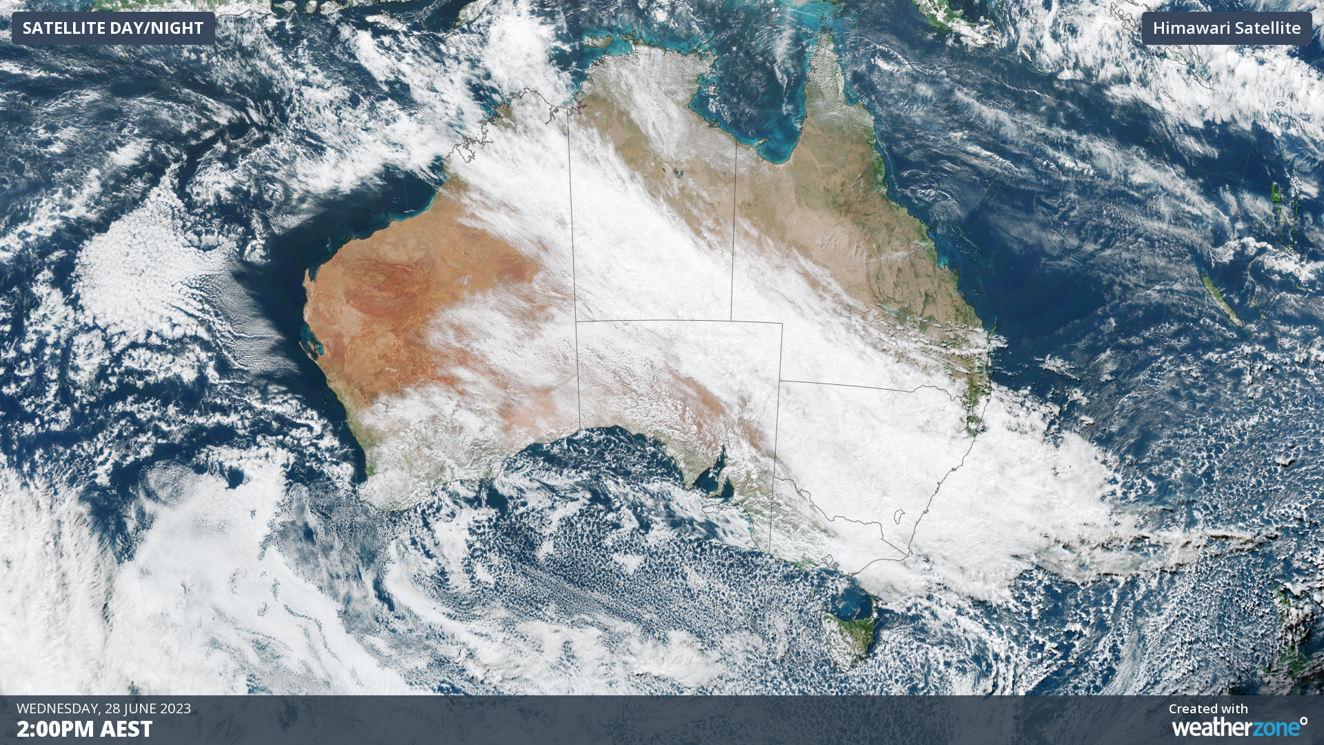
Wednesday’s cold was caused by thick cloud preventing the sun from warming things up. That cloud has now cleared the Sydney area, with sunny conditions set to prevail across most of eastern NSW in coming days.
But as you can see on the Thursday morning sat pic above, the massive northwest cloudband has not yet dissipated. That means that areas in northern NSW, central and southern Qld, plus even parts of the NT and WA, could all experience below average temps this Thursday.
DTN APAC can provide super-rapid forecast updates every 5 minutes so you can stay ahead of the competition. To find out more, please visit our website or email us at apac.sales@dtn.com.




