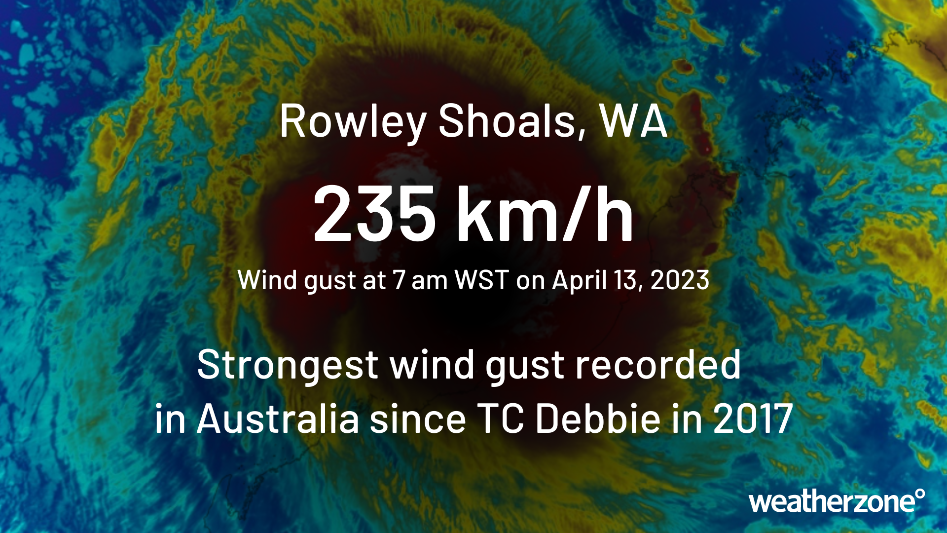
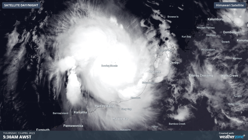
Tropical Cyclone Ilsa continues to intensify on Thursday morning, with a wind gust of 235 km/h recorded at 7am Rowley Shoals, a trio of tiny coral atolls located 300 km west of Broome.
This is the strongest wind gust recorded anywhere in Australia since TC Debbie in 2017
Ilsa is now a Category 4 cyclone with sustained winds near the centre of 165 km/h. Winds are expected to keep strengthening throughout Thursday and into Friday.
This is now an extremely hazardous weather event. In its latest bulletin, the BoM warns that:
Heavy rainfall and squally thunderstorms are expected over the western Kimberley, possibly extending to the eastern Pilbara today. Rainfall totals of 200 to 400 mm of rainfall are possible later today and Friday near where Ilsa crosses the coast.
Abnormally high tides are possible about the coast between Broome and Port Hedland today and as the system crosses the coast tonight or during early Friday morning. In some locations the tide may be close to or exceed the highest astronomical tide of the year.
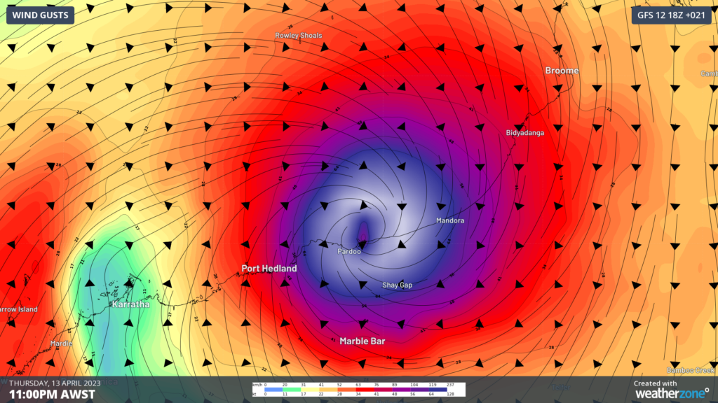
Extreme wind gusts of up to 275 km/h are expected by late Thursday night or early Friday morning. This is at the high end of a category 4 tropical cyclone and Ilsa could feasibly make landfall as a category 5 tropical cyclone, the highest category that exists.
In its most recent update, the BoM also provided the following details about Ilsa:
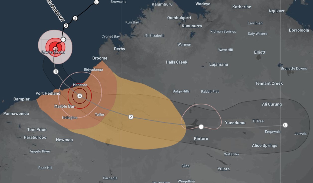
- Its estimated location at 8 am WST was 290 kilometres N of Port Hedland and 295 kilometres kilometres NW of Wallal Downs (a cattle station roughly halfway between Broome and Port Hedland)
- The storm is moving SSW at 15 km/h
- Now a Category 4 cyclone, Ilsa is expected to turn to the SE towards the east Pilbara coast.
- A severe impact is likely along the coast and adjacent inland parts east of Port Hedland and west of Bidyadanga, most likely between Pardoo Roadhouse and Wallal Downs, later tonight or early Friday morning.
- During Friday, Ilsa is forecast to maintain tropical cyclone intensity as it tracks past Telfer and further inland across the Northern Interior district
- The system is expected to weaken below tropical cyclone strength overnight Friday as it moves east into southern parts of the Northern Territory
Please stay up to date with the latest warnings, advice, and alerts for Tropical Cyclone Ilsa on our warnings page.
DTN APAC has a suite of tropical cyclones services. Right now, we are issuing Detailed Tropical Cyclone Impact Advisories (issued every 1-6 hours aligning with offical advisories) to our clients in the path of the storm. Through our products you can have as much preparation as possible for tropical cyclones and their impacts. To find out more, please visit our website or email us at apac.sales@dtn.com.


