
Western Sydney could see its second 40ºC of the month this weekend, with intense late-season heat also hitting Brisbane, Canberra and Melbourne over the next few days.
Two separate tongues of hot air will sweep across eastern and southeastern Australia during the next four days. This type of weather pattern is more typical of summer than early autumn, with some places likely to see their hottest weather this late in the season for more than 20 years.
Video: Forecast 850hPa temperatures according to the ECMWF-HRES model, showing two pulses of hot upper-level air passing over eastern and southeastern Australia during the next few days.
The first pulse of heat will target NSW and Qld on Thursday and Friday:
- Temperatures should push into the mid-thirties in Brisbane and Sydney on Thursday.
- This could be the first time since 2019 that both cities reach 35ºC on the same day.
- Brisbane will see similar temperatures on Friday, although a southerly change will limit heating to the low thirties in Sydney.
A second pulse of hot air will then spread across Victoria on Saturday and up into NSW and the ACT from Saturday into Sunday:
- Melbourne is expected to reach 34 to 36ºC on Saturday, which could be its hottest day this late in autumn for 10 years.
- Sea breezes will limit heating in eastern Sydney on the weekend, although parts of western Sydney could approach 40ºC on Sunday.
- Penrith may reach 40ºC on Sunday, which will be its second 40ºC so far this month and its latest 40ºC autumn day in 25 years. This would also be only the second time on record we have seen two 40ºC days in the Sydney Basin during March.
- Canberra is predicted to reach 35ºC on Sunday, which would also be its latest 35ºC day for 25 years.
Sydney’s Observatory Hill weather station is forecast to reach 30ºC or higher each day between Thursday and Sunday. This would be the first time in 165 years of records Sydney has seen four consecutive days at or above 30ºC in autumn.
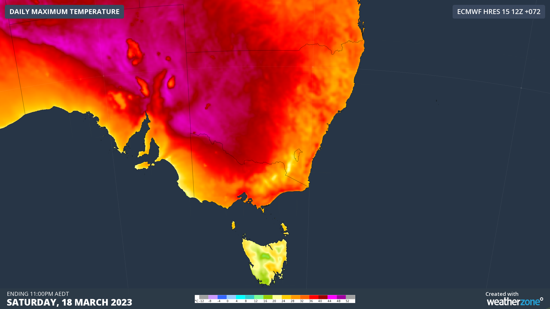
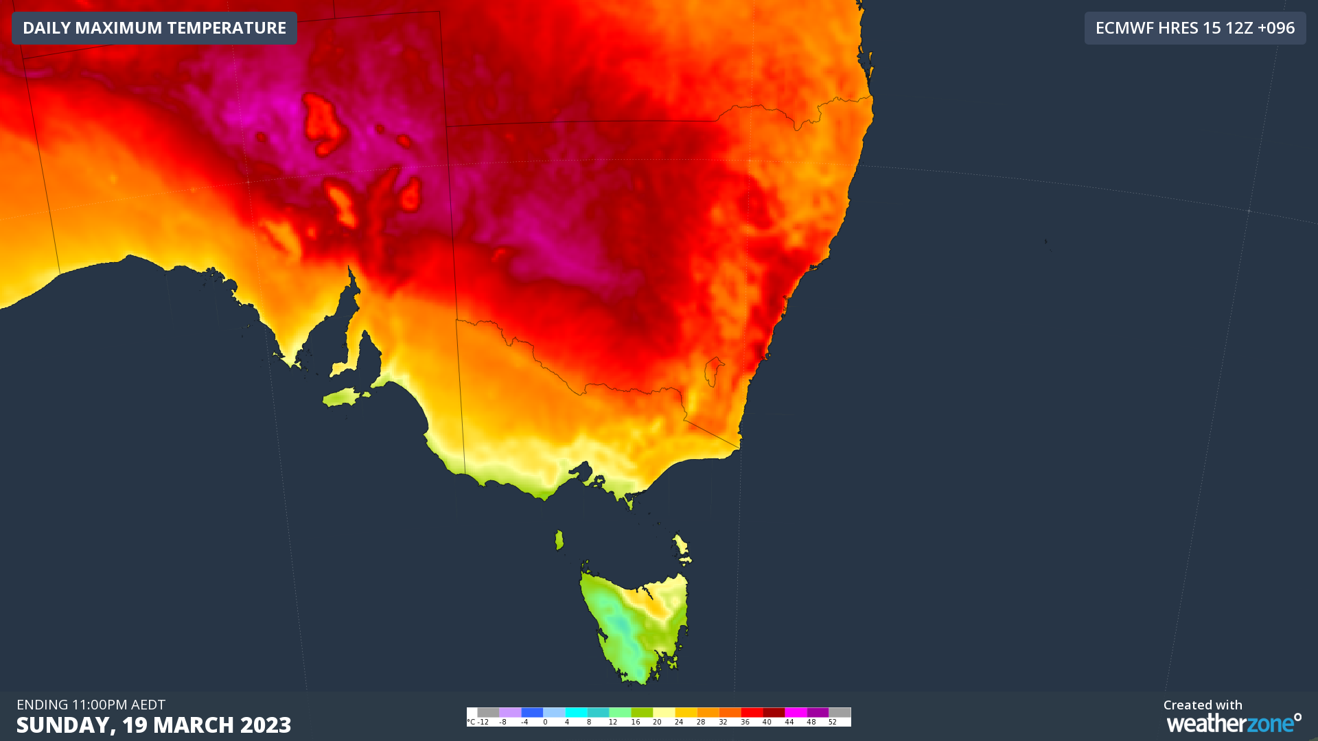
Images: Forecast maximum temperatures on Saturday and Sunday, according to the ECMWF-HRES model.
This week’s heat will have beaches packed and air conditioners running like it’s the middle of summer, putting unseasonably high demand on both surf life savers and the National Electricity Market. LOR1 conditions are forecast for Thursday afternoon in NSW.
To find out about Weatherzones temperature and heatwave forecasts, visit our website or email us at apac.sales@dtn.com.


