Prosper in a dynamic world
Search

Rolling down the EAC


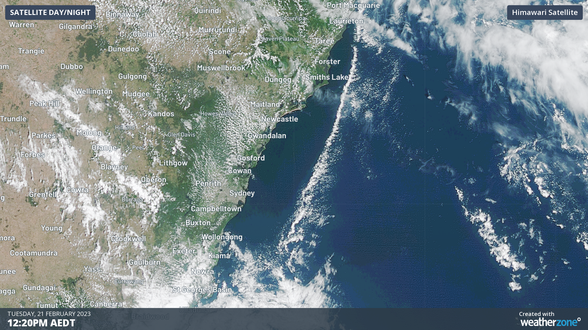
A roll cloud has been spotted following the East Australia Current (EAC) down the NSW coast this morning, making use of nearrecord high ocean temperatures.

The EAC is one of the world’s major warm water ocean currents that transports water from the equator to the Southern Ocean. Made famous by the movie “Finding Nemo”, many marine species including fish, turtles, sharks and whales use this current to navigate down the Australian east coast.

Helped by this summer’s La Niña and persistent easterly winds, the EAC is flowing straight down the coast, making waters just off the coast around 1.5 – 3.0°C higher than normal.

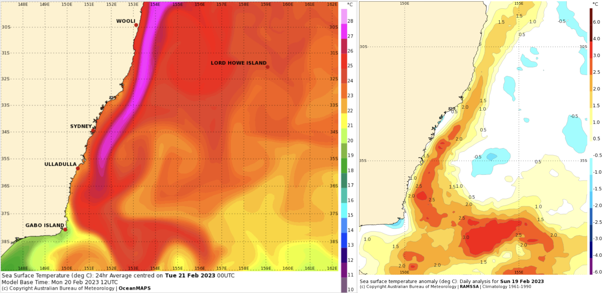
 Image: SST off the NSW Coast, absolute values on the left, anomalies from average on the right. Source BoM

Since February and March are the months when Sea Surface Temperatures (SSTs) peak, waters are near record values, especially off the Eden Coast.

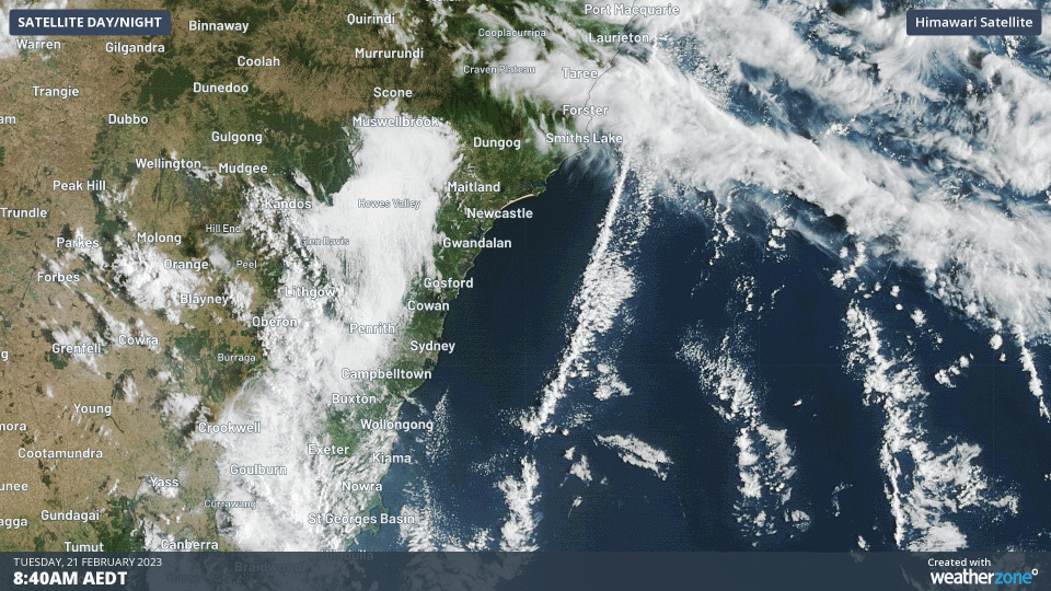
Image: Turtles weren’t the only thing swimming down the EAC this morning

This morning’s roll cloud was a string of cumulus clouds making use of the high temperatures and humidity right over the EAC. They were seen ‘flowing’ to the south with northerly winds.

Later on Tuesday and Wednesday, a southerly change will move up the coast, with a small coastal trough forming. This system is expected to bring moderate to occasionally heavy rain and some thunderstorms to the Sydney, Hunter and Mid North Coast areas, likely tapping into the extra moisture around the EAC.

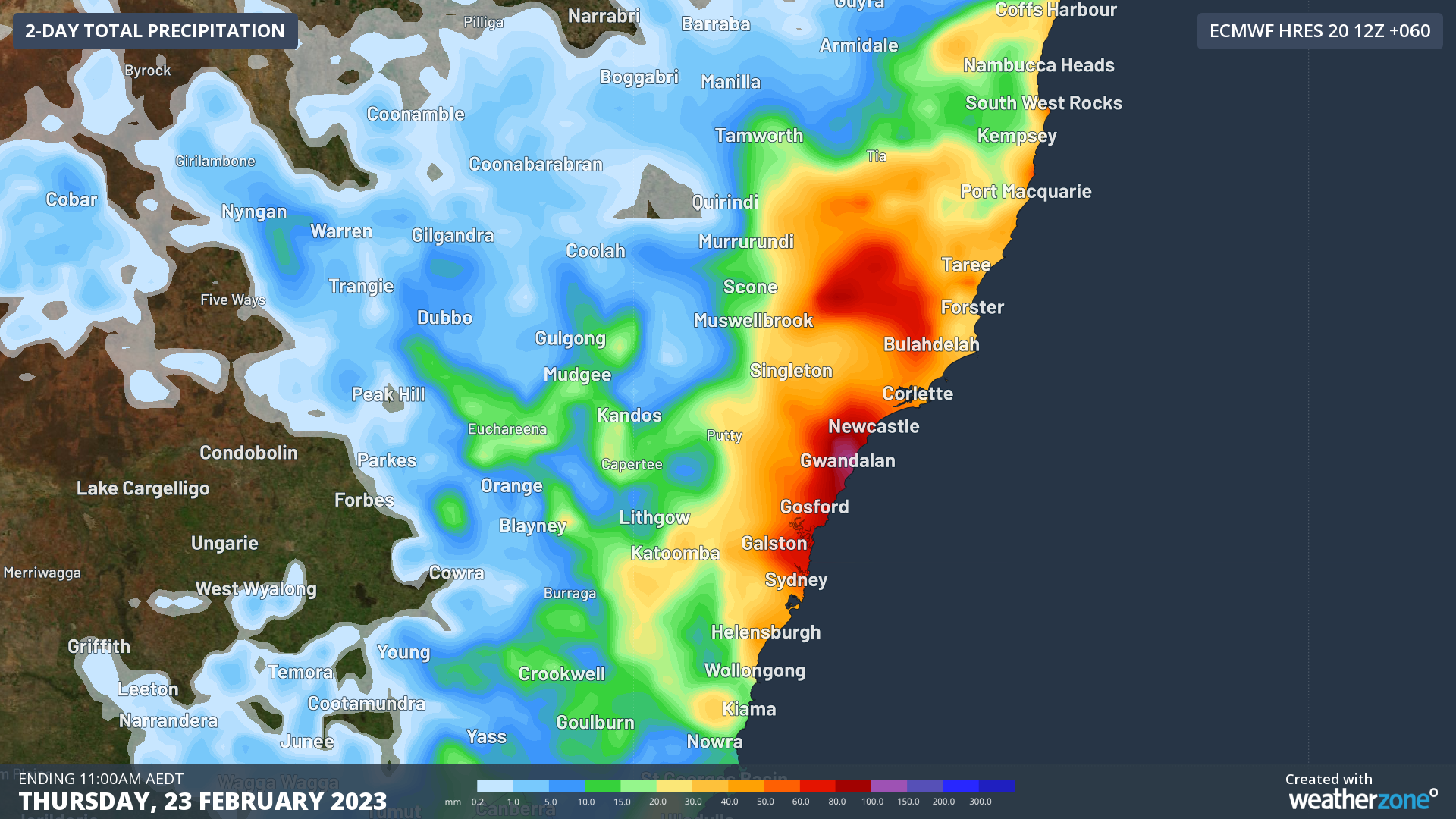
Image: Forecast rainfall to 11am Thursday from ECMWF

DTN APAC offers an array of marine services to help your business, whether its on land, near-coast or in deep water. To find out more please visit our website or email us at apac.sales@dtn.com.

Latest news

Satisfy your weather obsession with these news headlines from around the nation, and the world.

Madden-Julian Oscillation increasing tropical cyclone potential for northern Australia industries

Sea surface temperatures exceeding 31°C off the coast of northern Australia and an active phase of the Madden-Julian Oscillation (MJO) are increasing the likelihood of early-season tropical cyclone activity, with hints of the season’s first tropical cyclone coming as early as next week. Tropical cyclones require sea surface temperature of 26.5°C or warmer to develop, […]

Tropical cyclone season begins with warm oceans surrounding northern Australia

The 2025-26 tropical cyclone season has begun with abnormally warm oceans surrounding northern Australia, signalling an increased risk for severe tropical cyclones in the coming months. The Australian tropical cyclone season runs from November 1 to April 30. During this six-month period, there are usually about 9 to 10 tropical cyclones in the Australian region, […]

7.8 million lightning pulses detected by DTN’s Total Lightning Network over Australia in one week

A barrage of thunderstorms battered large areas of eastern and northern Australia over the past week, producing close to 8 million lightning pulses across the country and more than 4 million over Queensland alone. DTN’s Total Lightning Network (TLN) detected around 7.79 million lightning pulses above Australia last week. This lightning was observed over every […]

Warmest October on record for Sydney, Brisbane

Sydney and Brisbane just had their warmest October on record, despite a relatively cool end to the month. A surge of cold air caused temperatures to plummet in eastern Australia earlier this week. In Brisbane, the temperature only reached 22.2°C on Tuesday, while Sydney’s maximums remained below 18°C on both Tuesday and Wednesday. These chilly […]