Air temperatures are expected to reach into the forties in multiple states over the weekend. What can the temperature get to in a typical open cut mine?
The temperatures we commonly report here at Weatherzone are the official air temperature readings for Bureau of Meteorology sites. The thermometers used are housed in special Stevenson Screens that ensure the device is always in the shade, with good air circulation. Devices are also to be placed in the open on a grassed surface to reduce the effects of nearby buildings and roads. All these conditions are important to enable the comparison of temperatures between sites and times for record-keeping. But in practice, the temperature can differ by several degrees depending on your surroundings.
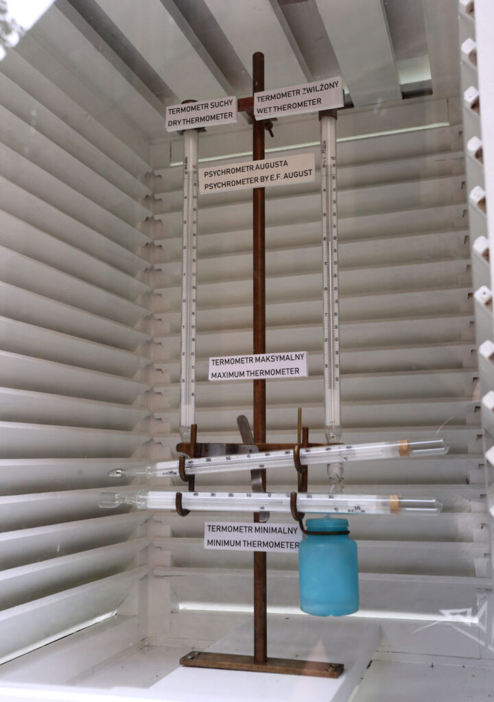
Image: A Stevenson Screen. The shutters shield the thermometers from direct sunlight while allowing air to freely flow through the box.
The first and most important change to temperatures in an open cut mine is simply that they are in the sun. Temperatures in direct sunlight are typically 6-9 degrees Celsius higher than those recorded in the shade. To a human, it can feel upwards of 15°C hotter in direct sunlight in summer when the sun is overhead.
This effect is strong in an open cut mine, although due to their depth, the bottom of the mine may have fewer hours of direct sunlight, as the sun dips below the sides of the mine.
A deeper mine will also lack the air circulation that a Stevenson Screen provides. Winds prefer to blow in a straight direction, and typically just blow over the top of a mine, allowing the air to settle. (Note: this is why mines are particularly susceptible to morning fog forming). Without a mixing of air heat can build-up easier than on the surface, although sometimes it can keep the hottest air out, usually in the morning or in winter.
Another big change depends on what the mine is mining. The colour and brightness of the rocks in the mine can lead to a substantial variation in temperatures. Darker colours, like the blacks of coal and basalt, absorb a lot of heat, keeping the local temperature up to 15°C hotter than in the shade. On a hot day, these rocks, just like a bitumen road, can exceed 70°C.
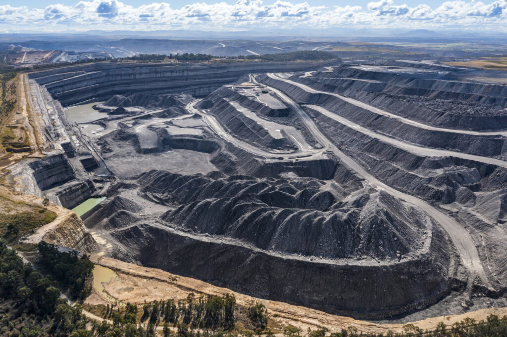
Image: An open cut coal mine. The black colouring of the coal absorbs much more heat than the surrounding ground and vegetation.
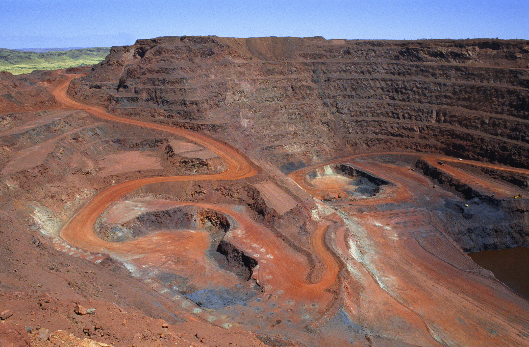
Lighter colour rocks, like sandstone, gold, and some rocks high in sulphur, tend to reflect more light, and typically are only about 3-7 degrees hotter than the surface air temperature. Most minerals like iron and copper fall somewhere in-between, usually around 5-10 degrees hotter.
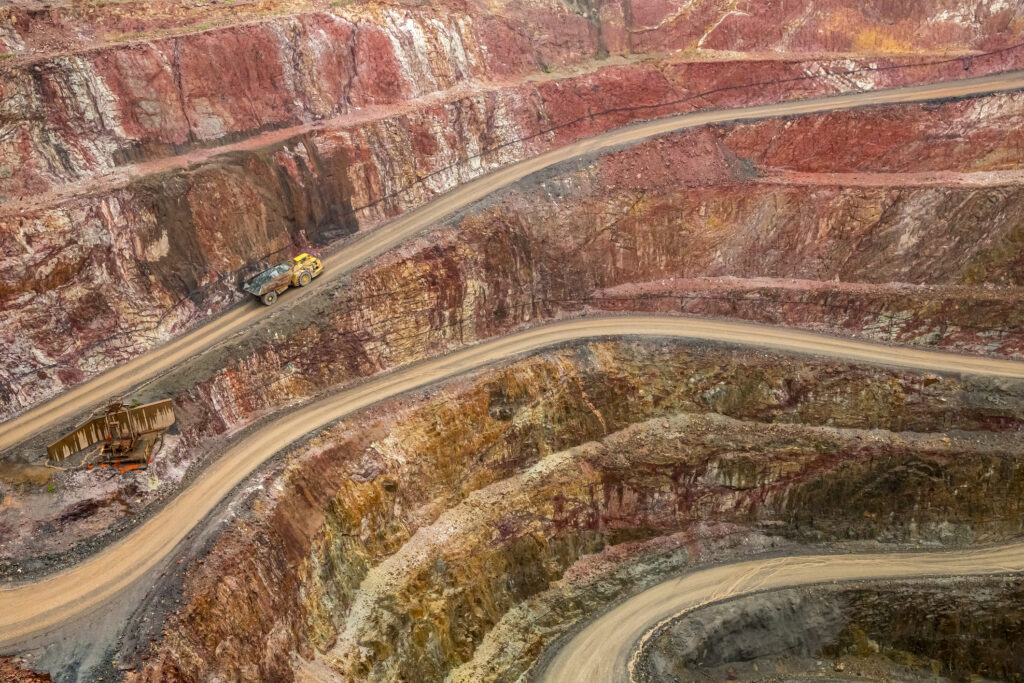
Image: An open cut gold mine. The gold is lighter in colour and a little shiny, helping to reflect heat and stay cooler.
All these factors account for summer days in an open cut mine to be somewhere between 5 and 20°C hotter than the reported air temperature. Add in humidity, and the feels like temperature can exceed 60°C on some days. This is why there is a lot of attention paid to hydration of workers in mines.
DTN APAC provides both air temperature and feels-like forecasts so you can see when conditions are set to become oppressive to workers, and steps can be taken to mitigate the risk. Our mining dashboards can also be configured to alert when the temperature reaches a certain threshold, so you know when to enact measures to protect your staff. To find out more, please visit our website or email us at apac.sales@dtn.com.


