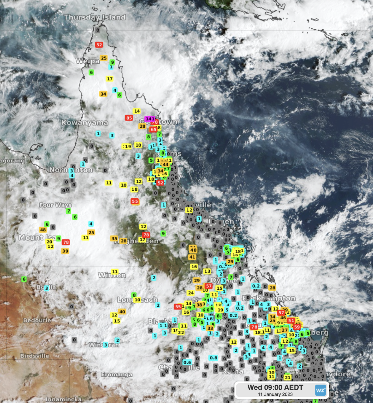
Parts of outback Queensland have received a really good soaking in the past 24 hours, with numerous falls in the range of around 50-80 mm recorded to 9 am Wednesday in the vicinity of the outback towns of Cloncurry, Longreach and Mt Isa.
Other parts of the state have also seen significant falls, and further heavy rain is likely over much of the north of the state over the next week, particularly in coastal regions, as a trough interacts with a moist onshore airflow.
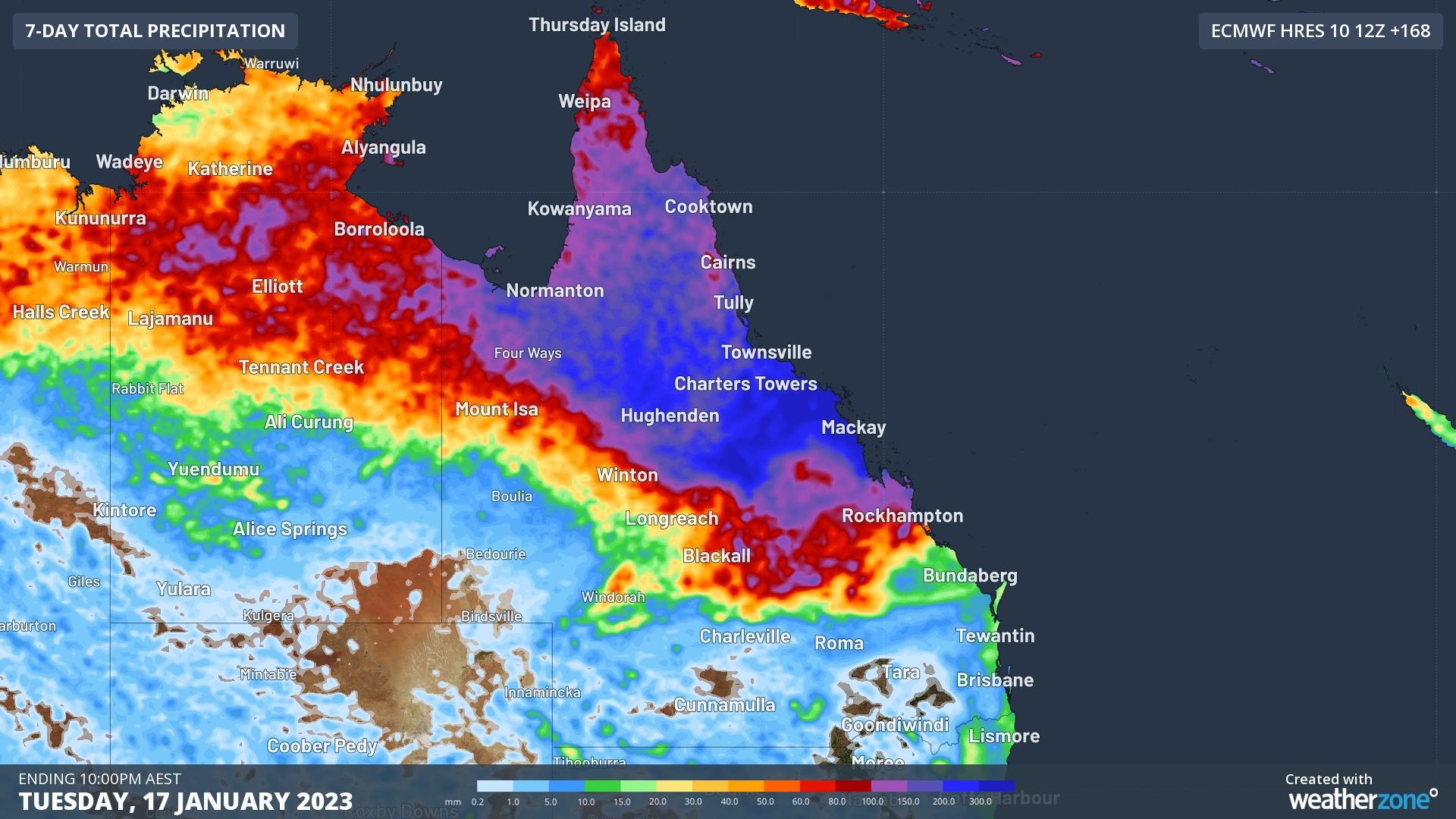
The chart below shows the predicted rainfall over the next week. As you can see, the heaviest falls (in dark blue) are expected between about Mackay and Townsville, and there is some indication that the area could see an extreme rainfall event with as much as 700 mm of rain.

Image: The northern half of “The Sunshine State” will take a break from sunshine. Source: ECMWF.
But as things stand now, the most welcome rainfall has been in western Queensland. This is not unusual. It is of course the wet season, when normally parched western Queensland receives its heaviest rainfall. So, for example:
- Longreach averages just 433.4 mm annually, but the wettest month is January with an average of 76.4 mm.
- Mt Isa averages just 460.7 mm annually, but the wettest month is January with an average of 115.1 mm.
- Cloncurry averages just 500.6 mm annually, but the wettest month is January with an average of 156.6 mm.
With so much cloud and rain about, top temps will also be well down on the January average in the towns mentioned above, with maximums in the low-to-mid-thirties rather than the usual high-thirties.
Thunderstorms will also likely be a feature of the weather in Queensland in the coming week. Some fairly strong storms have already occurred across the state in the last 24 hours, and the BoM issued a Severe Thunderstorm Warning on Wednesday morning for parts of the Central Highlands and Coalfields, Capricornia, and Darling Downs and Granite Belt forecast districts.
Please check our Warnings page for the latest updates.


