Wild winds and rain battered South Australia earlier this week, but why did it cause thousands to go without power?
A low-pressure system lingering in the Bight combined with a blocking high to the east delivered strong easterly winds and rain over the region.
Strong easterly wind gusts between 60-80km/h was observed across Adelaide and the Mount Lofty Ranges on Tuesday, October 4. The strongest gusts were observed at:
- Neptune Island recorded a gust of 87km/h, the strongest gust state-wide
- Parafield Airport saw a 78km/h gust, which was the strongest since winter 2021
- Adelaide Airport experienced over a dozen wind gusts exceeding 60km/h, peaking at 69km/h
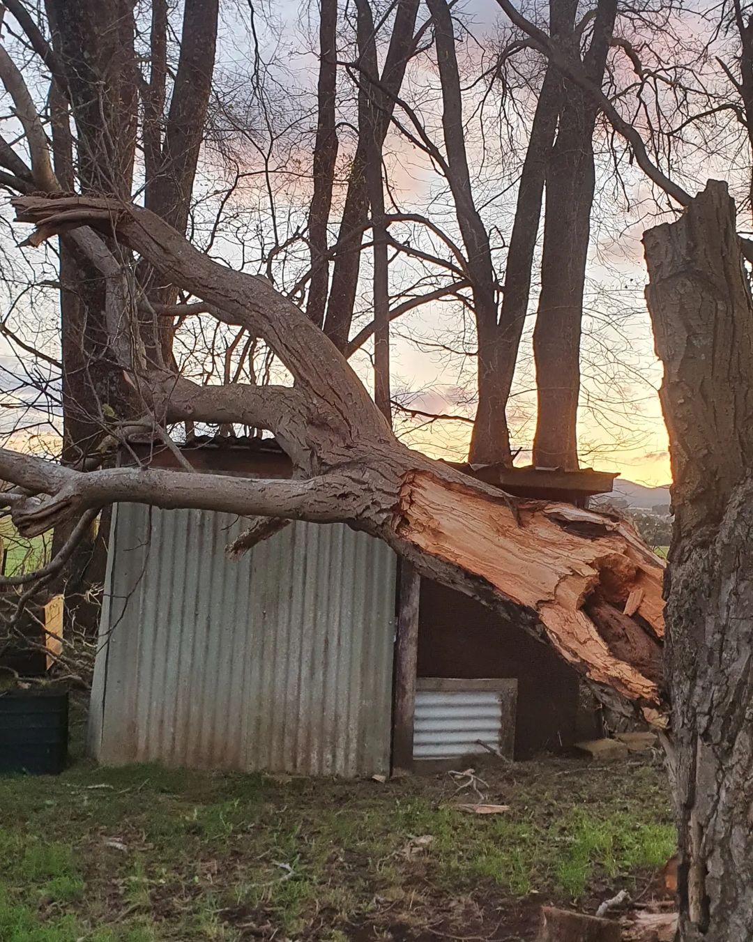
These gusty winds caused trees and branches to fall over powerlines across northern, eastern and southern suburbs of Adelaide. According to SA Power, more than 35,000 people in SA were still without power on Wednesday, October 5.
We’ve swung in crews from nearby regional areas as well as contractors to help metropolitan crews continue to restore power following yesterday’s damaging storm. More than 35,000 people have been affected by power outages. We’re hopeful that all outages will be restored today. pic.twitter.com/7RJyWm2Gn5
— SA Power Networks (@SAPowerNetworks) October 5, 2022
While these winds were strong, it is unusual for wind speeds of this strength to topple trees and cause widespread power outages.
The tree and infrastructure damage were exacerbated by heavy rain and above average soil moisture, which helped to topple trees and added weight to the tree’s branches and leaves.

Image: Root zone soil moisture in SA on Wednesday, October 5. Source: Bureau of Meteorology
However, one of the main causes of the damage was the direction of the wind. The Adelaide region most commonly sees its strongest winds from the west, but these winds came in from the east.
Why do some wind directions cause more damage than others?
In addition to wind speed and duration, the wind direction also plays a big role in determining how severe the damage will be.
A landscape that is accustomed to prevailing winds from the west is likely to see more damage or destruction when powerful winds blow in from the east.
Trees and branches adapt and grow with the prevailing winds by growing more roots on their leeward side relative to the prevailing wind direction. However, this makes them vulnerable to other wind directions, particularly winds from the opposite direction.

So, when a strong easterly wind event such as Tuesdays occurs, it tends to snap back the trees in the opposite direction to what they were built around. Broken branches that could hang on during a westerly wind can also often snap when pushed in the opposite direction.
These branches and trees then fall on the powerlines, triggering widespread blackouts for thousands of people.
How can Weatherzone help?
Storm Impact Analytics (SIA) is a damage and outage incident prediction system that uses a sophisticated, machine learning-based approach to provide a set of quantitative predictions that support a more prepared response to service interruptions.
The system takes into account the wind direction, in addition to wind speed and duration, and can accurately predict the number of outages. It can also simulate outages caused by heavy rainfall, thunderstorms and extreme temperatures. For more information, please contact us at apac.sales@dtn.com.


