
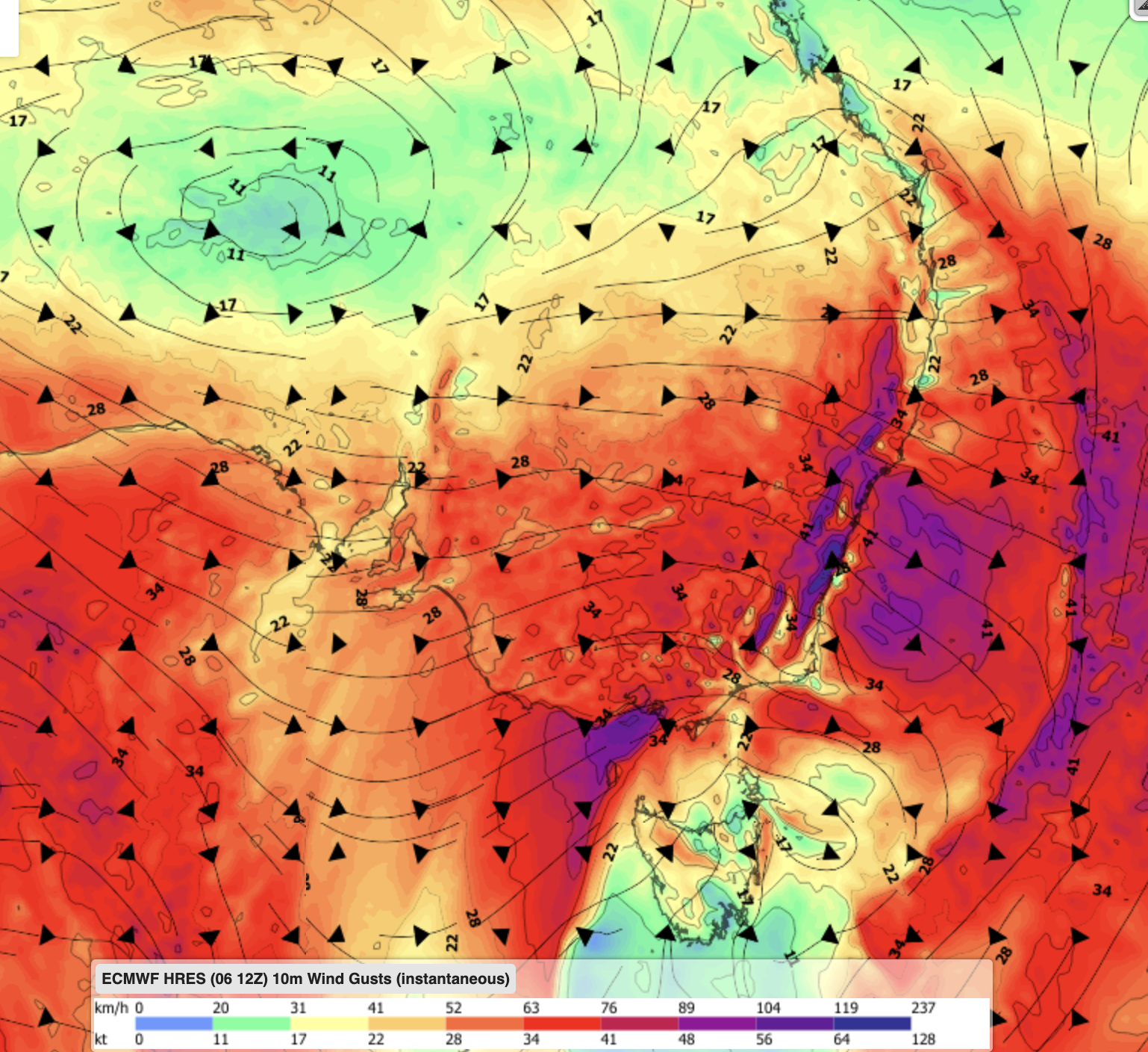
The National Electricity Market (NEM) is bracing for one of its most active wind weeks of the year, with two powerful cold fronts bringing wind gusts which could force wind farms into cutouts at times.
The first vigorous cold front is set to sweep across southeastern Australia late this week into early next, with another powerful front following closely behind during the middle of next week.
The increased frontal activity is being driven by the Southern Annular Mode (SAM) which tended negative during late July into August.
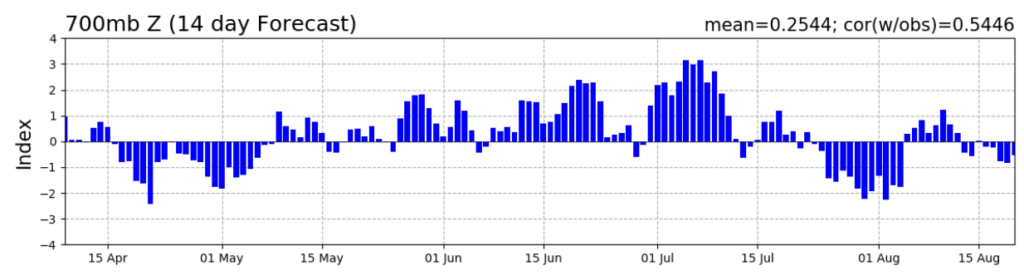
Image: Southern Annular Mode (SAM) observed and forecast. Source: NOAA climate prediction Centre
During negative SAM phases, cold fronts pass further north than usual meaning that the NEM can experience more frequent and intense bursts of wind.
Models suggest that positive SAM could return during the middle of August with high pressure building behind these systems, bringing another lull in wind across the NEM.
The forecast: two fronts, one big wind week
The first cold front is forecast to bring widespread gusts reaching 90–100 km/h across large parts of Victoria and New South Wales, with pockets potentially exceeding 120km/h, within range of typical wind farm cutout thresholds on Monday, August 10.
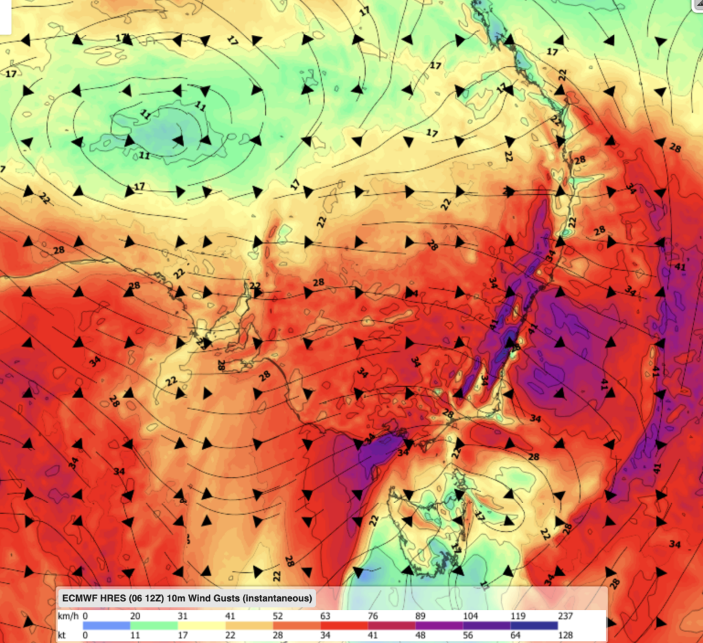
Image: ECMWF Instantaneous Wind gust forecast for 1pm AEST on Monday, August 10
Another burst of powerful winds is forecast on Wednesday, August 12, is forecast to bring widespread gusts of 70–80 km/h across South Australia, Victoria and Tasmania, with isolated pockets of 90-100 km/h along exposed coasts and ranges.
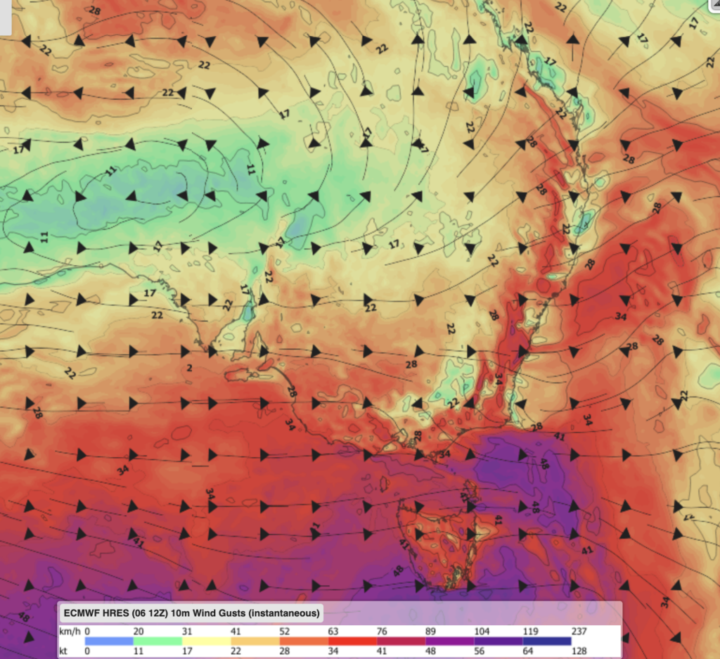
Image: ECMWF Instantaneous Wind gust forecast for 1pm AEST on Wednesday, August 12
What does this mean for wind generation?
Forecast wind farm output across the NEM is expected to be large through the first half of next week as the fronts move through, possibly peaking at the top of the fleet’s output range on Monday and possibly Wednesday. Wind power generation is expected to ease from Thursday as the second cold front moves further east over the Tasman Sea.
Why extreme wind can mean less power
Not all wind speeds are great for wind generation; wind turbines have an upper wind speed limit of sustained winds above 90 km/h. Beyond this, speed operators typically shut down the turbine to avoid mechanical damage.
This creates a ceiling for the windiest days and can reduce the overall wind power making its way into the grid.
Demand pressure adds to the picture
Cold conditions and wind chill are expected to keep demand elevated across the NEM over the coming week, adding another layer to a market already dealing with a run of strong fronts.
There’s currently no Lack of Reserve notice, as of Friday at 1pm AEST, but the combination of high heating demand and a wind fleet that may curtail output right at the peak of Monday’s front is the kind of setup that can tighten supply margins and put upward pressure on spot prices, particularly during evening peaks.
This week, DTN APAC experts will be monitoring:
- Whether the forecast dip in output next week is concentrated in New South Wales, South Australia, Victoria and Tasmania (specifically, the regions sitting most directly under the strongest gust forecasts), or whether it’s spread more evenly across the NEM.
- How quickly output recovers once the second front clears, and whether a third system materialises behind it while the negative SAM pattern persists.
- Market signals: periods of sudden, weather-driven wind curtailment are exactly the kind of event that can tighten supply margins and move prices, particularly if they coincide with an evening peak or a lull in other generation sources.
With a negative SAM keeping the storm track pinned across the southern states for at least the next week, it could shape up to be one of the years windiest weeks across the NEM.
DTN APAC offers industry-leading weather intelligence for the Renewables industry, including solar, wind, and hydro. Learn more




