Hot and windy weather are bringing extreme fire danger near Darwin on Wednesday, just days after the city saw its first rain in four months.
Prior to last weekend, Darwin had not seen any rain since May. This 115 day dry spell came to an end when rain started pouring into the gauge on Sunday afternoon as a thunderstorm moved over the city. Despite only collecting 9 mm, this was the city’s first rain of the build-up and its first sign of the approaching wet season.
In true September fashion, the weekend’s brief rain has been replaced by mostly sunny skies, high temperatures and elevated fire danger ratings this week.
After reaching 35.8°C and 35.5°C on Tuesday and Wednesday, respectively, Darwin is forecast to reach around 34 or 35°C again from Thursday to Friday next week. This warmth will combine with gusty southeasterly winds to cause extreme fire danger ratings in parts of the Darwin and Adelaide River district on Wednesday and in the Barkly North district on Tuesday and Wednesday.
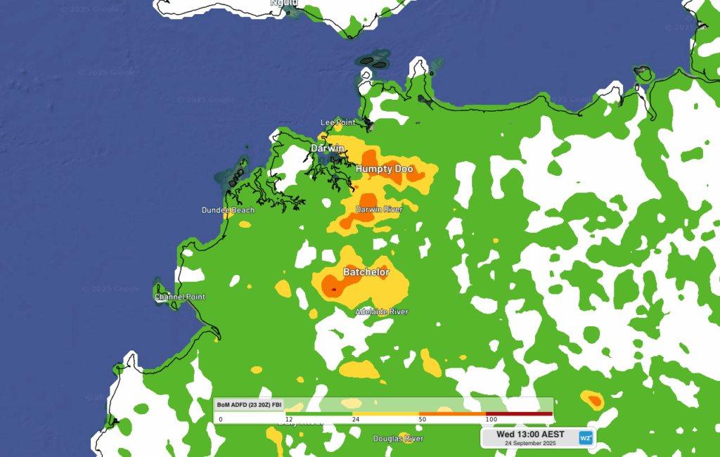
Image: Modelled fire behaviour index over the northwest Top End on Wednesday afternoon. The orange shading shows areas where extreme fire danger is being predicted.
Fires are normal in the NT at this time of year as rising temperatures and abundant dry vegetation provide ideal conditions for fires to take hold. The official Fire Danger Period for the Top End typically runs until early October, while fire activity in the Barkly and Tanami districts usually peaks through spring. The videos below show thunderstorm activity on Sunday (left) that brought Darwin’s first drops of rain in four months. Lightning from some of these thunderstorms could have lit fires in the region, as seen from the plumes of smoke on Monday (right).
Video: Rain and thunderstorms seen on DTN’s Stormtracker dashboard on Sunday (left) and smoke from a fire near Batchelor on Monday (right).
Fire danger usually decreases after Australia’s northern rainfall onset, which is defined as the date when at least 50 mm of rain has accumulated after September 1 – this roughly enough rainfall to stimulate plant growth after a typical dry season. This year’s northern rainfall onset it expected to occur earlier than usual for most of the NT.
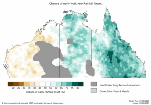
Image: Northern rainfall onset outlook. Source: Bureau of Meteorology
DTN APAC’s dashboards allow you and your business to keep up to date with the latest fires across the NT and Australia.
How DTN APAC Services Fire-Prone Outdoor Industries
Working in often challenging conditions across high-risk outdoor operations including forestry, emergency services, mining, rail, and utilities, our consolidated weather services ensure full situational awareness for you and your team.
DTN APAC serves fire-prone outdoor industries, delivering trusted weather data and severe weather alerting to maintain safety, protect your assets and underpin your operational planning.
Reinforce your Prevention, Preparedness, Response and Recovery (PPRR) efforts with our tailored services.
Prevention: Utilise our seasonal outlooks and daily forecasting to identify and implement prevention measures. Understand the climate risks affecting your operations. Calculate optimal timing for maintenance activities, vegetation management, and scheduled shutdowns.
Preparedness: Gain understanding of bushfire risk in the days, weeks and months leading up to peak fire season. Use DTN APAC’s seasonal outlooks and 14-day forecasting to plan workforce deployment, equipment positioning, and preventative operations such as controlled burns or asset maintenance.
Response: We deliver fire danger forecasts and provide nowcasting and forecasting of severe weather events, including thunderstorm/lightning detection and alerting, to give you full situational awareness of emergency conditions likely to impact your operations and infrastructure.
Recovery: Assess the weather risks affecting post-incident recovery and restoration processes. Utilise post-event analysis reports to support insurance claims, evaluate operational response effectiveness, and inform future risk management strategies.
We work to bring you full situational awareness so you can mitigate risk, ensure workforce safety, and maintain operational continuity across your outdoor assets.
Learn more about our large range of industry leading products and services or email us at sales.apac@dtn.com
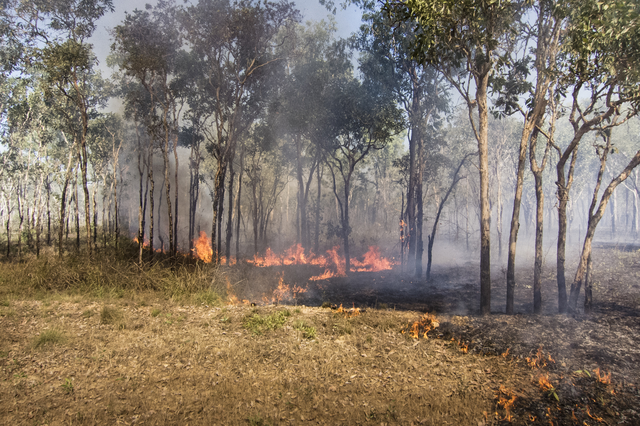
Thumbnail image source: iStock / Uwe Moser


