
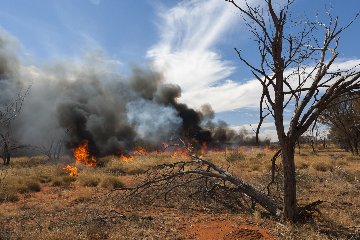
The latest seasonal bushfire outlook from Australian Fire and Emergency Service Authorities Council (AFAC) warns of elevated fire risk for northern Western Australia, eastern South Australia and much of western Victoria this spring.
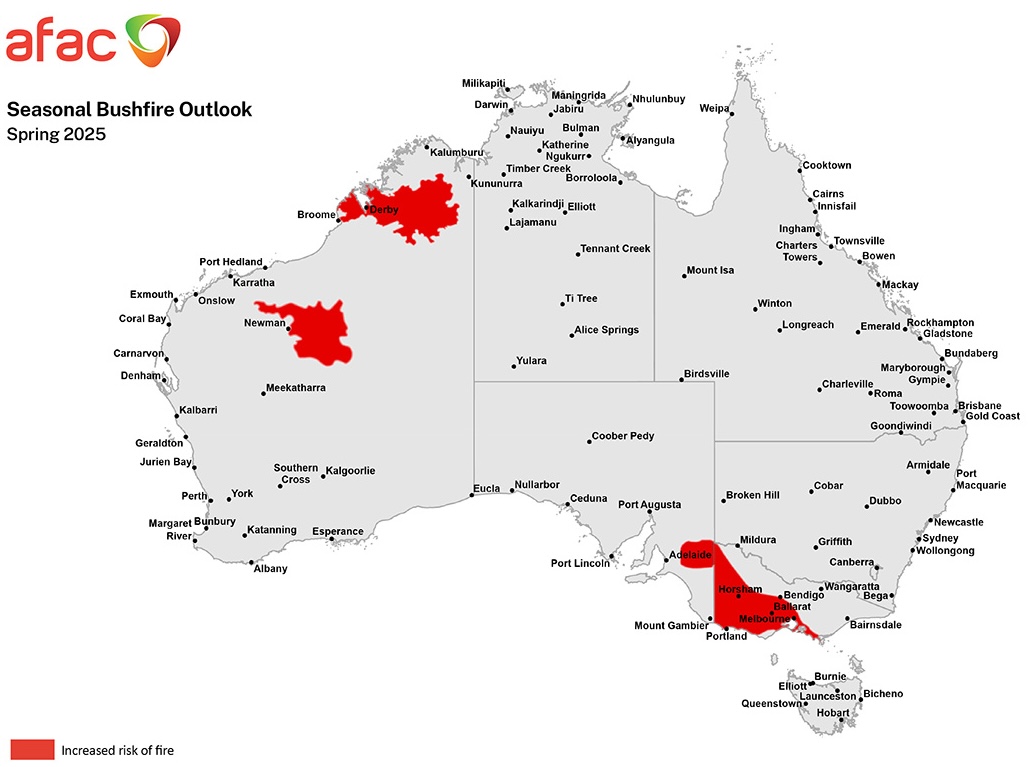
The spring 2025 fire season outlook, with areas of increased chance of fire shaded in red
In WA, a large portion of the Kimberley and inland Pilbara are highlighted as areas at an increased risk of fires this season. These areas saw increased rainfall over the past wet season with the passages of Tropical Cyclones Zelia, Dianne and Errol, as well as an unseasonable rainband in May. All this extra rainfall has allowed a higher density of vegetation to grow in these regions that is now drying out. Furthermore, these areas are expected to see well above average temperatures over the coming months, creating the conditions required for a more active fire season.
Much of western Victoria, extending eastward along the south to parts of Central, including Greater Melbourne, and into West and South Gippsland, and westward across the border to include the Riverland and Murraylands in South Australia are expected to see higher fire activity this spring. Despite some solid winter rainfall, these areas are still experiencing near record rainfall deficiencies over the last 18 to 24 months and are in severe drought.
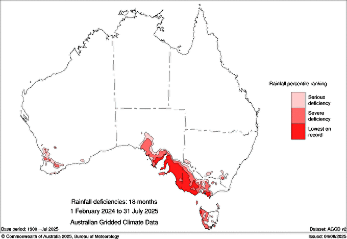
Rainfall deficiencies over the last 18 months show large parts of SA and Vic have had their driest year-and-a-half on record
The fire activity in the southeast will be highly contingent on how much rain falls during spring. It is now likely that a negative Indian Ocean Dipole will develop in 2025 and this typically increases rainfall in the southeast via northwest cloudbands. However, if rainfall is not enough to compensate for the extreme rainfall deficiencies in these areas, fire danger will likely quickly rise later in spring and into summer.
These conditions also apply for much of Tasmania, although their fire season is typically later than on the mainland, peaking in late summer and into autumn. However, based on current conditions, an earlier start to the fire season is expected.
Conditions in Queensland are more complex than in other parts of the country, as last wet season’s prolific rainfall has meant a lot of vegetation growth has occurred. The primary concern for the start of spring is dry shrubland that is masked by grass growth. Under hot and dry conditions, these environments will dry out quickly and potentially allow fast-moving fires to take hold. However, much of the forest canopy, including rainforests, is looking healthy, so overall the risk is normal.
Across NSW, the ACT and southwest WA, healthy winter rainfall and importantly the forecast of above average rainfall continuing into spring has helped to mitigate the risk of fires to normal levels.
The NT has already commenced their fire season, and the overall forecast is for normal fire conditions. Some large but slow-moving fires have already been burning for over a month in parts of the Territory, but vegetation growth is close to normal levels. The season is expected to slowly wind down with the arrival of the wet season, which is more likely to start earlier this year. However, this will start with most rain arriving via thunderstorms and lightning that can also start fires.
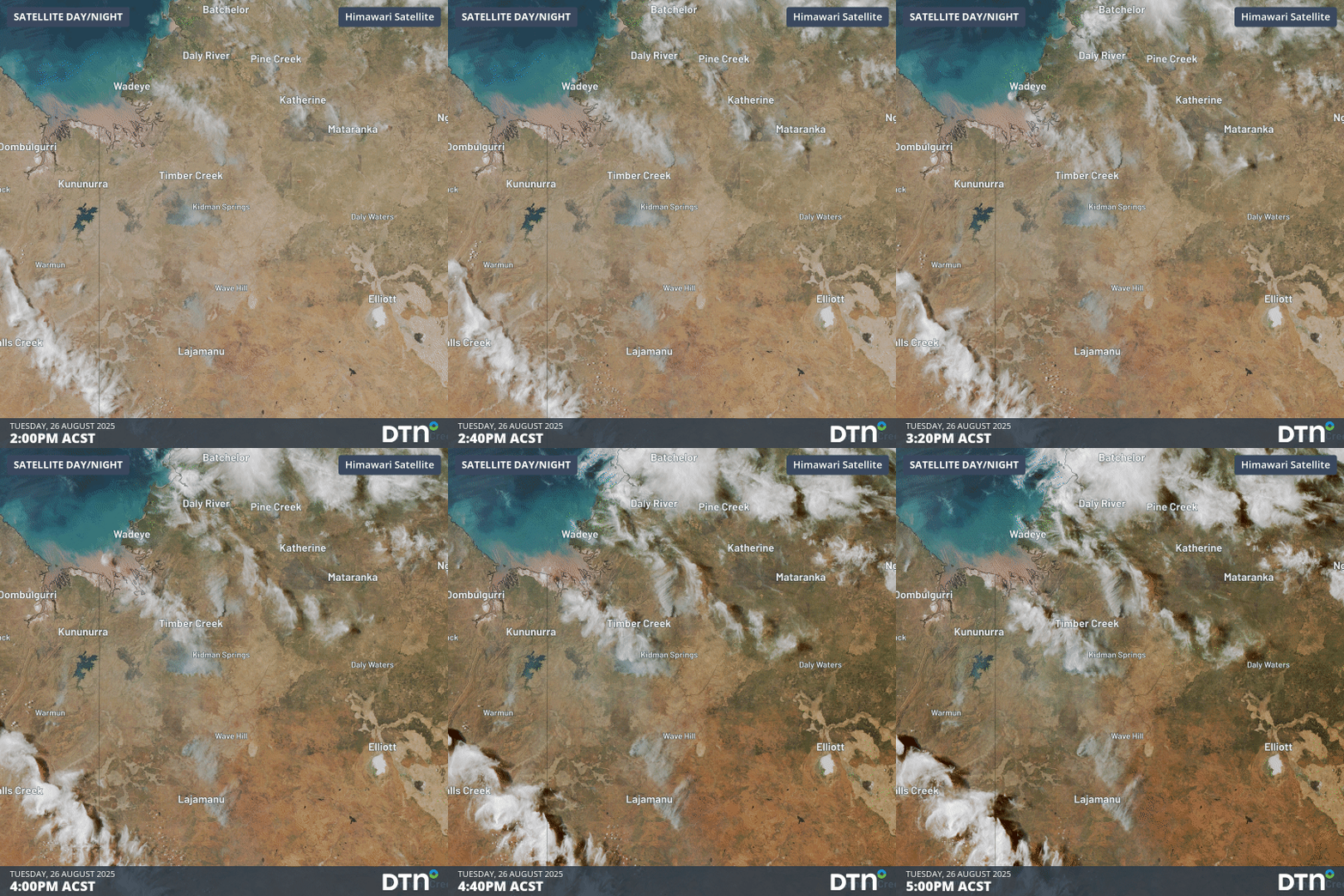
Smoke from some fires over the NT can be seen on Wednesday afternoon. Some burnt out areas can also be seen, generally to the north of the fire front
How DTN APAC Services Fire-Prone Outdoor Industries
Working in often challenging conditions across high-risk outdoor operations including forestry, emergency services, mining, rail, and utilities, our consolidated weather services ensure full situational awareness for you and your team.
DTN APAC serves fire-prone outdoor industries, delivering trusted weather data and severe weather alerting to maintain safety, protect your assets and underpin your operational planning.
Reinforce your Prevention, Preparedness, Response and Recovery (PPRR) efforts with our tailored services.
Prevention: Utilise our seasonal outlooks and daily forecasting to identify and implement prevention measures. Understand the climate risks affecting your operations. Calculate optimal timing for maintenance activities, vegetation management, and scheduled shutdowns.
Preparedness: Gain understanding of bushfire risk in the days, weeks and months leading up to peak fire season. Use DTN APAC’s seasonal outlooks and 14-day forecasting to plan workforce deployment, equipment positioning, and preventative operations such as controlled burns or asset maintenance.
Response: We deliver fire danger forecasts and provide nowcasting and forecasting of severe weather events, including thunderstorm/lightning detection and alerting, to give you full situational awareness of emergency conditions likely to impact your operations and infrastructure.
Recovery: Assess the weather risks affecting post-incident recovery and restoration processes. Utilise post-event analysis reports to support insurance claims, evaluate operational response effectiveness, and inform future risk management strategies.
We work to bring you full situational awareness so you can mitigate risk, ensure workforce safety, and maintain operational continuity across your outdoor assets.
Learn more about our large range of industry leading products and services or email us at sales.apac@dtn.com




