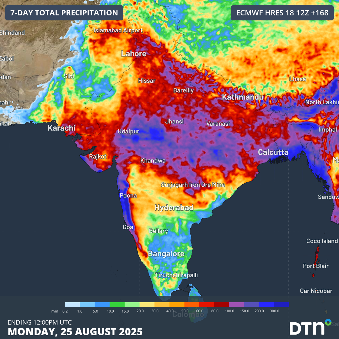
A surge of monsoonal winds and rain across northern India will top up an already plentiful monsoon season.
The Indian Southwest Monsoon to date
The graph below shows the distribution of monsoonal rainfall across the Indian sub-continent since the start of June.
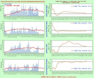
Image: Daily and cumulative monsoonal rainfall across India’s four homogeneous regions since June 1, 2025. Source: India Meteorological Department (IMD).
Parts of northern India experienced early monsoon rainfall in late May and early June before a dry spell extended into mid June. Rainfall has since come in steady bursts across the country, leading to a close to normal total monsoon rainfall cumulative, as seen below.
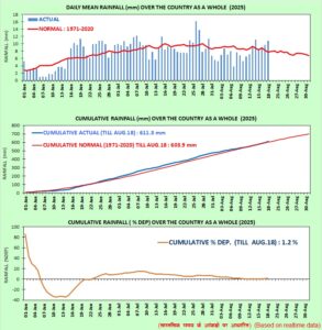
Image: Daily and cumulative monsoonal rainfall across India since June 1, 2025. Source: IMD.
Monsoon burst heading north
The animation below shows a deep surge of moist monsoonal southwesterlies moving north over India. Heavy rainfall over central parts of the country will spread into northern India later this week, lingering into early next week.
Video: 6-hourly precipitation and 950hPa (about 500m above sea level) winds over India between Tuesday, August 19, 2025, and Wednesday, August 27, 2025.
This burst of southwesterly winds and rainfall is associated with an active phase of the Madden-Julian Oscillation (MJO). The MJO is a region of enhanced cloud and rainfall that moves from west to east near the equator, moving around the globe over a period of roughly 30 to 60 days.
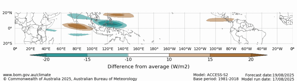
Image: Forecast outgoing long-wave radiation anomaly for August 19, 2025, associated with the Madden-Julian Oscillation. The green areas show where cloud cover is expected to be enhanced, while the brown shading represents suppressed cloud cover. Source: Bureau of Meteorology.
Across the coming week, broad parts of Western, Central, Eastern and Northern India will receive over 100 mm of rainfall, with 300-400 mm expected across parts of the Western Ghats, Bengal Basin, and Aravalli and Vindhya ranges.
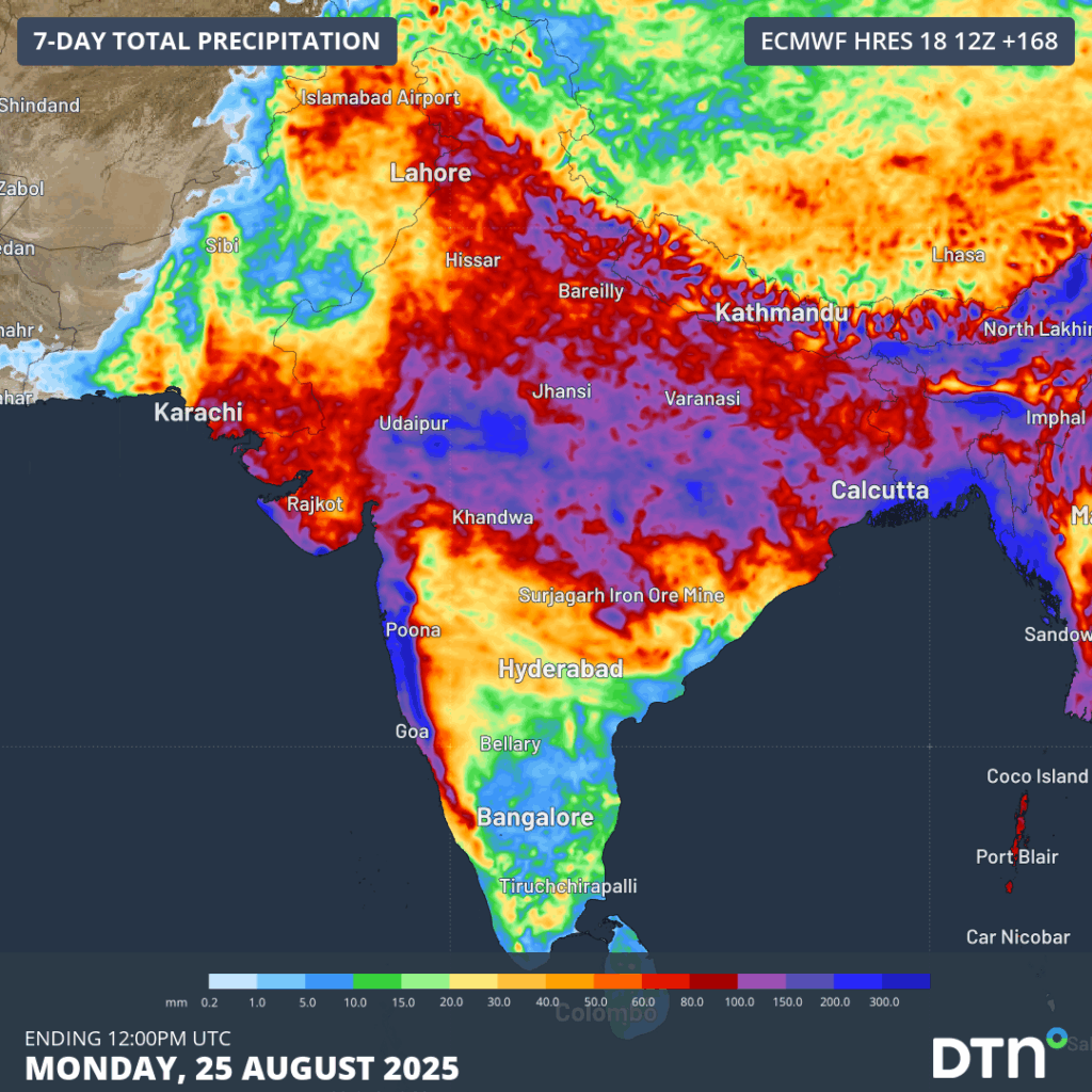
Image: Forecast rainfall accumulations over the next 7-days across the Indian sub-continent.
This burst of monsoonal rainfall will lead to flooding in some areas, with disruptions of transport and electrical networks possible.
How DTN APAC supports businesses through tropical cyclones and monsoonal rain
DTN APAC specialises in industry-leading forecast, alerting and threat analysis of tropical cyclones across Australia and Asia, offering you expert, customised solutions when the weather turns wild.
Providing rapid-update forecast information, we alert you to any low-pressure system gaining power within your region and, unlike other providers, can track its development out to 7 days. This gives you the time to prepare and safeguard your staff, sites and assets.
You will have the most precise weather intelligence charting rainfall, wind speeds and potential storm surges to help you make critical decisions quickly. Whether it’s adjusting key work schedules, protecting your staff or securing your site, we have the alerting capability to keep you steps ahead of the storm.
As the climate delivers increasingly severe weather events, their potential to impact your business operations grows.
Whether it’s preparing for the coming season’s tropical storm potential, or rapid-response forecasting with a typhoon approaching, or simply ensuring your operations team is equipped to confidently make decisions ahead of severe weather, our weather Risk Communicators are here for you.
Our weather risk communicators deliver short- to long-term guidance from:
- hourly-event weather monitoring (alerting you of impending destructive winds and heavy rain ahead of a tropical cyclone).
- week to month operational planning based on likely timing of increased monsoonal rain or periods of reduced cyclone activity.
- seasonal long term planning based on climate drivers and the likely trends across the coming months.
We deliver clear and comprehensive weather data, personalised risk assessments and briefings to you and your team, so that your critical decisions can be made with confidence.
We are available 365 days a year, so you always have the timely guidance you require, especially when severe conditions hit.
You have our insights to rely on to see you through complex situations, minimising potential loss of profit and maximising the safety of your staff and assets.
Learn more about our large range of industry leading products and services or email us at sales.apac@dtn.com