
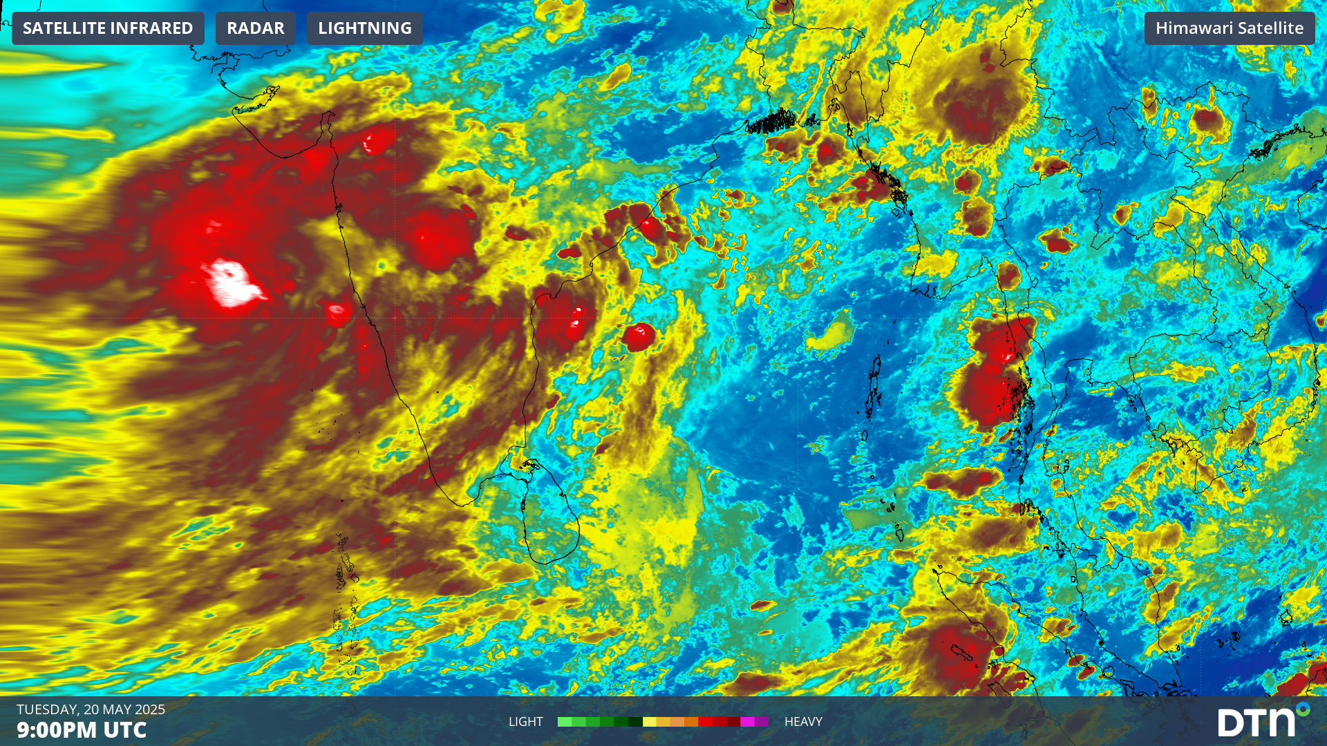
Heavy rainfall and squally thunderstorms will intensify over southern India with the arrival of the southwest Indian monsoon this week.
The Indian Meteorological Department (IMD) is responsible for tracking the advance of the monsoon over the Indian sub-continent. The latest map issued by the IMD shows the northern limit of the southwest monsoon just to the south of Kerala, near the far southern reaches of India. According to the IMD, monsoon onset is likely to reach Kerala during the next 4 to 5 days, about a week ahead the normal onset date.
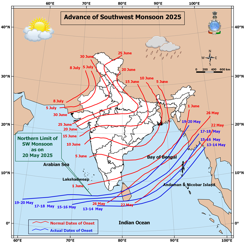
Image: Advance of the 2025 southwest monsoon onset (blue) and the normal dates of onset (red). Source: Indian Meteorological Department
The monsoon has advanced over the southern Bay of Bengal, the Andaman Sea and the Nicobar and Andaman Islands over the past week. Westerly winds laden with moisture can be seen streaming just south of Indian in the satellite image below, with intense thunderstorms affecting western and central India.
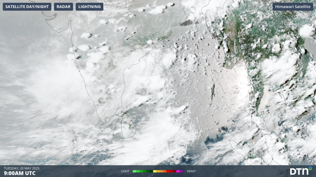
Image: Satellite imagery on Tuesday, May 20, showing monsoonal flow over the Bay of Bengal, with thunderstorm activity over parts of India in the monsoon build up.
The southwest monsoon is characterized by a surge of westerly winds extending 5-7 kilometres above sea level. These winds are laden with moisture from the Arabian Sea, bringing a surge of heavy rainfall and squally conditions across much of southern India.
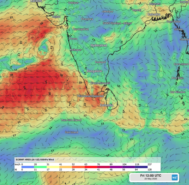
Image: 500hPa winds on Friday, May 23 showing surge of westerly winds crossing into southern India.
The southwest monsoon usually takes 4-6 weeks to progress into the far north of the country. The Western Ghats, an insurmountable mountain range along the west of India, splits the monsoon into the Arabian Sea and Bay of Bengal branches.
DTN APAC Explainer: The Indian Monsoon
As seen in the image below, heavy rain will affect parts of the Western Ghats and the south and southeast as the monsoon edges into the far south of the country and a severe thunderstorm outbreak extends into central parts. The heaviest falls are expected across the west coast, including in Mumbai, Goa and Thiruvananthapuram, as well as over parts of Odisha, Telangana and Andhra Pradesh, with weekly totals expected to reach 300 to 400mm.
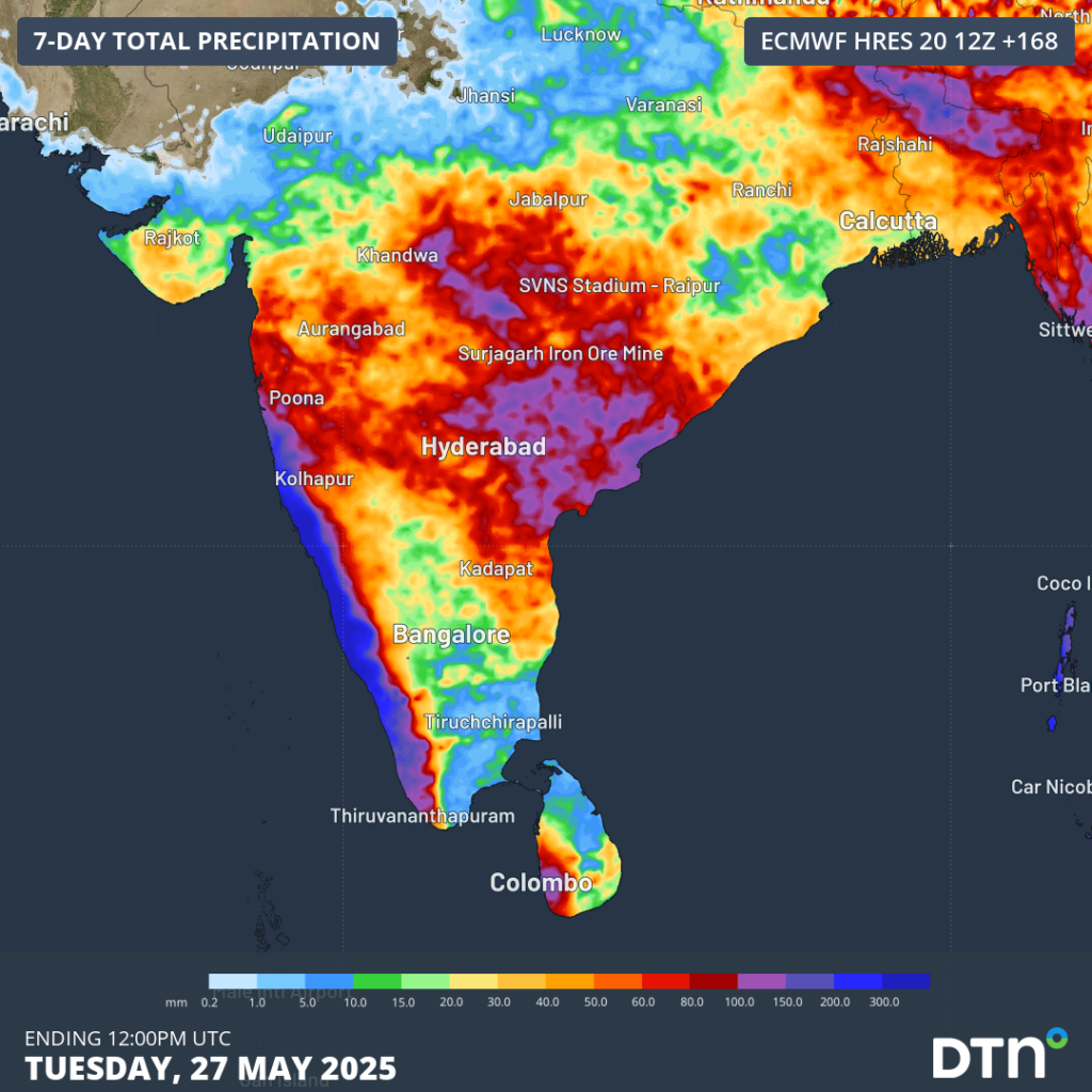
Image: weekly rainfall forecast to Tuesday, May 27.
The surge of westerly monsoonal winds will remain contained to the southern part of the country over the coming week. However, this surge should spin up a series of tropical storms and possible cyclonic storms over the Arabian Sea and/or the Bay of Bengal next week.
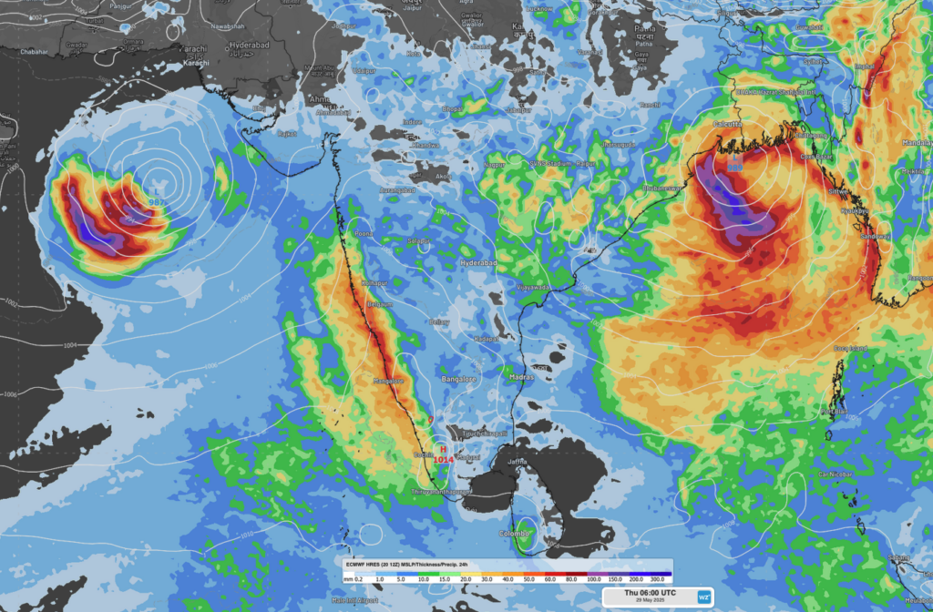
Image: Mean Sea Level Pressure and 24-hour rainfall on Thursday, May 29, showing possible cyclonic storms forming in the Arabian Sea and Bay of Bengal.
The onset of the monsoon over the Indian sub-continent brings relief from sweltering heatwaves, but the heavy rainfall led to significant disruptions to transport, energy and mining sectors. The monsoon rains are also imperative to many agricultural areas, making up a large majority of the yearly rainfall.
How DTN APAC can help
Flood risk system
DTN’s flood risk system uses radar and geofencing to provide businesses with rainfall alerts and forecasts. The system can be customised to a business’s operations and industry.
The system scans rainfall intensity every 6 to 10 minutes and sends alerts and updated to business’s specific locations. It also uses geofencing technology to target alerts for specific sites and works with Opticast, a forecast system that predicts rainfall intensity and accumulation. We can also provide long-term rainfall forecasts up to six months in advance.
Benefits to businesses:
- Helps businesses plan ahead and reduce the impact on operations
- Provides real-time situational awareness
- Helps businesses maintain flood risk awareness
- Improves communications with local information and flood alerts
- Provides team-wide access to flood risk data
Tropical cyclone forecasting
DTN APAC, specialises in industry-leading forecast, alerting and threat analysis of tropical cyclones, offering you expert, customised solutions when the weather turns wild.
Providing rapid-update forecast information, we alert you to any low-pressure system gaining power within your region and, unlike other providers, can track its development out to 7 days. This gives you the time to prepare and safeguard your staff, sites and assets.
To find out more about large range of products and services contact us at sales.apac@dtn.com




