
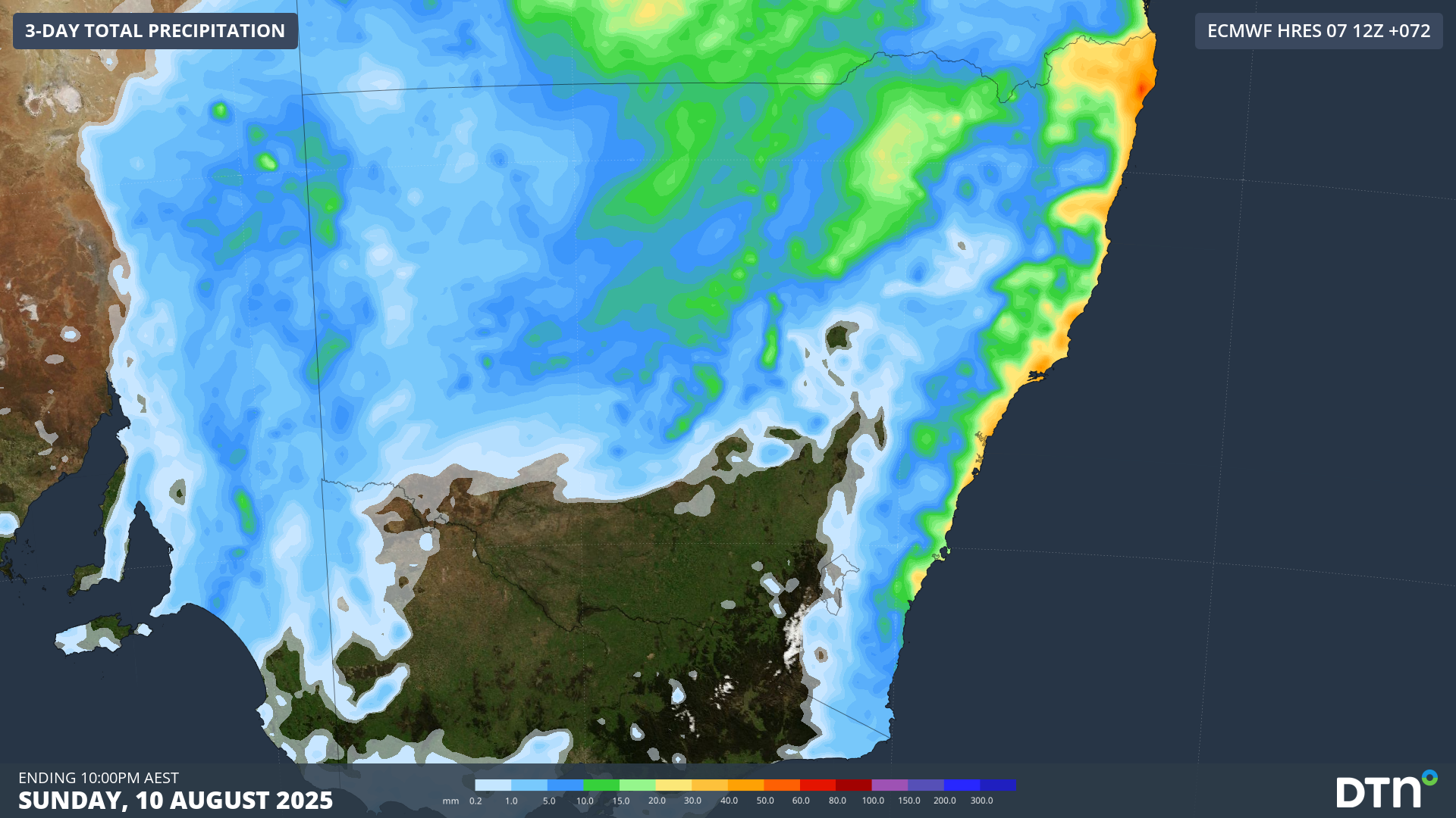
There has only been one completely dry day in Sydney so far this month and the city will see more wet weather this weekend, continuing its wettest August in 9 years.
In an average August, Sydney would typically receive about 80 mm of rain during the entire month. But this August has already exceeded this long-term average, with 98 mm of rain accumulating in the city during the eight days ending at 9am on Friday, August 8.
Despite only being 8 days into the month, this is already Sydney’s wettest August since 2016. It has also been the city’s wettest start to August in 168 years of records.
Moisture-laden onshore winds will cause showers and cloud to stream over eastern NSW from Friday night into the weekend. These streaming showers will cause intermittent periods of wet and dry weather throughout the weekend, with low rooftop solar power output from the densely populated metropolitan region.
Abnormally warm sea surface temperatures in the Tasman Sea will help provide moisture in the atmosphere for this weekend’s showers. Water off the southern half of the NSW coast is currently 2 to 3°C warmer than average, which is in the top 10% of historical records for early August. Warmer water causes more evaporation, which provides fuel for rainfall.
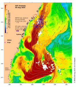
Image: Sea surface temperature anomalies near central NSW on August 5, showing an abnormally warm tongue of water sitting off the coast. Source: IMOS
Coastal areas of Sydney should see about 5 to 15 mm of rain on Saturday and a bit less on Sunday. Falls will be lighter as you move inland towards the ranges. Similar rainfall rates will also occur for most other areas in eastern NSW this weekend.
How DTN APAC services the energy sector
DTN APAC supplies precise weather intelligence to over 75% of the National Energy Market (NEM); and is the trusted provider for the Australian Energy Market Operator (AEMO).
DTN APAC’s next-generation nowcasting and forecasting system, OpticastTM, is independently proven to outperform other industry models, allowing energy traders to respond rapidly to changing conditions. From 14 day forecasting to seasonal outlooks, you have access to complete and powerful weather intelligence giving you the confidence to make the best call.
Meeting the needs of the changing market, DTN APAC utilises high-resolution modelling and local knowledge to provide 5-min granularity observations and forecasts, optimising your market bidding and maximising your profits. These, coupled with briefings from our energy meteorologists, give you full awareness of the associated risk.
Benefit from specialised indices such as apparent temperature, Cooling/Heating Degree Days (CDD/HDD) and Effective Degree Days (EDD) to help accurately predict demand. You can get a clear picture of forecast conditions across the market and quickly assess heat/heatwave potential from 14 days out to 12 months.
No matter where your energy trading focus lies, we have the power generation and weather insights to inform your critical decisions, keeping you ahead of the curve.
Learn more about our large range of industry leading products and services or email us at sales.apac@dtn.com




