An outbreak of heavy rain and severe thunderstorms will impact Victoria and NSW over the coming long weekend.
As seen in the synoptic image below, this outbreak of storms and wet weather will be caused by a broad low pressure trough and cold front.
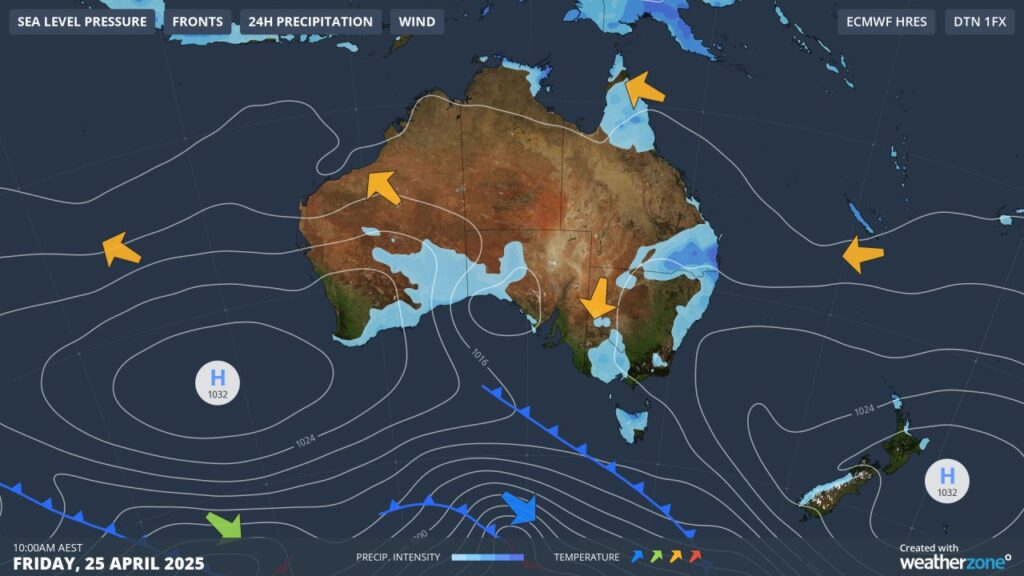
Image: Synoptic image for Friday, 25 April.
As the weekend goes on, the surface low pressure trough will move east over NSW. A pool of cold air reaching well above the surface will move over the surface trough, increasing the thunderstorm potential and deepening the surface low pressure.
Along with this synoptic situation in place, streams of tropical moisture from both the northwest and northeast of the country (the purple streams converging over central and eastern Australia in the image below) will enhance the potential for heavy rain over the coming days.
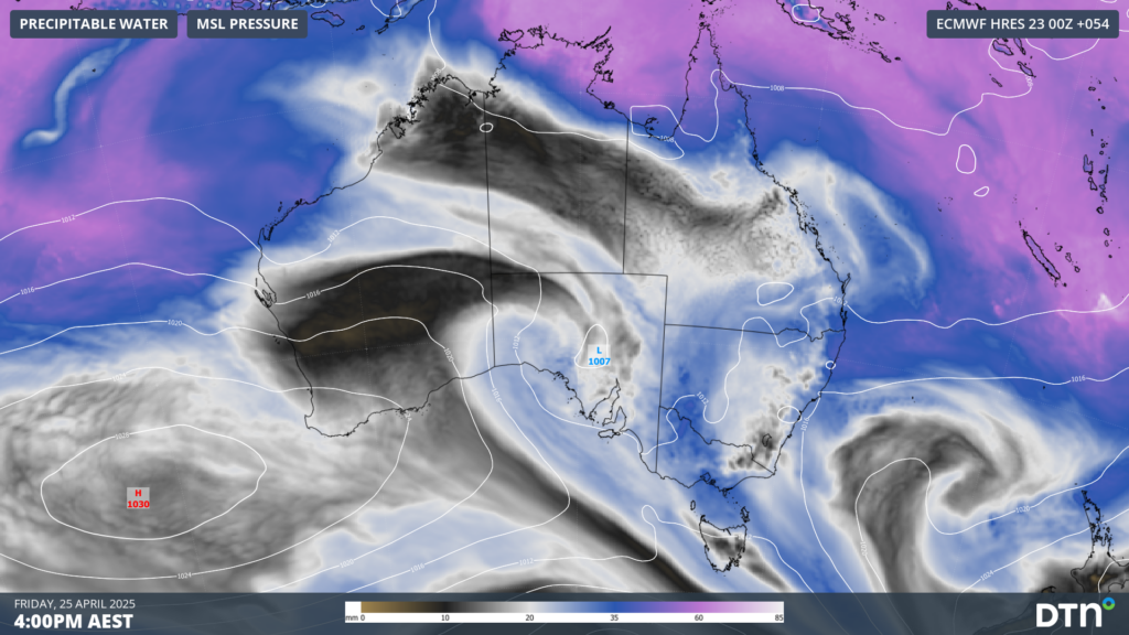
Image: Precipitable water and mean sea level pressure on Friday, 25 April afternoon.
Victoria
Thunderstorms and rain are possible from around dawn on Anzac Day (this Friday) over parts of western and central Victoria. The greatest risk of heavy rain and severe thunderstorms will come between about late morning and early evening, across much of the state, except over eastern Victoria.
As seen in the rainfall map below, widespread falls of 20-30mm will impact parts of central, western and northern Victoria until early Saturday, most of which is expected on Friday, with pockets of 40-50mm possible.
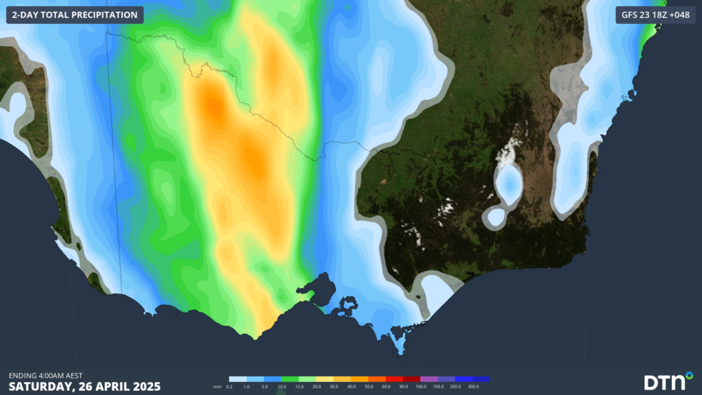
Image: Accumulated rainfall to 4am on Saturday, 26 April.
While a soggy Anzac Day dawn service isn’t ideal, this rainfall will be a much welcomed sight across western and central Victoria, which is has been experiencing severe rainfall deficiencies over the past 14 to 24 months, as seen in the image below.
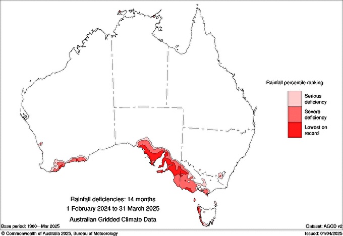
Image: Rainfall deficiencies across Australia between February 2024 and March 2025. Source: Bureau of Meteorology
Thunderstorms may still linger into the early hours of Saturday but should contract to northern and eastern parts of the state as the trough deepens over NSW. A high pressure ridge should clear most showers into Sunday, leaving a cool day with some lingering cloud cover.
New South Wales
Heavy rain and intense thunderstorms are only expected over the southwest of the state on Friday afternoon and evening. Rainfall will spread over western and central NSW on Saturday morning, reaching east (including over Sydney) into the afternoon and evening, and into the southeast early on Sunday. Localised heavy falls are most likely with these thunderstorms, however large hail and damaging wind gusts are also possible, most likely over western and northern parts of the state.
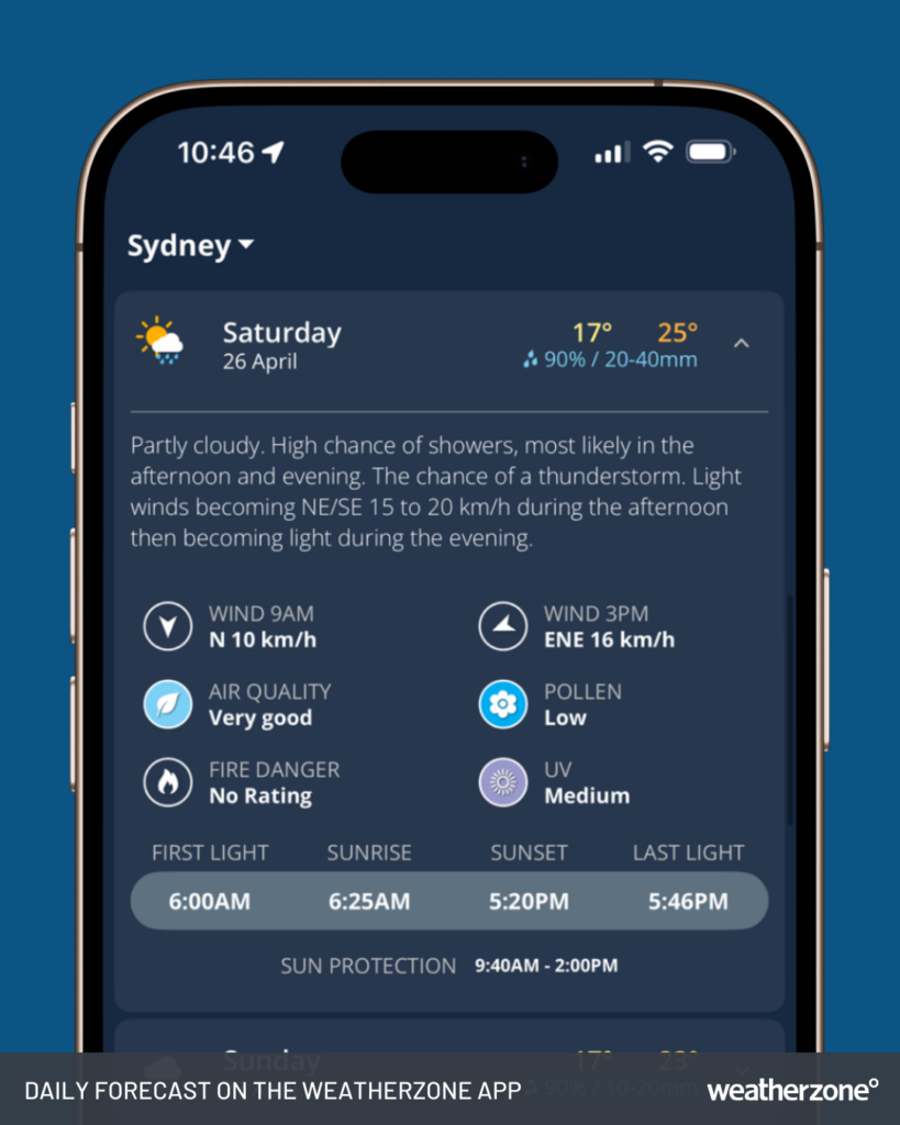
Image: Daily forecast on the Weatherzone app for Sydney, NSW, on Saturday, April 26.
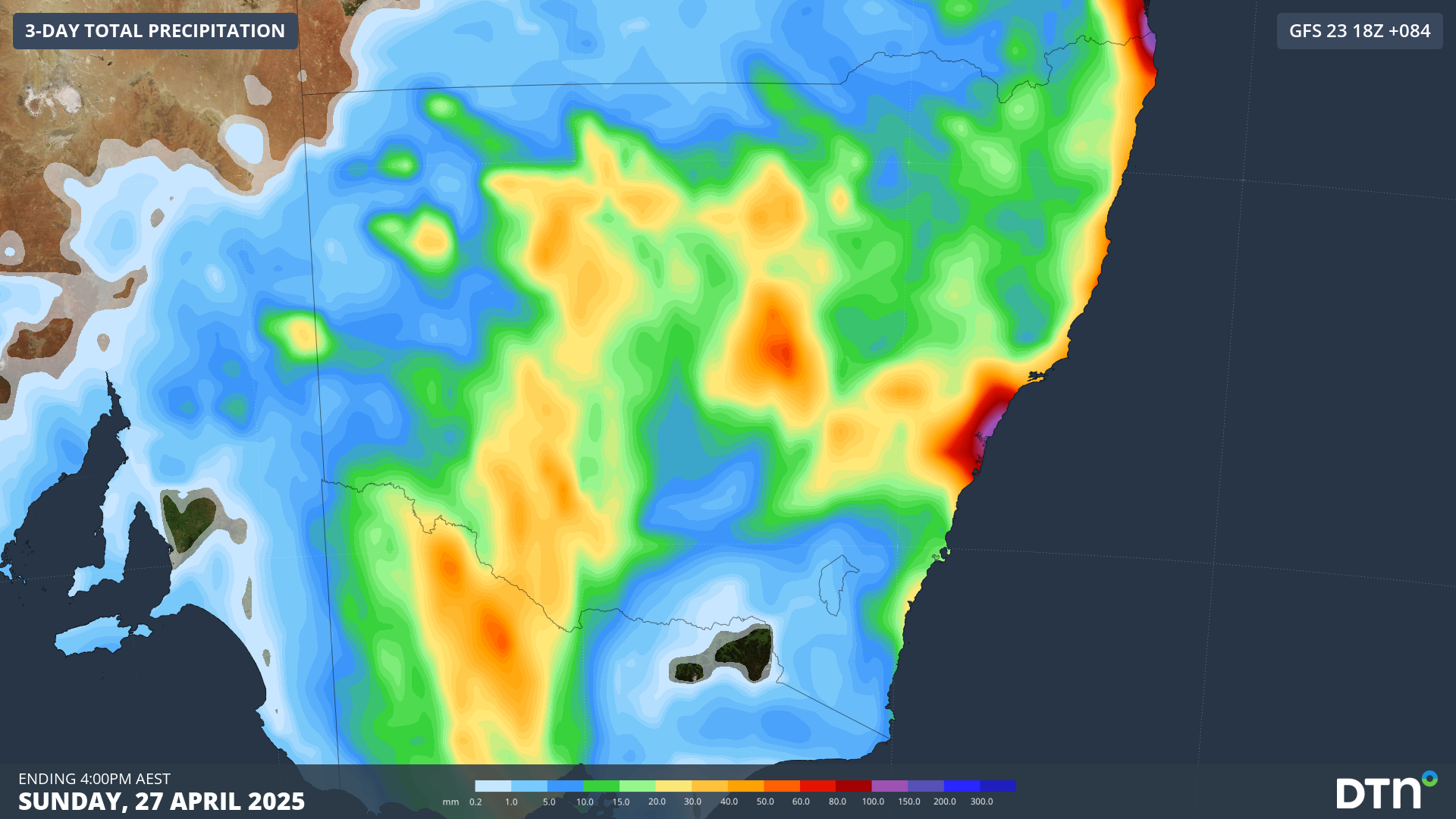
Widespread falls of 15-30mm are expected over the coming days, including across western NSW. The image below shows some areas of more intense rainfall over eastern NSW as the trough deepens on Sunday.
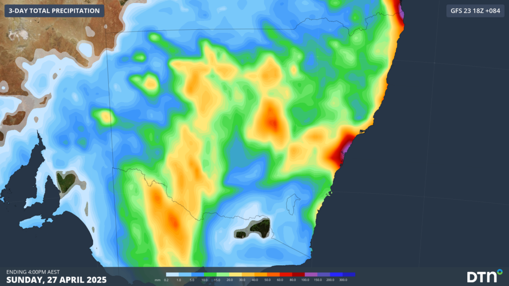
Image: Accumulated rainfall to 4pm on Sunday, 27 April over NSW.
Winds will strengthen from the south along eastern NSW on Sunday as a low deepens off the coast, with gusty showers persisting into Monday.
How DTN APAC can help
Stormtracker is a severe weather solution that can assist you in observing, in real-time, any storm or event that has the potential to impact your business.
Embedded in DTN APAC’s industry interfaces, the system gives you a time advantage when monitoring conditions developing over your infrastructure and location.
Stormtracker is our Global Information System (GIS) tracking tool, providing multiple weather layers and zoom controls overlaid on a map of your location and infrastructure. You can choose a snapshot or full screen view, depending on your requirements. The maps allow you to monitor all weather, and specifically any systems likely to cause risk for your business. You also have the capacity to observe:
- real time lightning and thunderstorm alerts
- localised lightning strike frequency
- official warnings for storm, cyclone, wind, flood and fire
- sentinel hotspot fires and fire agency current incidents
Stormtracker’s radar imagery updates every 10 minutes, so you are always able to respond rapidly to changing conditions. You can customise alerting to notify you when your staff or infrastructure are under threat. With increased situational awareness, your ability to make informed decisions quickly is optimised.
DTN APAC’s experience and intelligence gives you a clear path through complex situations. Let us assist you, offering actionable insight when extreme weather poses risk to your business.
To find out more about large range of products and services contact us at sales.apac@dtn.com