A massive line of dangerous thunderstorms is bearing down on Sydney this Monday morning, having already impacted parts of central NSW transport operations.
Heavy rainfall will develop from this afternoon along the NSW South Coast, however the immediate weather flashpoint is the entire Sydney region, with the BoM declaring a storm in southwest Sydney as “very dangerous” in its 11:20 bulletin. Horsley Park in western Sydney observed 77.6mm in one hour to 11:50am as the storm moved slowly over the area.
The severe weather forecast over the next 48 hours in NSW and eastern Vic is being generated by a low pressure system located near Nowra on Monday morning. The low pressure system and an upper-level trough are lifting warm and humid air, increasing instability across the region.
The thunderstorms have already generated heavy rainfall totals with huge accumulations in just 30 minutes:
- Murrumburrah saw 47.6mm to around 6:30am
- 45mm fell at Mount Palmer to around 1:30am
- 28mm was observed in this period to 5:15am at Goulburn
- Narrawa saw 32.4mm fall to around 7:30am
The Bureau of Meteorology warns that, at 11:20 am AEDT, “A VERY DANGEROUS THUNDERSTORM likely to produce heavy, locally intense rainfall that may lead to dangerous and life-threatening flash flooding was detected near Horsley Park and Liverpool.” Another severe thunderstorm likely to produce heavy rainfall that may lead to flash flooding was detected near Penrith and Warragamba.
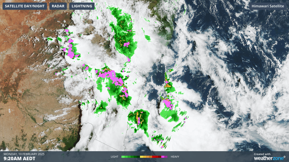
The image below shows the severe thunderstorms active across central parts of NSW on Monday morning.
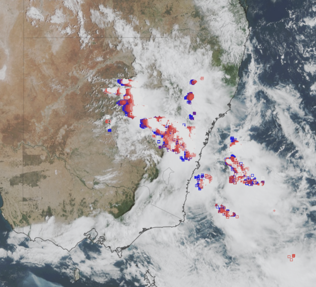
Image: Himawari-9 satellite image and lightning at 10:30am AEDT on Monday, February 10. White lightning strikes are the most recent, fading to red and blue strikes over the previous hour.
Severe thunderstorms are expected to continue across NSW and northeastern Vic into the evening, with another big storm day forecast for eastern NSW on Tuesday.
Widespread thunderstorms are expected to continue Monday across much of NSW and northeast Vic on Monday, with the primary risk of heavy rainfall.
However, damaging wind gusts and large hail may also be generated by storms on and west the Great Dividing Range. Supercell thunderstorms may develop in the same area with the risk of life-threatening intense rainfall, destructive wind gusts and giant hail.
Heavy rainfall for the South Coast
On the southern flank of the low pressure system, moist easterly winds are forecast to generate heavy rainfall across the South Coast from this afternoon into Tuesday.
One computer model shows that falls in the order of 100 to 150mm are expected along the South Coast and parts of the Central and Southern Tablelands, Slopes and Plains in the next 48 hours. Dependent on the position of the low and thunderstorm activity some areas could see totals of 200 to 250mm in the next few days.
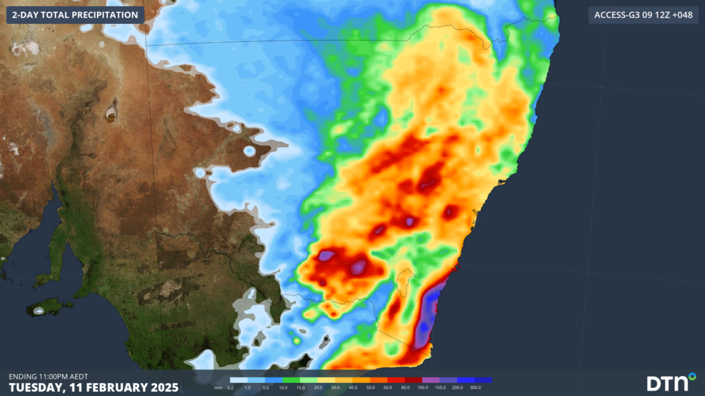
Image: Accumulated 2-day rainfall up to 11pm AEDT on Tuesday, February 11, according to ECMWF
The rainfall during this period is expected to be heavy with six hourly totals between 40 to 80mm forecast and isolated totals of up to 120mm possible. The very heavy rainfall forecast may lead to flash flooding in the area from this afternoon into Tuesday morning.
There is still some uncertainty with the movement and location of the low, so please keep an eye out for the latest warnings in the next 48 hours.
DTN APAC, specialises in building tailored weather monitoring and alerting solutions. These provide heightened visibility, guiding you to plan and respond effectively when adverse weather threatens transport operations. Our weather insights, including flood and fire proximity alerts, warn you of potential and real-time hazardous weather affecting water, rail and road conditions.
Your control interface delivers centralised services, password protected for your personnel. It’s purpose-built to meet your unique specifications, delivering easy-to-visualise critical intelligence that is scalable. Industry-leading lightning detection, GIS storm tracking, nowcasting, forecasting and severe conditions alerting are the foundation of the weather API. You then have the option to layer additional premium solutions to meet your unique requirements.
Leverage our comprehensive weather data to inform your route planning, minimise delays where possible, and mitigate the disruptive effects of severe weather events. For more information please visit our website or email us at sales.apac@dtn.com.


