
After a searing hot day, Western Australians sweltered through a near record warm night last night causing energy demand to surge.
The uncomfortable days and nights are being caused by extremely hot and dry easterly winds flowing over the west coast in response to Severe Tropical Cyclone Sean.
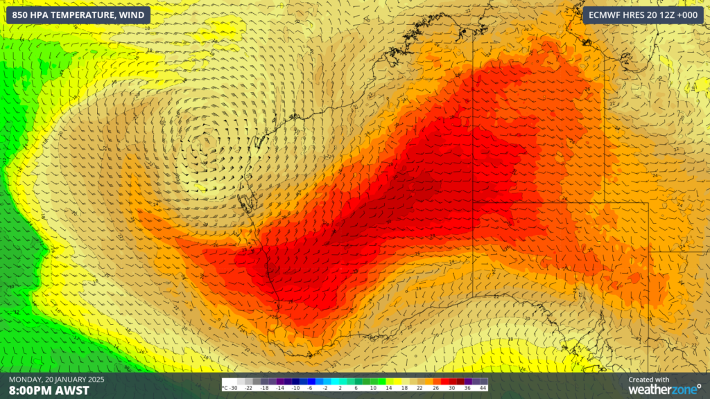
Image: 850hPa temperature and wind at 8pm AWST on Monday, January 20 showing clockwise winds around Severe Tropical Cyclone Sean dragging a hot airmass from Australia’s interior all the way to the west coast.
This is causing a severe to extreme heatwave to impact southwestern WA, with Geraldton equalling its highest record temperature of 49.3°C on Monday, meanwhile Perth airport hit 44.7°C and the city 43.6°C.
After an extremely hot day, temperatures remained in the mid to high 30s across the southwest of the state until around 8pm before finally dropping into the high 20s after midnight, keeping energy demand high well into the evening and overnight.
For some locations in western WA Monday night was the warmest in decades;
- Mandurah’s minimum dropped to 28.4°C which equals the record set in 1968.
- Bickley a western suburb of Perth recorded a minimum of 27.1°C, which is the warmest night in at least 30 years.
- Perth’s temperature dropped to a warm 27.2°C, 9°C above average and only 2.5°C off the record.
The severe to extreme heatwave is set to continue across large parts of WA for the next three days, with temperatures forecast to reach the high 30s to low 40s. Overnight temperatures will also remain warm in the mid to high 20s until the weekend.
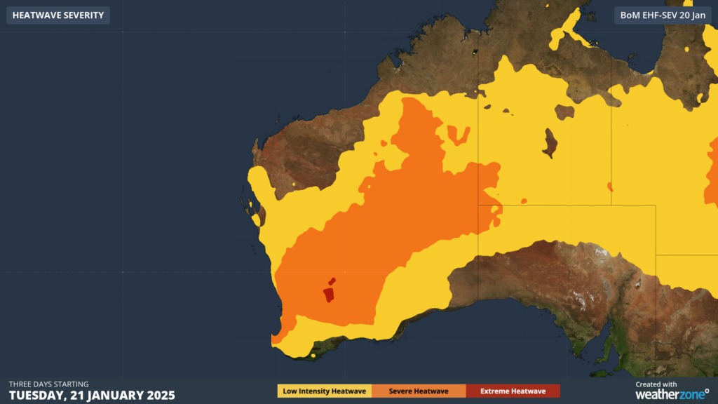
Image: Heatwave severity for the three days beginning on Tuesday, January 21.
Perth’s temperature will remain in the high 30s to low 40s for the next three to four days, while the overnight temperatures will only drop to the mid 20s until the weekend.
Looking ahead, a significant cool change is forecast on Sunday, with maximums finally dropping to around 29°C.
DTN APAC supplies precise weather intelligence to over 75% of the National Energy Market (NEM); and is the trusted provider for the Australian Energy Market Operator (AEMO).
Weatherzone’s next-generation nowcasting and forecasting system, OpticastTM, is independently proven to outperform other industry models, allowing energy traders to respond rapidly to changing conditions. From 14 day forecasting to seasonal outlooks, you have access to complete and powerful weather intelligence giving you the confidence to make the best call.
Meeting the needs of the changing market, Weatherzone utilises high-resolution modelling and local knowledge to provide 5-min granularity observations and forecasts, optimising your market bidding and maximising your profits. These, coupled with briefings from our energy meteorologists, give you full awareness of the associated risk.
Benefit from specialised indices such as apparent temperature, Cooling/Heating Degree Days (CDD/HDD) and Effective Degree Days (EDD) to help accurately predict demand. You can get a clear picture of forecast conditions across the market and quickly assess heat/heatwave potential from 14 days out to 12 months
No matter where your energy trading focus lies, we have the power generation and weather insights to inform your critical decisions, keeping you ahead of the curve. For more information contact us at sales.apac@dtn.com
Thumbnail image: Istock/Charlie Guo


