
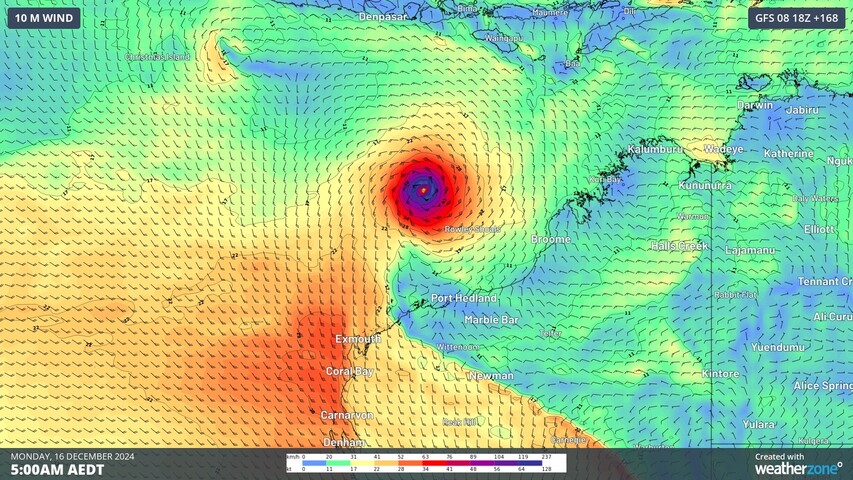
Abnormally warm ocean temperatures to the northwest of Australia will energise a swarm of tropical lows in the next couple of weeks, increasing the risk of tropical cyclone development before Christmas.
The map below shows abundant cloud cover to the northwest of Australia at the beginning of this week. This tropical cloud cover has formed in response to warmer-than-average sea surface temperatures off Australia’s northwest coast and an active pulse of the Madden-Julian Oscillation in the Australian region.
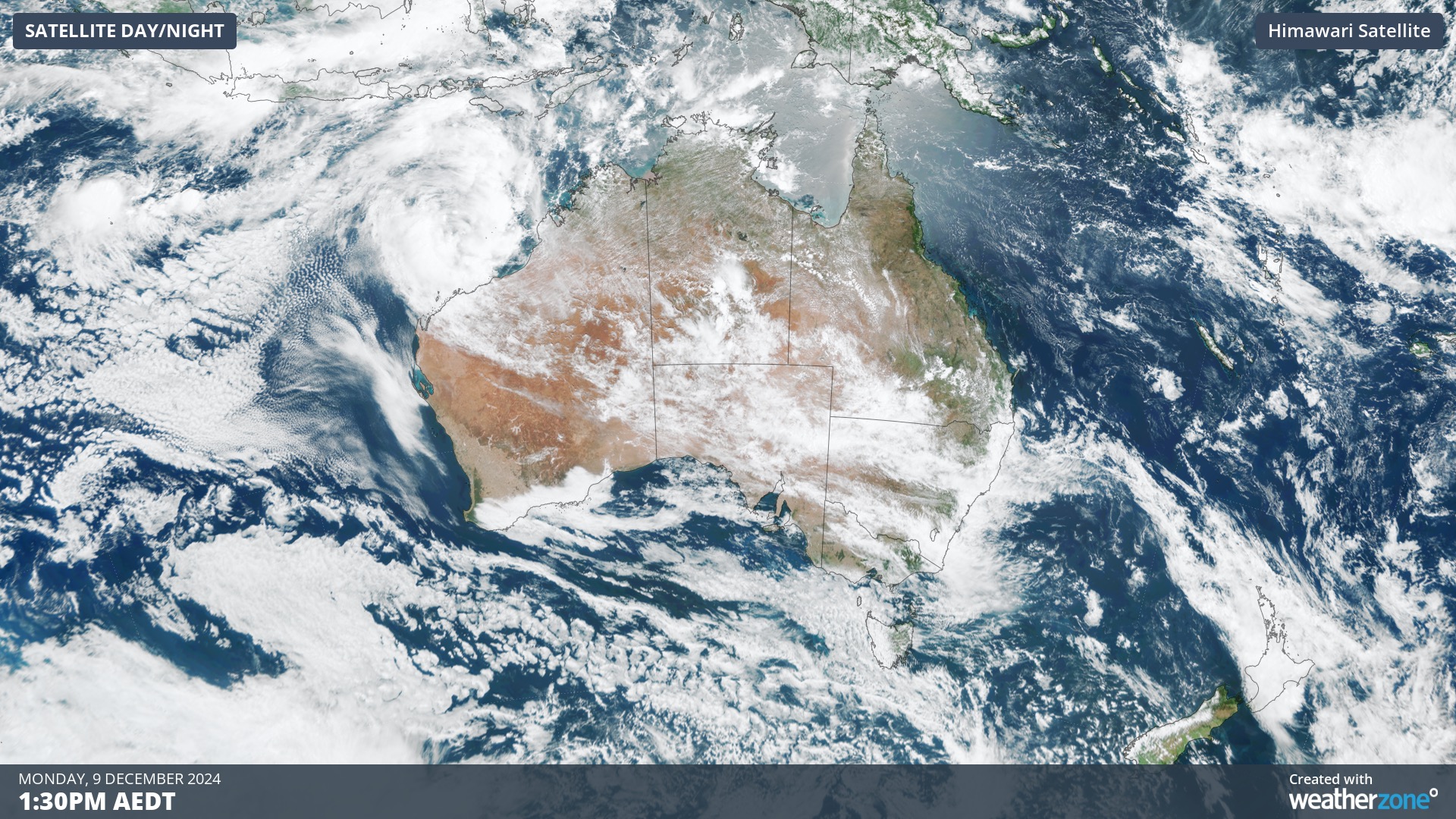
Image: Visible satellite image showing clouds over Australia on Monday morning.
Clusters of cloud like this can act as a breeding ground for tropical cyclone activity, with individual areas of convection acting like seeds that can grow to become more organised tropical low pressure systems and eventually fully-fledged tropical cyclones.
Forecast models suggest that two or three separate low pressure systems could form to the northwest of Australia this week, two of which have a moderate risk of becoming tropical cyclones.
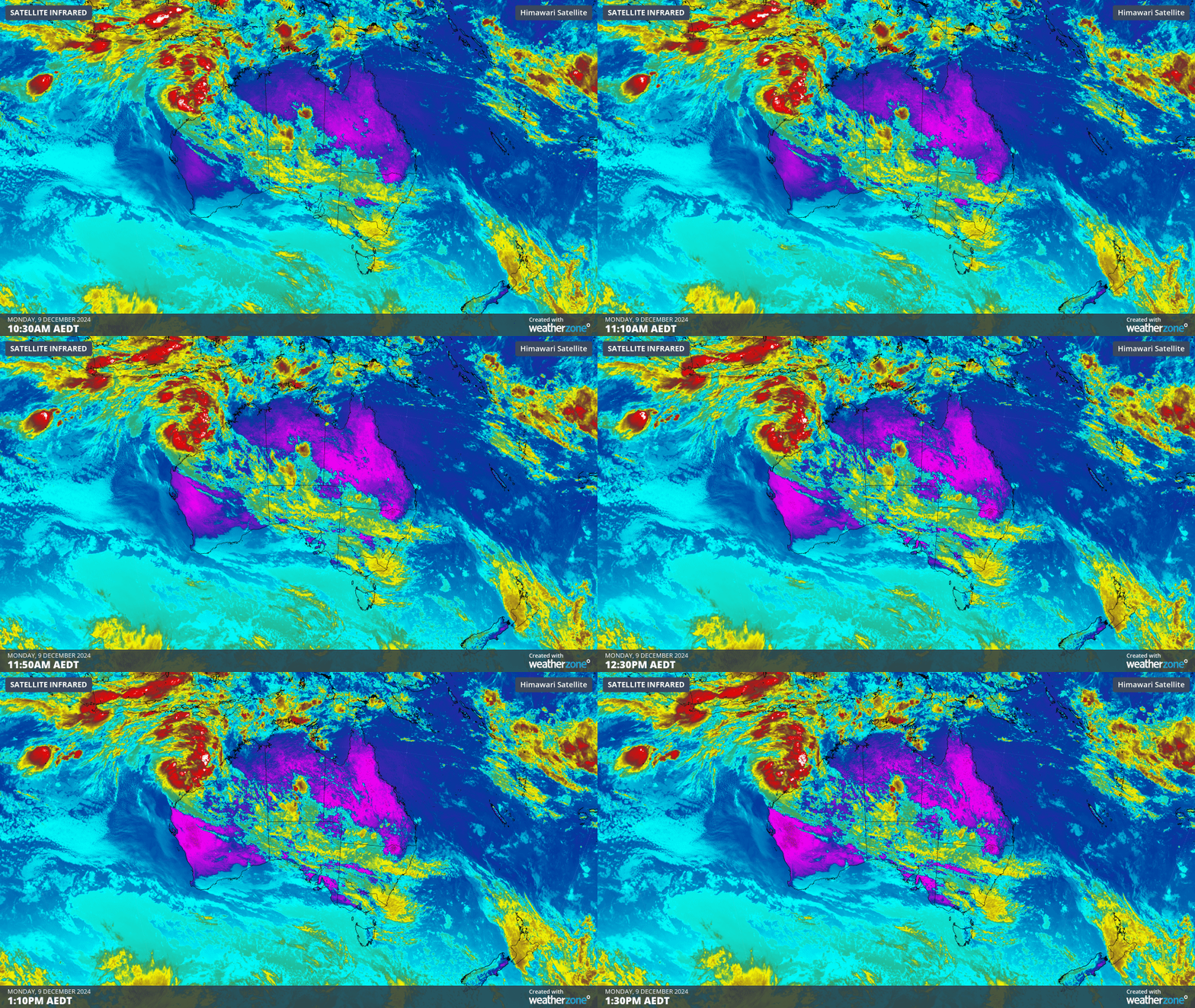
Image: Enhanced infrared satellite images showing two developing tropical lows northwest of Australia on Monday.
One tropical low has already formed near the Cocos (Keeling) Islands. This system is expected to cause increased shower and thunderstorm activity over the Cocos (Keeling) Islands in the next few days, although at this stage it only has a low chance of developing into a tropical cyclone.
Another low is forming closer to Australia, sitting to the north of the Pilbara coast on Monday morning. This system is expected to become more consolidated as it moves towards the west southwest in the coming days, roughly parallel to the WA coastline but remaining offshore. This low has a moderate risk of becoming a tropical cyclone on Tuesday or Wednesday. On its current predicted future track, this system won’t directly impact the Australian mainland, however communities in the north of WA should keep a close eye on it for updates throughout the week.
A third tropical low could form over the Timor or Arafura Seas later this week, roughly to the north of WA’s Kimberley coast. While it’s too far out to have high confidence with this system, some computer models suggest that it could develop into a tropical cyclone off the north coast of WA later this week or early next week. At this stage, there is a moderate chance of this system developing into a tropical cyclone this weekend or early next week.
While there is no guarantee of tropical cyclone activity off the northwest coast of Australia in the next couple of weeks, the risk is being amplified by abnormally warm sea surface temperature in the region. Some areas are currently as hot as 32°C, more than 2°C above average for this time of year.
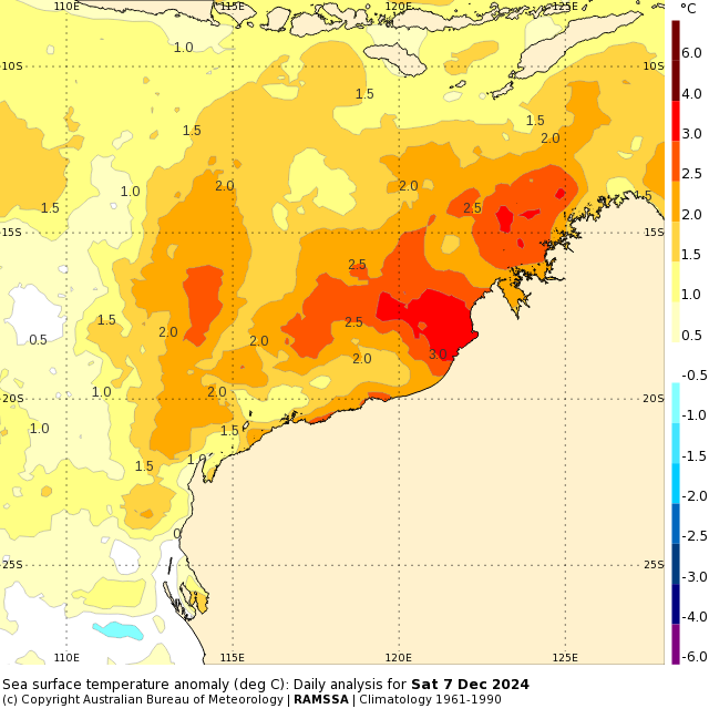
Image: Sea surface temperature anomalies off the northwest coast of Australia on December 7. Source: Bureau of Meteorology
Warm seas provide more energy to developing storms and low pressure systems, which can help them strengthen into tropical cyclone.
As the climate delivers increasingly severe weather events, their potential to impact your business operations grows.
DTN APAC, specialises in industry-leading forecast, alerting and threat analysis of tropical cyclones, offering you expert, customised solutions when the weather turns wild.
Providing rapid-update forecast information, we alert you to any low-pressure system gaining power within your region and, unlike other providers, can track its development out to 7 days. This gives you the time to prepare and safeguard your staff, sites and assets.
You will have the most precise weather intelligence charting rainfall, wind speeds and potential storm surges to help you make critical decisions quickly. Whether it’s adjusting key work schedules, protecting your staff or securing your site, we have the alerting capability to keep you steps ahead of the storm.
We will support you, 24/7, keeping you informed and making your critical decisions easier.
For more information please visit our website or email us at sales.apac@dtn.com.




