
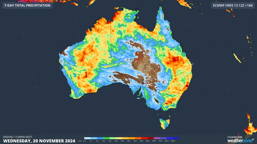
The Southern Annular Mode (SAM) has shifted into a positive phase and Australia is already feeling its wet and stormy influence. With this positive SAM expected to linger into the back half of November, enhanced rain and thunderstorm activity is likely to remain a prominent feature over Australia in the coming weeks.
What is the Southern Annular Mode?
The SAM is one of Australia main broad-scale climate drivers. It typically influences Australia’s day-to-day weather patterns on the scale of a few weeks at a time.
The SAM is an index that measures the north-south displacement of a westerly wind belt that flows around the middle latitudes Southern Hemisphere, passing between Australia and Antarctica.
When the SAM is in a positive phase, these westerly winds, and the cold fronts and low pressure systems they carry, are located further south than usual for that time of year. When the SAM is negative, the westerly winds, fronts and low are positioned further north than usual for that time of year.
The SAM’s influence on Australian weather varies throughout the year. For example, a negative SAM typically increases wind, rain and snow potential over large areas of southern Australia in winter. By contrast, a negative SAM in summer increases the likelihood of dry weather over most of southeastern and eastern Australia.
What is the SAM doing now?
The SAM entered a positive phase in the first week of November and has remained positive in the past fortnight. Forecast models suggest that this positive SAM phase should linger throughout November and could spill into early December.
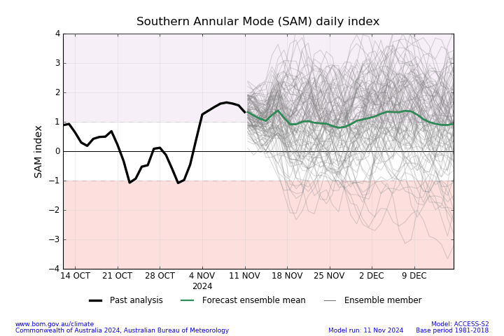
Image: SAM observations and forecast. Source: Bureau of Meteorology
A positive SAM during late spring and early summer usually increases the flow of air from the Coral and Tasman Seas towards eastern Australia. This increase in moisture-laden easterly winds can enhance rain and thunderstorm activity over much of eastern and southeastern Australia.
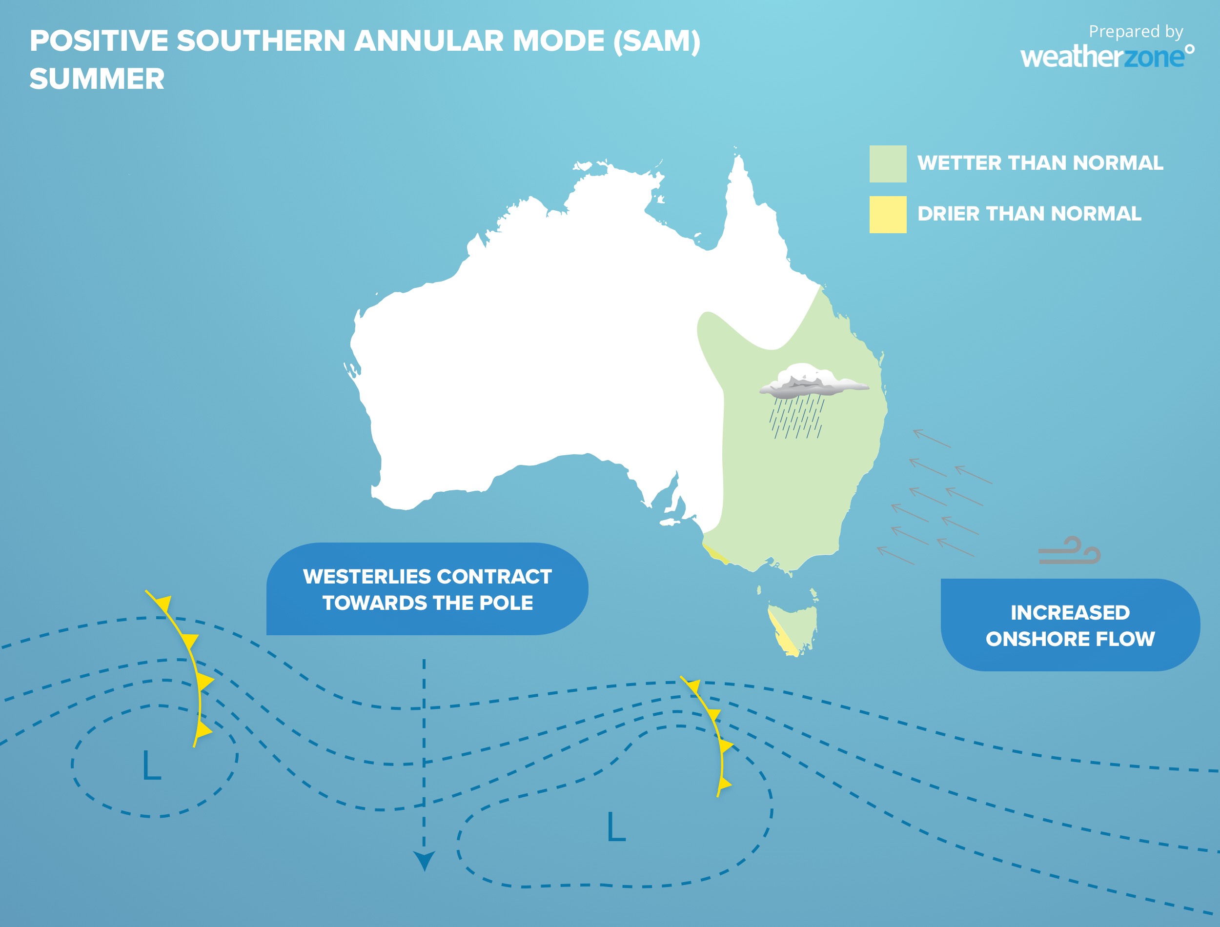
Image: Typical positive SAM impacts during summer.
This month’s positive SAM event is already having a noticeable impact on Australia’s weather, and this influence will likely continue into the back half of November.
Rain and thunderstorms have developed over parts of eastern Australia almost every day this month, with severe thunderstorms hitting parts of Qld and NSW on numerous occasions in the past fortnight.
Looking ahead, computer models predict further wet and stormy weather over large parts of Australia in the coming two weeks, including large areas of eastern Australia.
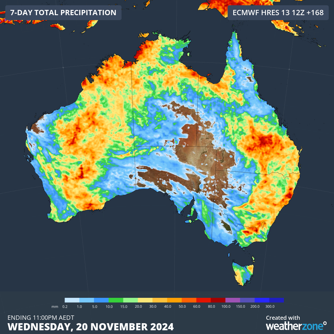
Image: Forecast accumulated rain during the next 7 days (for the week ending on Wednesday, November 20, 2024).
The map above shows that eastern Australia is not the only part of the country that’s expecting substantial rain in the coming week. In addition to the positive SAM, above average sea surface temperatures to the northwest of Australia will also help fuel widespread rain and thunderstorms over northern and western Australia in the coming fortnight.
The shifting climate is bringing increased complexity and greater risks to businesses worldwide. We are here for you, delivering trusted weather solutions to optimize your operations and profitability.
DTN APAC is a diverse team, with global forecasting, product development and analytics expertise. Couple this with extensive industry experience spanning Aviation to Energy, and we are primed to assist you in strengthening your response to weather
impact.
We work hard to identify your operational pressures and tailor our services and products to meet your needs. Concise communication, giving you full situational awareness exactly when you need it, is our focus. We want to reduce weather risk in your operations, every day.
We deliver clear and comprehensive weather data, personalised risk assessments and briefings to you and your team, so that your critical decisions can be made with confidence.
We are available 365 days a year, so you always have the timely guidance you require, especially when severe conditions hit.
You have our insights to rely on to see you through complex situations, minimising potential loss of profit and maximising the safety of your staff and assets. For more information please visit our website or email us at sales.apac@dtn.com.




