A large pool of unusually warm water to the northwest of Australia will increase the risk of strong tropical cyclones near WA this season.
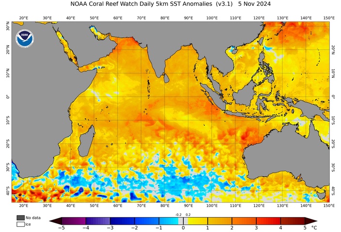
The map below shows that sea surface temperatures near Australia’s northwest coast are currently more than 2°C above average for this time of year. Some pockets are even more than 3°C warmer than usual for November.
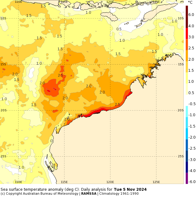
Image: Sea surface temperature anomaly on Tuesday, November 5, 2024. Source: Bureau of Meteorology.
In terms of actual temperatures, the water off the north coast of WA is currently around 27 to 30°C. While this is only a few degrees warmer than usual for this time of year, it’s an important temperature range for tropical cyclone development.
Tropical cyclones require water temperatures of at least 26.5°C to form. One they develop, several factors can influence their intensification, including wind shear (change of wind direction and speed with height), the ability of air to flow away from the cyclone in the upper-levels and the availability of moisture in the surrounding environment.
Warm sea surface temperatures help tropical cyclone gain strength by providing more moisture into the surrounding atmosphere via evaporation.
While warm seas alone don’t guarantee that tropical cyclones will develop, they do increase the availability of the fuel they need to intensify.
The pool of abnormally warm water near WA is causing some seasonal forecast models to predict an increased number of tropical cyclones near Australia’s northwest coast. The red areas on the map below where the SEAS5 model from the European Centre for Medium-Range Weather Forecasts (ECMWF) is anticipating an above average number of tropical cyclones this season.
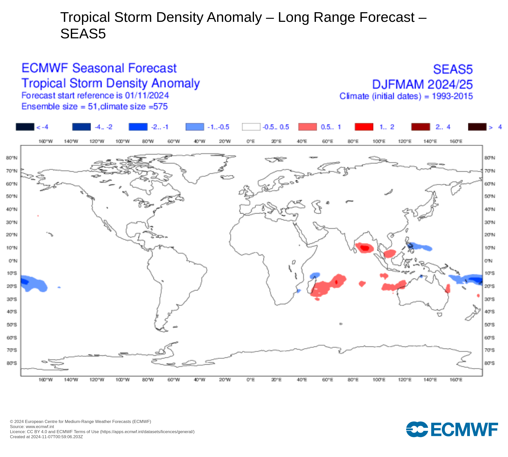
Image: Tropical cyclone density anomaly for the December 2024 to May 2025 period, according to the ECMWF-SEAS5 model. The shaded areas show where more (red) or fewer (blue) tropical cyclones are expected to pass within 300 km over the next 6 months, compared to the climatological mean. Source: ECMWF
The Bureau of Meteorology’s seasonal outlook predicts a near-average number of tropical cyclones in the waters surrounding WA. However, their outlook does point out that “The likelihood of severe (strong) tropical cyclones is higher than average, because of the warmer than average ocean temperatures forecast for the Australian region in the coming months.”
Any tropical cyclones that form or move near the northwest coast of Australia this season will be worth keeping a close eye on because the abundance of warm water in the region could help them intensify more rapidly than usual.
As the climate delivers increasingly severe weather events, their potential to impact your business operations grows.
DTN APAC, specialises in industry-leading forecast, alerting and threat analysis of tropical cyclones, offering you expert, customised solutions when the weather turns wild.
Providing rapid-update forecast information, we alert you to any low-pressure system gaining power within your region and, unlike other providers, can track its development out to 7 days. This gives you the time to prepare and safeguard your staff, sites and assets.
You will have the most precise weather intelligence charting rainfall, wind speeds and potential storm surges to help you make critical decisions quickly. Whether it’s adjusting key work schedules, protecting your staff or securing your site, we have the alerting capability to keep you steps ahead of the storm.
We will support you, 24/7, keeping you informed and making your critical decisions easier. For more information please visit our website or email us at sales.apac@dtn.com.


