
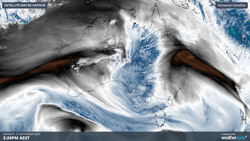
More than 80% of Australia could see rain this week as a surge of tropical moisture spreads across the country, causing wet weather from the Kimberley to Tasmania.
A slow-moving upper-level trough will cause clouds, rain and thunderstorms to gradually spread across Australia from northwest to southeast this week. This system will deliver rain to parts of every state and territory during the next seven days.
This system has already delivered heavy rain in northwestern Australia, with parts of WA’s Pilbara district receiving their heaviest September rain in more than 50 years on the weekend. This moisture is now spreading across central Australia, as you can see in the satellite images below.
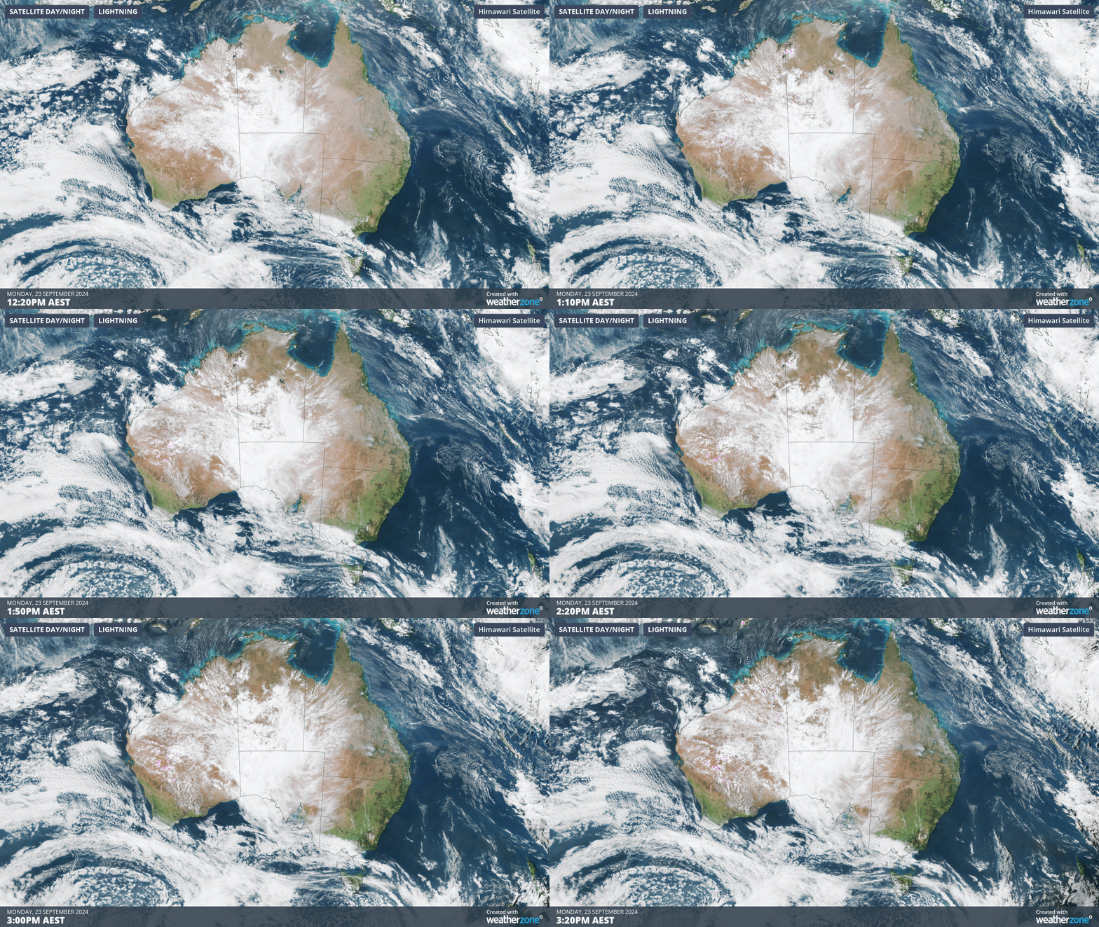
Image: Visible satellite and lightning images showing tropical moisture spreading over central Australia on Monday.
Rain and some thunderstorm activity will continue to spread across central and southern Australia on Monday and Tuesday before tracking across the country’s southeast from Wednesday and then Australia’s eastern states from Thursday.
Some computer models suggest a lingering low pressure trough could cause showers and thunderstorms to persist over parts of eastern Australia on Friday and into the weekend. There are also indications that another frontal system will cause a new band of showers and thunderstorms over WA and SA from Friday to Sunday. However, it’s important to note that there is a high degree of uncertainty regarding the weather systems in the back end of this week. So, we will need to wait a few more days for more reliable forecast information beyond Friday.
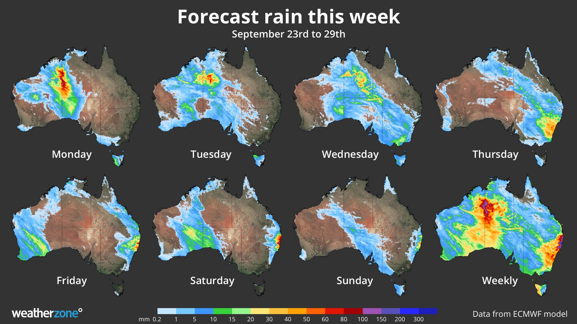
Image: Forecast daily and weekly accumulated rain this week, according to the ECMWF-HRES model.
Some of this week’s rain will fall over areas of the country that had an abnormally dry winter, adding much-needed moisture back into the landscape. The red areas on the map below show where rainfall was below average in winter, with the darker red shading highlighting areas that had seasonal rainfall in the lowest 10% of historical records.
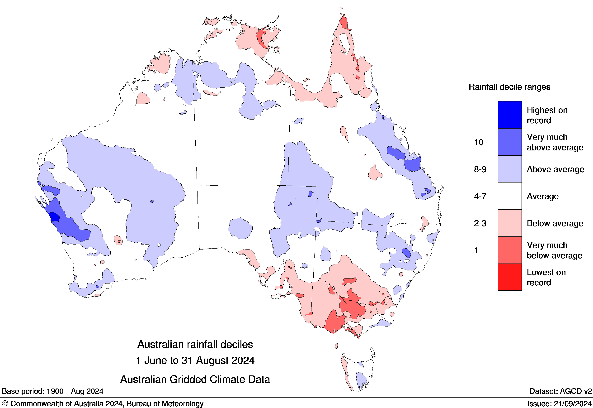
Image: Rainfall deciles in winter 2024. Source. Bureau of Meteorology
This week’s dynamic weather pattern may also cause severe weather or severe thunderstorms at times. Be sure to check the latest warnings and road closures before travelling.
You can’t control the shifting climate, but you can gain precision insights to optimise your response.
DTN APAC, a DTN company, has been providing weather intelligence and innovative forecasting systems to Australian businesses since 1998.
We have intuitive solutions that serve industries from aviation, mining and energy right through to marine, and everything in between. Rest assured, if we don’t already have a product to address your business’ weather needs, we will work tirelessly to create one.
With our network of global partners, we provide trusted, industry-leading services that can mitigate weather risk, keep your valuable staff and assets safe, and ensure you are operating at peak efficiency. For more information, please visit our website or email us at apac.sales@dtn.com.




