
The mercury is rising in WA over the coming days with parts of the Pilbara and Kimberley are forecast to see temperatures reach at least 36°C for five consecutive days.
This prolonged period of spring warmth is being caused by a stubborn high pressure system sitting over the Bight for the rest of the week directing warm easterly winds from the interior of Australia to the west coast. There is also a heat trough that is extending over the west coast from late Wednesday, generating some showers.
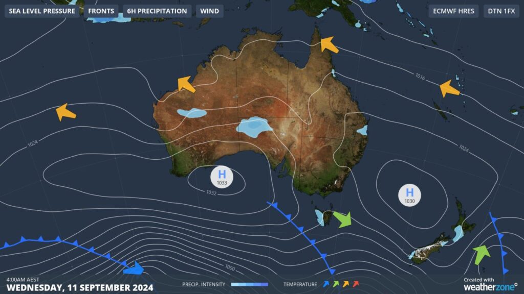
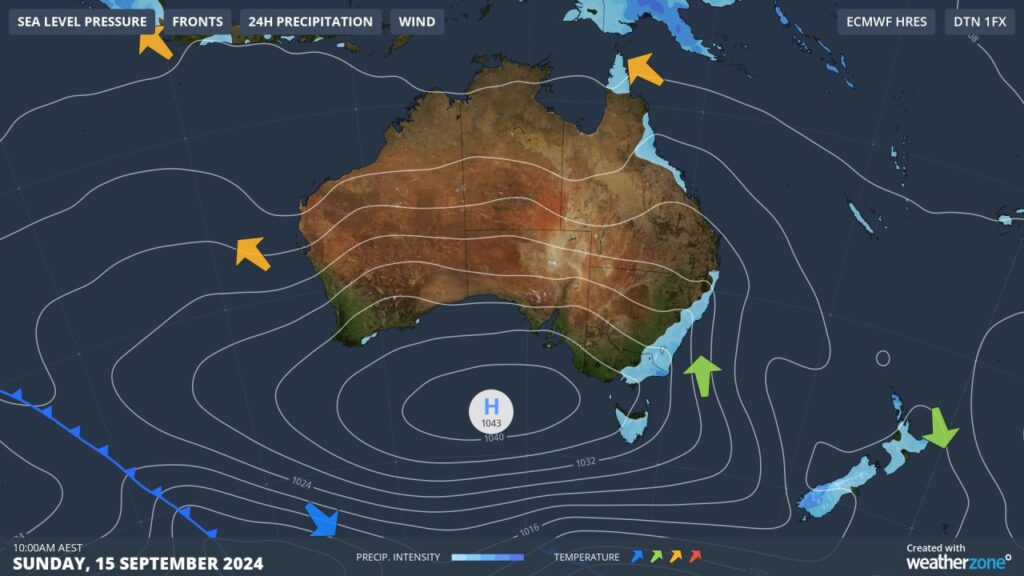
Images: Mean Sea Level Pressure (MSLP) on Wednesday, September 11 and Sunday, September 15 (top to bottom).
This stagnant pattern is allowing extreme heat to build over northwestern Australia, with some towns in the Kimberley and Pilbara set to endure five days in the high 30s to low 40s. Unfortunately, there will be no relief overnight with some locations only dropping to 24°C overnight.
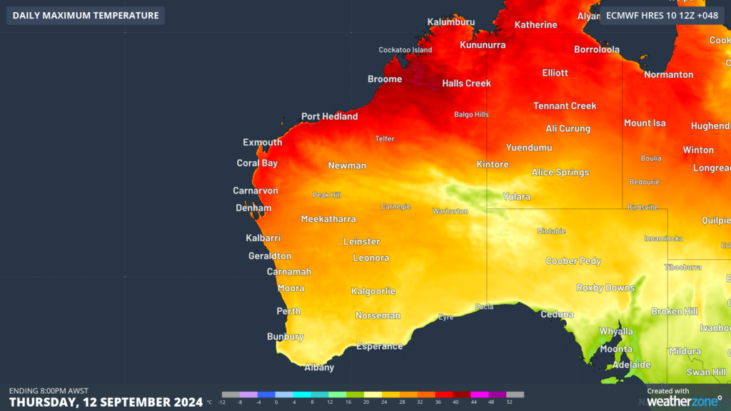
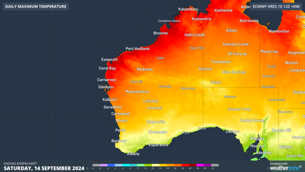 Images: Maximum temperature forecasts on Thursday, September 12 and Saturday, September 14 (top to bottom) according to ECMWF
While the north of the state swelters, Perth will experience three days in the mid to high 20’s, which is around 5 to 7°C above the September average.
Perth’s minimum temperatures should also be around 4 to 5°C above average early Thursday to Saturday mornings, with the temperature failing to drop below 14 to 15°C.
Looking ahead, temperatures should drop to the low to mid 30’s in the Pilbara and Kimberley early next week when the high pressure system finally moves east away from the state. Meanwhile Perth’s temperature should drop below 25°C from Sunday.
DTN APAC provides both air temperature and feels-like forecasts so you can see when conditions are set to become oppressive to workers, and steps can be taken to mitigate the risk. Our mining dashboards can also be configured to alert when the temperature reaches a certain threshold, so you know when to enact measures to protect your staff. To find out more, please visit our website or email us at apac.sales@dtn.com.


