
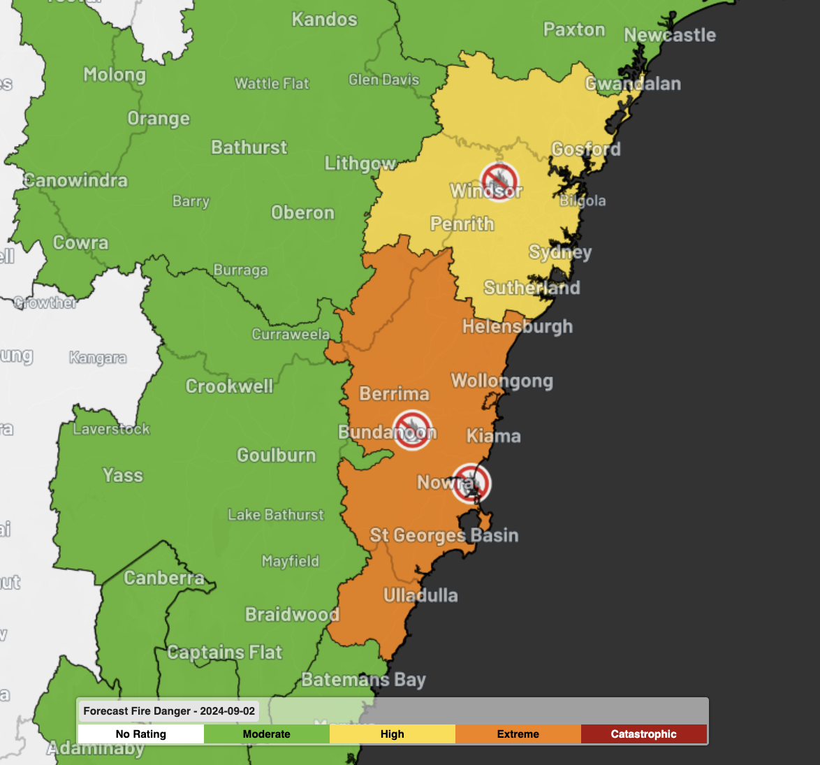
Total Fire Bans (TFBs) have been issued for Greater Sydney and the Illawarra in NSW, a month ahead of the typical start to the fire season.
Gale force winds are once again blowing across eastern Australia ahead of a cold front; the third such system in the last seven days after damaging winds on both Wednesday and Friday last week.
Coupled with unseasonably warm temperatures much closer to the summer average, fire dangers are elevated across the state. Note that, typically, the fire season officially starts on October 1 for most of the state.
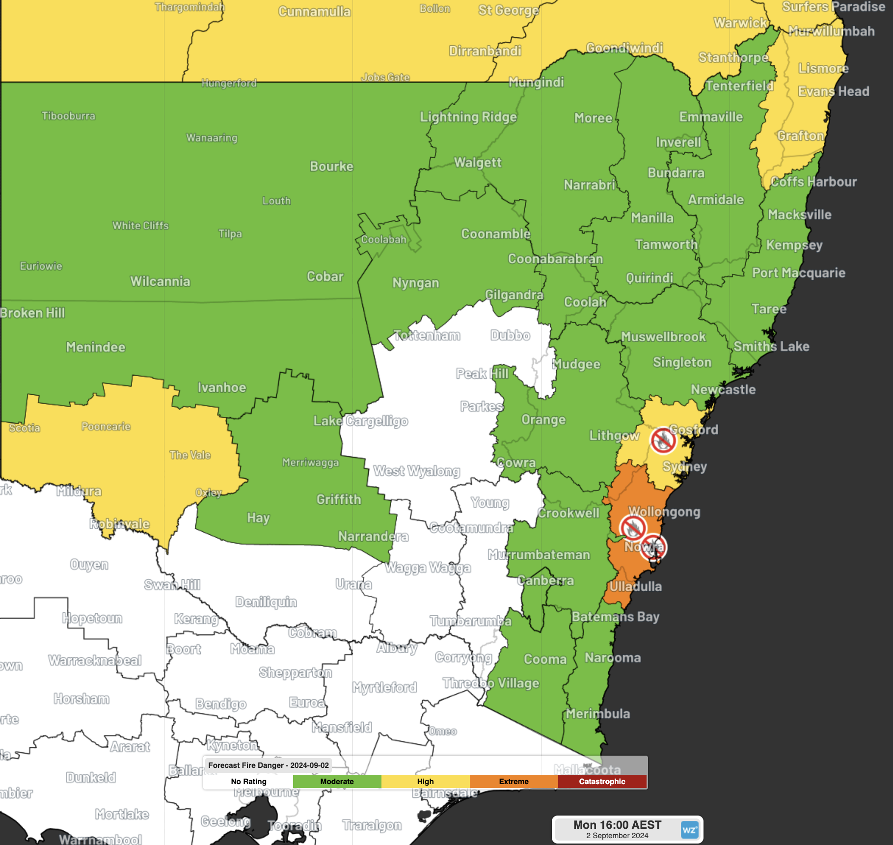
Image: Fire Danger Ratings for Monday, September 2, 2024
In response to the high winds, temperatures and low humidity, TFBs have been issued for the Greater Sydney and Illawarra Fire Districts on Monday.
Some powerful wind gusts have already occurred as of midday on Monday in these regions, with the standouts being:
- 107 km/h at High Range (Wanganderry; highest in 4 years)
- 106 km/h at Bombala (highest in 4 years) and Camden
- 104 km/h at Nowra
- 98 km/h at Mount Boyce (highest in 4 years) and Moss Vale
- 91 km/h at Kurnell
- 85km/h at Badgerys Creek
- 78km/h at Sydney Airport
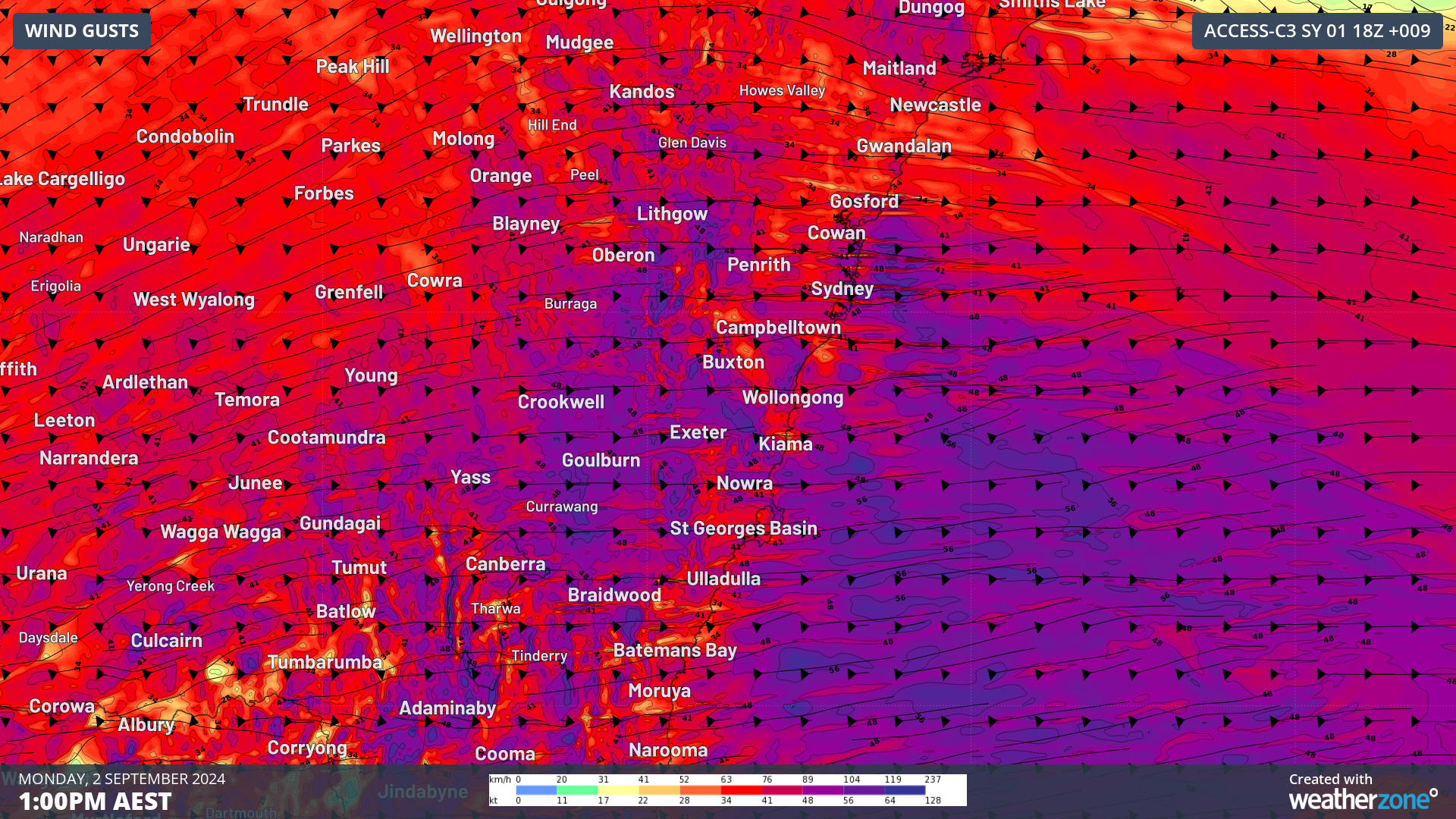
Image: Forecast wind gusts from Access-C Sydney at 1pm on Monday, September 2, 2024
Locally, fire dangers are forecast to reach ‘Catastrophic’ levels for parts of Jervis Bay this afternoon, with much larger areas seeing ‘Extreme’ Fire Behaviour Index (FBI) readings.
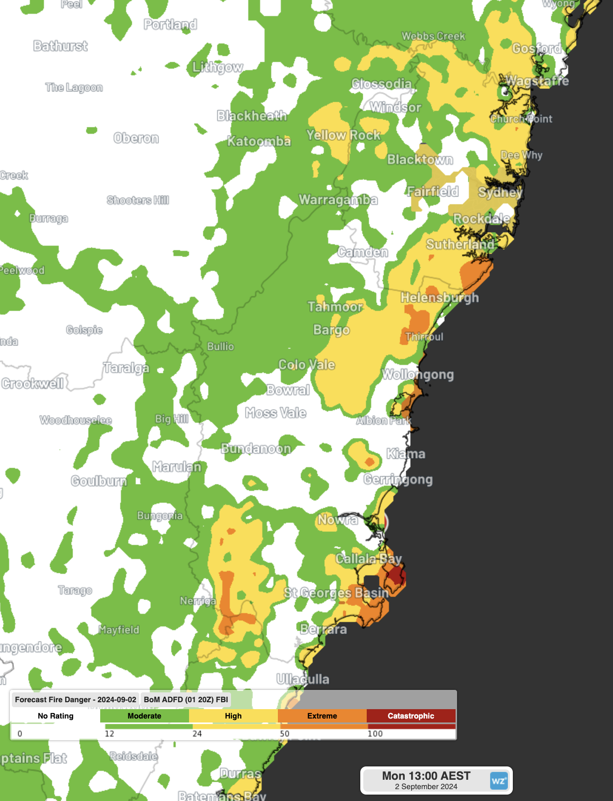
Image: Forecast FBI readings for 1pm on Monday, September 2, 2024
You can track current fires, including those at ‘Watch and Act’ and ‘Emergency’ levels of alertness on the RFS website or through the ‘Hazards near me’ NSW government app.
Fortunately, the cold front that is leading to these powerful winds will produce a genuine drop in temperatures, unlike the other ‘cold’ fronts in the past week. After a top of 25°C on Monday for Sydney, it is only expected to reach 18°C on Tuesday, with winds easing overnight. Warmer temperatures are expected to return by the end of the working week.
DTN APAC serves the forestry, fire, safety and emergency sectors, delivering trusted weather data and severe weather alerting to maintain safety, protect your assets and underpin your planning. Some of our key products are:
- Access to the Total Lightning Network, delivering unparalleled accuracy of lightning strike data
- Fire hotspot tracking and alerting through Stormtracker, so new fires can be assessed and controlled nearly immediately after they form
- Seasonal briefings by our expert meteorologists and climatologists customised to your business to better tailor your preparedness for the upcoming seasons
For more information, please visit our website or email us at apac.sales@dtn.com.




