Sydney just shivered through one of the windiest and coldest 5-day streaks in more than a decade, as freezing southerly winds lashed the NSW coast for days.
The cold and ferocious winds were directed over the NSW coast by a slow-moving Tasman Low, which was held in place by a stubborn high pressure system over southern Australia.
The Tasman Low rapidly deepened on Sunday, July 28 and continued to impact the NSW coast until Thursday, August 1.
The image below shows the low in the Tasman directing a brisk southerly airstream over the NSW coast on Wednesday, with frequent cloud and showers moving north onto the coast.
Image: Himawari-9 satellite image at 8am AEST on Wednesday, July 3
During the five days to midnight August 1, Sydney Observatory Hill recorded five consecutive days no warmer than 16.5 °C, with gusts peaking higher than 45 km/h each day. This is the coldest, windiest spell Sydney has seen in 13 years.
Some notable observations during this period are:
- Sydney’s ‘feels like’ temperature was –0.3°C at 9:50am on Sunday, July 28.
- Sydney’s daytime temperature reached only 15°C on Sunday, July 28.
- The overnight temperature dropped to 6.9°C early Tuesday morning, July 30.
- Sydney’s mean wind speed peaked at 53.7 km/h and gusted up to 77.8 km/h on Sunday, July 28.
- The prolonged period of southerly winds whipped up large and powerful surf, with Sydney’s waves peaking at 5 metres with a period of 14.9 seconds.
The low has now moved away from Australia. As of Friday morning, the low was located near New Zealand’s North Island. As a result, conditions are now easing over NSW.
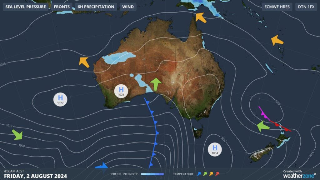
While winds will be weaker on Friday, it will still feel cold, with temperatures in the city feeling no warmer than 12-13°C this afternoon.
On the weekend the city will warm up further to 19 °C, with mostly sunny skies and light winds.
Weatherzone Business has grown to become the outright leader within the Australian energy market, serving wind, solar, hydro, trading, utilities and network companies.
You can’t control the weather, but you can gain precision insights to optimise your response. What lights us up is providing your energy business with tailored weather information to reduce your risk and keep you moving ahead of the curve.
Our services cover all aspects – from wind and solar generation to demand forecasts, wholesale markets to retail so, no matter where your company sits, we have solutions for you. We have worked closely with market participants to create products that meet the evolving needs of the sector, aiming to increase safety and profitability for our customers.
Benefit from the timely delivery of accurate weather information, allowing informed and effective decision-making.
To find out more, please visit our contact page or email us at apac.sales@dtn.com.