
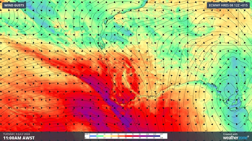
Damaging winds, blustery showers and wintry thunderstorms will lash parts of southwestern Australia on Tuesday as a cold front hits WA, elevating wind power generation in the state.
The satellite animation below shows the front approaching the southwest of WA on Tuesday morning. The band of thicker cloud off the southwest coast of WA highlights the cold front, while the large field of speckled cloud behind the front reveals a mass of cold air approaching WA.
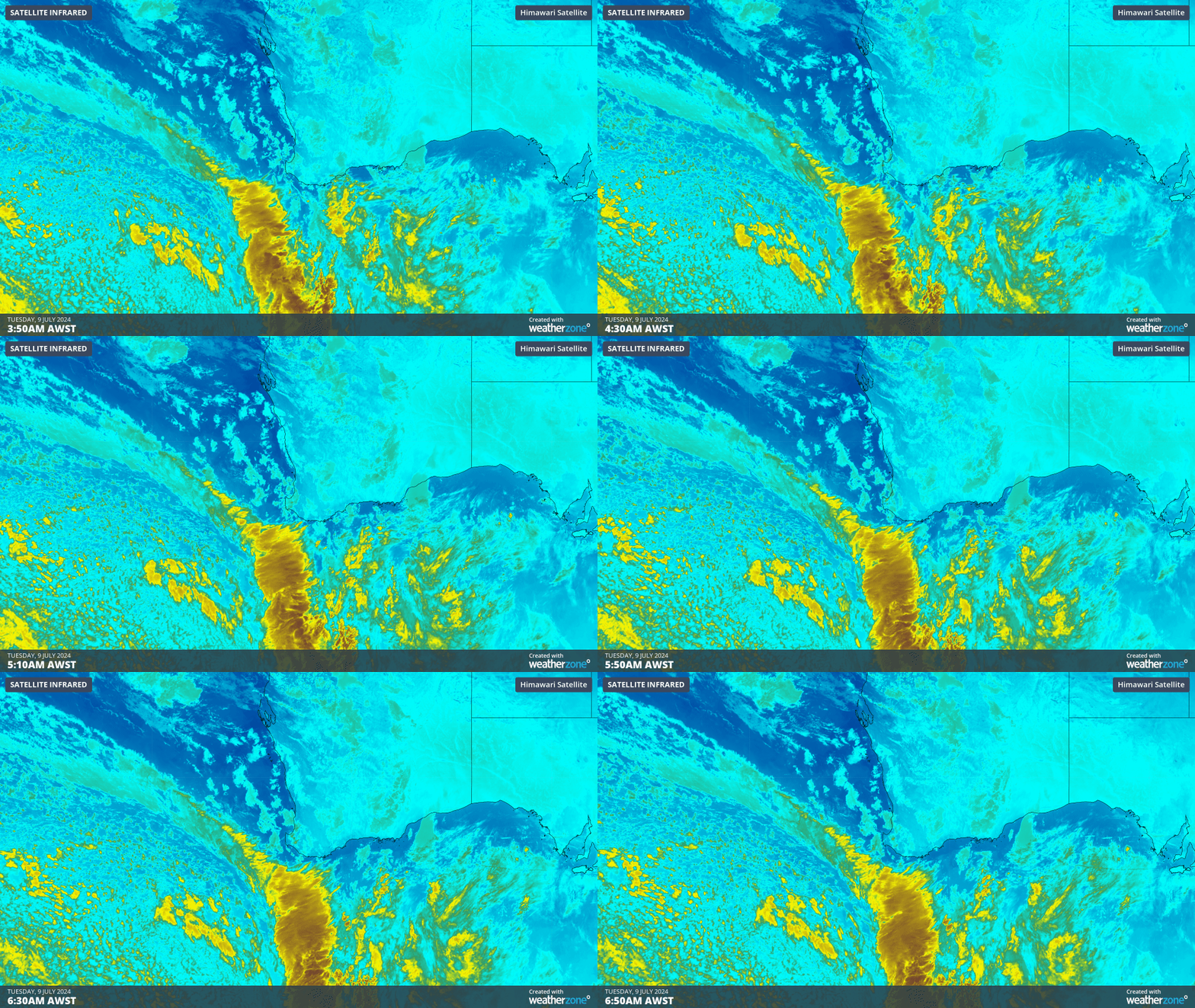
Video: Enhanced infrared satellite images captured by the Himawari-9 satellite on Tuesday morning.
The cold front is expected to reach the South West Capes around lunchtime and make it to Perth around 5 to 7pm AWST on Tuesday. The most disruptive and dangerous weather will occur ahead of and near the cold front.
Wind and showers will increase ahead of and with the passage of the front on Tuesday morning and afternoon, with a few thunderstorms also possible ahead of the front.
Sustained wind speeds of 50 to 60 km/h and gusts reaching above 90 km/h are possible in areas to the southwest of a line from Perth to Albany during Tuesday morning and afternoon. A severe weather warning has been issued for damaging winds in this region, including Perth.
Some areas in the far southwest of the state were already clocking damaging wind gusts early on Tuesday morning, with Cape Leeuwin registering a gust of 98 km/h shortly after 7:30am AWST.
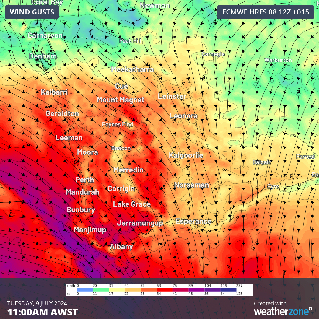
Image: Forecast wind gusts at 11am AWST on Tuesday, July 9, according to the ECMWF model.
This should increase wind power generation in WA on Tuesday, however there is potential for ‘cut outs’ in the far southwest of WA. Most wind farms turn off the turbines if the wind speed reaches the ‘cut off’ wind speed of 90km/h (25m/s) to prevent damage to the turbines. Unfortunately, if the propellers are turned off on the turbines due to high winds, wind power is not being harnessed. During these periods of intense winds, wind power capacities will be reduced if the turbines remain turned off.
Showers and a few thunderstorms will sweep through with the front, soaking Bunbury in the early afternoon and Perth in the early evening. This fast-moving band of showers should only deliver about 5-15 mm of rain to the South West and Lower West, and some adjacent inland areas.
Wind and rain will ease over the southwest of WA on Tuesday night as the front moves further east and weakens. However, rain and showers associated with a low pressure trough will spread across parts of the Central Wheatbelt, Central West, Gascoyne and Goldfields districts on Tuesday night into Wednesday morning.
The map below shows how much rain one computer model is predicting on Tuesday and Wednesday combined.
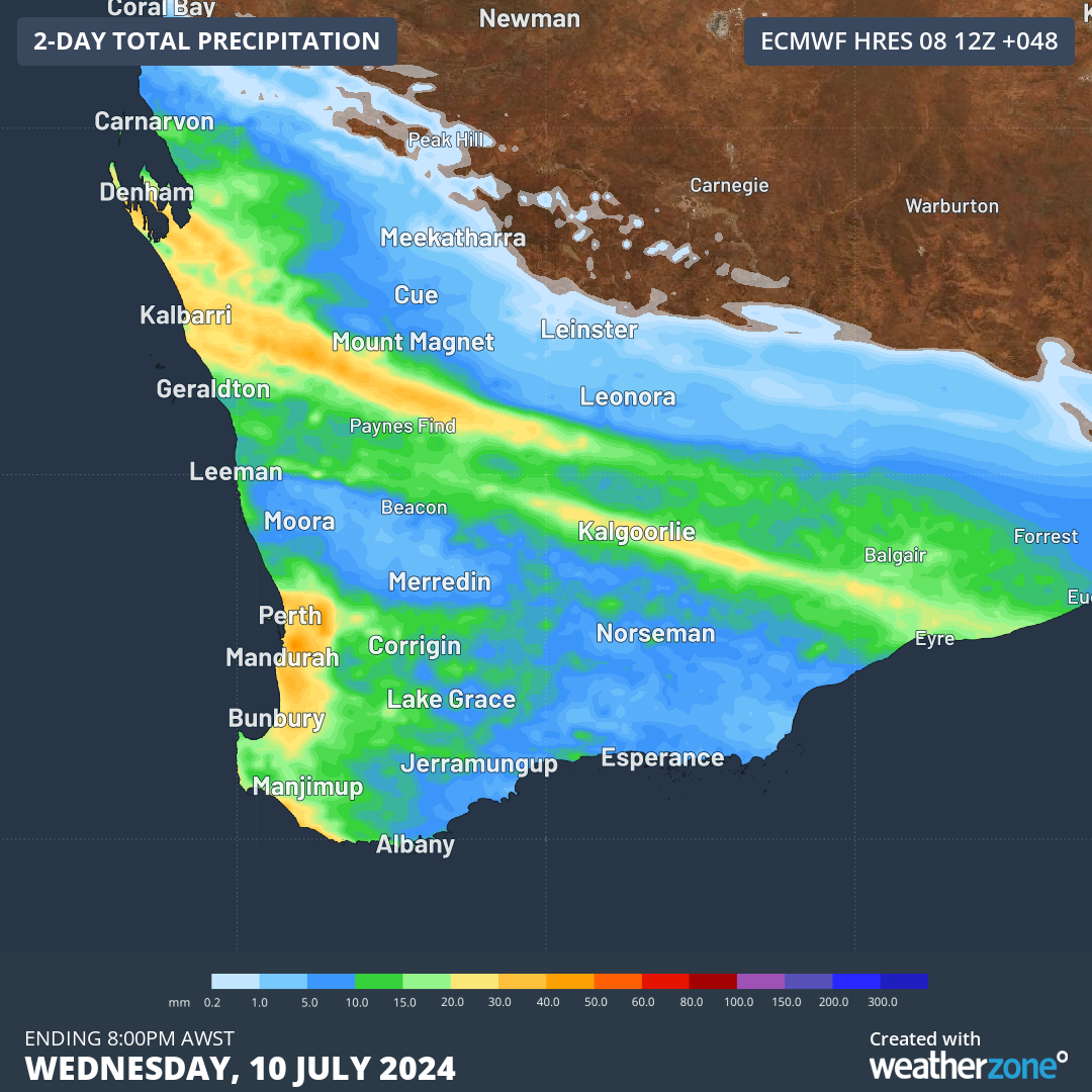
Image: Forecast accumulated rain during the 48 hours ending at 8pm AWST on Wednesday, July 10, according to the ECMWF-HRES model.
Be sure to stay up to date with the latest severe weather warnings if you are in southwestern Australia on Tuesday.
DTN APAC delivers industry-leading weather and power generation forecasting and real-time alerting to inform your critical decision-making. Together we can keep your staff and assets safe, and efficiency high.
With lightning strikes, severe weather, flood and fire posing risk to wind farms across Australia, we have tailored solutions that can significantly improve your oversight and response.
Total Lightning Network comprises of regional and global sensors to detect intra-cloud (IC) and cloud-to-ground lightning (CG) strikes within your proximity thresholds. It provides unparalled detection accuracy (<200m) and real-time lightning alerts to any device across your operations team.
Your customizable Energyzone interface and Weatherguard app will provide access to the Total Lightning Network as well as centralized data from state and territory fire agencies, the Bureau of Meteorology, and over 30 national and international private and state organisations. This enables full situational awareness of weather conditions and fire risk, as well as severe weather alerting via text, email and phone call, so your staff can respond effectively when required. To find out more, please visit our contact page or email us at apac.sales@dtn.com.




