
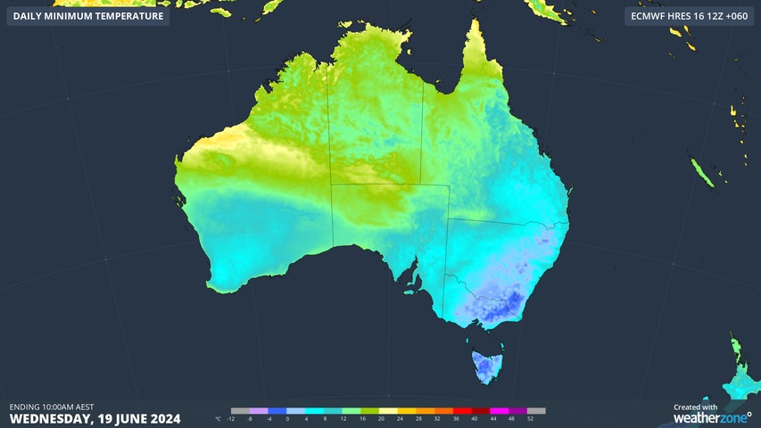
Sub-zero temperatures sent shivers across six states and territories on Monday morning, with some places experiencing their lowest temperatures in 2 to 4 years.
A lingering cold air mass combined with clear skies and relatively light winds caused temperatures to plunge across large areas of southeastern and eastern Australia on Sunday night into Monday morning.
The map below shows modelled temperature anomalies early on Monday, with the blue shading representing areas that were below average for this time of year.
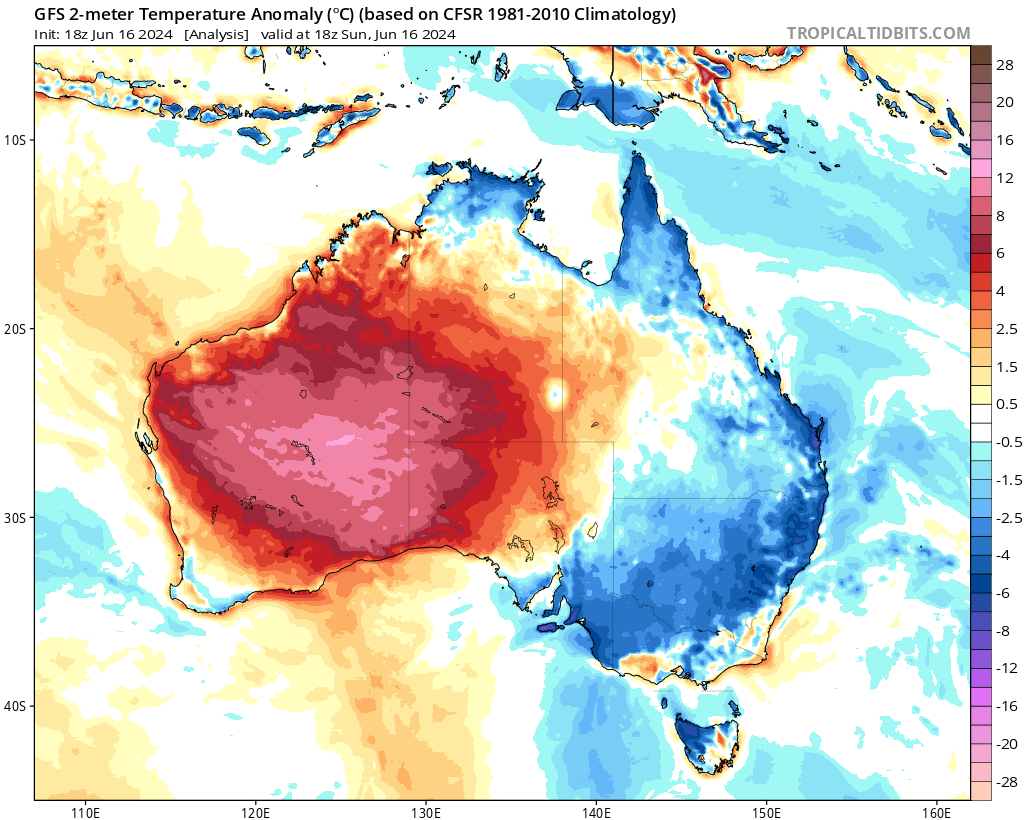
Image: Modelled 2-metre air temperature anomalies at 4am AEST on Monday, June 17, 2024. Source: Tropical Tidbits
Some of the standout observations from Monday morning included:
- -4.8°C at Yunta (SA)
- -3.8°C at Canberra (ACT)
- -3.6°C at Thredbo Top Station (NSW)
- -3.7°C at Mt Hotham (Vic)
- -2.4°C at Wynyard (Tas)
- -1.0°C at Roma (Qld)
Yunta’s -4.8°C on Monday morning was the lowest temperature in SA so far this year, and the site’s coldest morning in four years.
Even Cairns in northern Qld was feeling the chill on Monday, dipping to 12.8°C shortly before 7am during its coldest morning in two years.
Looking ahead, teeth-chattering minimum temperatures will continue to affect parts of southeastern and eastern Australia for the next few mornings under the influence of a near-stationary high pressure ridge.
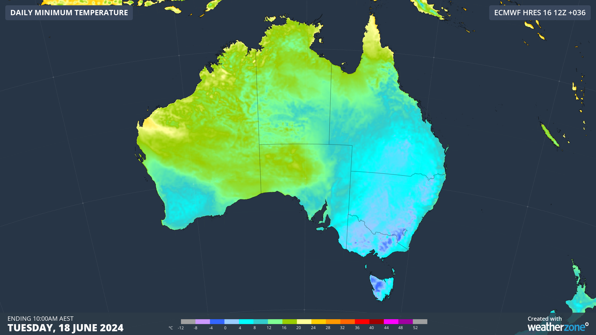
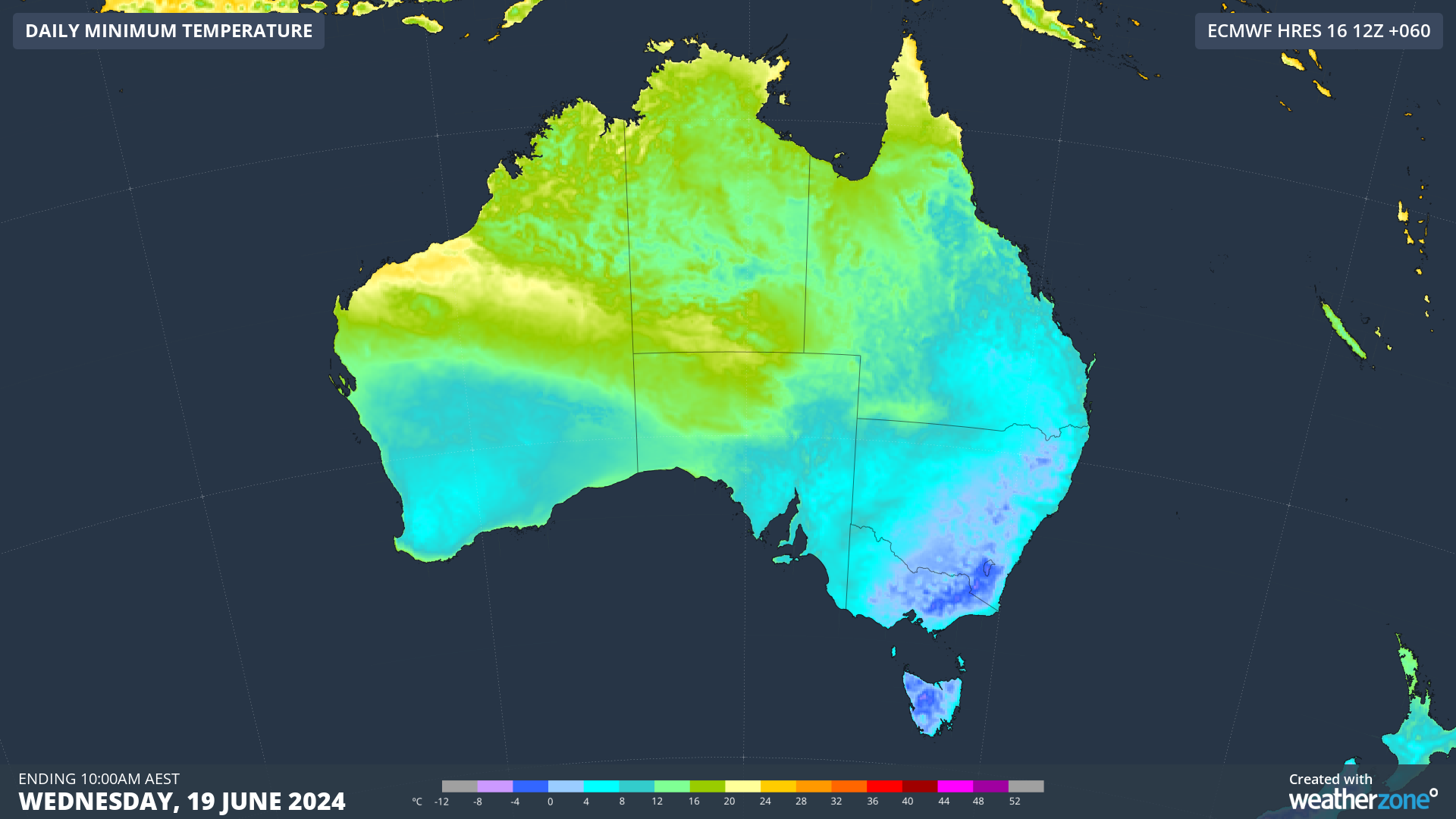
Images: Forecast minimum temperatures on Tuesday (top) and Wednesday (bottom) mornings, according to the ECMWF-HRES model.
Temperatures are likely to dip below -5°C in parts of southeastern Australia between Tuesday and Thursday mornings.
Weatherzone Business has grown to become the outright leader within the Australian energy market, serving wind, solar, hydro, trading, utilities and network companies.
You can’t control the weather, but you can gain precision insights to optimise your response. What lights us up is providing your energy business with tailored weather information to reduce your risk and keep you moving ahead of the curve.
Our services cover all aspects – from wind and solar generation to demand forecasts, wholesale markets to retail so, no matter where your company sits, we have solutions for you. We have worked closely with market participants to create products that meet the evolving needs of the sector, aiming to increase safety and profitability for our customers.
Benefit from the timely delivery of accurate weather information, allowing informed and effective decision-making. For more information please contact us at apac.sales@dtn.com.




